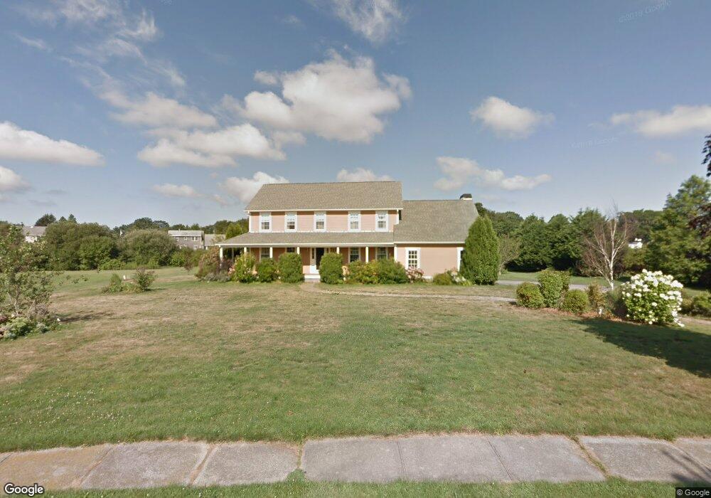
51 Lighthouse View Dr Middletown, RI 02842
Estimated Value: $1,361,000 - $1,514,000
4
Beds
3
Baths
3,213
Sq Ft
$450/Sq Ft
Est. Value
About This Home
This home is located at 51 Lighthouse View Dr, Middletown, RI 02842 and is currently estimated at $1,446,252, approximately $450 per square foot. 51 Lighthouse View Dr is a home located in Newport County with nearby schools including Middletown High School, St Michael's Country Day School, and St George's School.
Ownership History
Date
Name
Owned For
Owner Type
Purchase Details
Closed on
Aug 5, 2005
Sold by
Baker Heidi A and Baker Winthrop P
Bought by
Sucsy Robert James
Current Estimated Value
Home Financials for this Owner
Home Financials are based on the most recent Mortgage that was taken out on this home.
Original Mortgage
$350,000
Interest Rate
5.63%
Mortgage Type
Purchase Money Mortgage
Purchase Details
Closed on
Oct 12, 1999
Sold by
Ocean Ridge Dev
Bought by
Sullivan James G and Corcoran Alan S
Create a Home Valuation Report for This Property
The Home Valuation Report is an in-depth analysis detailing your home's value as well as a comparison with similar homes in the area
Home Values in the Area
Average Home Value in this Area
Purchase History
| Date | Buyer | Sale Price | Title Company |
|---|---|---|---|
| Sucsy Robert James | $690,000 | -- | |
| Sullivan James G | $329,000 | -- |
Source: Public Records
Mortgage History
| Date | Status | Borrower | Loan Amount |
|---|---|---|---|
| Open | Sullivan James G | $300,000 | |
| Closed | Sullivan James G | $350,000 | |
| Previous Owner | Sullivan James G | $418,000 | |
| Previous Owner | Sullivan James G | $455,000 |
Source: Public Records
Tax History
| Year | Tax Paid | Tax Assessment Tax Assessment Total Assessment is a certain percentage of the fair market value that is determined by local assessors to be the total taxable value of land and additions on the property. | Land | Improvement |
|---|---|---|---|---|
| 2025 | $11,043 | $936,600 | $407,900 | $528,700 |
| 2024 | $10,546 | $936,600 | $407,900 | $528,700 |
| 2023 | $8,142 | $646,700 | $289,900 | $356,800 |
| 2022 | $7,773 | $646,700 | $289,900 | $356,800 |
| 2021 | $7,773 | $646,700 | $289,900 | $356,800 |
| 2020 | $7,695 | $559,200 | $237,200 | $322,000 |
| 2018 | $7,689 | $559,200 | $237,200 | $322,000 |
| 2016 | $8,708 | $564,700 | $241,400 | $323,300 |
| 2015 | $8,493 | $564,700 | $241,400 | $323,300 |
| 2014 | $8,782 | $546,500 | $220,400 | $326,100 |
| 2013 | $8,586 | $546,500 | $220,400 | $326,100 |
Source: Public Records
Map
Nearby Homes
- 0 Honeyman Ave
- 476 Green End Ave
- 310 Corey Ln
- 119 Corey Ln
- 223 Corey Ln
- 55 John Clarke Rd Unit 8
- 55 John Clarke Rd Unit 3
- 16 Ward Ave
- 118 Wolcott Ave
- 0 Saltwood Dr
- 23 Indian Hill Cir
- 138 Green End Ave
- 141 Gray Craig Rd
- 10 Smithfield Dr
- 84 Allston Ave
- 7 Restmere Terrace
- 14 Kay Blvd
- 74 Valley Rd
- 1 Shangri-La Ln
- 0 Allston Ave
- 51 Lighthouse Dr
- 71 Lighthouse Dr
- 71 Lighthouse View Dr
- 90 Morrison Ave
- 40 Lighthouse View Dr
- 40 Lighthouse Dr
- 41 Lighthouse Dr
- 41 Lighthouse View Dr
- 70 Morrison Ave
- 85 Lighthouse View Dr
- 62 Morrison Ave
- 100 Morrison Ave
- 80 Lighthouse Dr
- 80 Lighthouse View Dr
- 25 Lighthouse View Dr
- 0 Morrison Ave
- 181 Compton View Dr
- 63 Morrison Ave
- 11 Lighthouse Dr
- 122 Morrison Ave