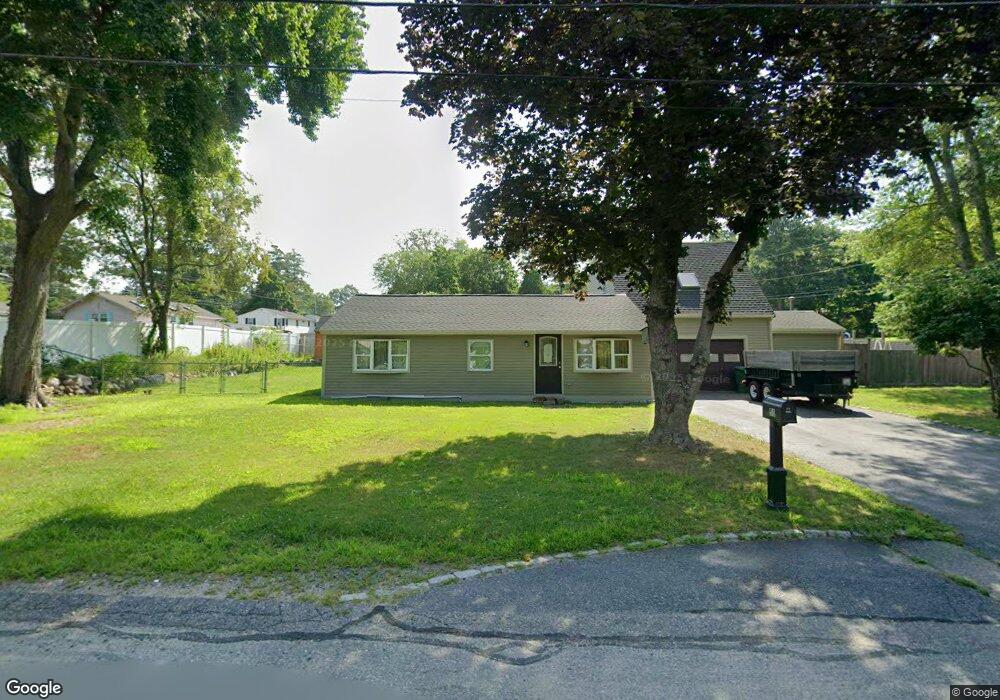
51 Lorna Ave Pembroke, MA 02359
Estimated Value: $506,000 - $608,000
3
Beds
1
Bath
1,338
Sq Ft
$412/Sq Ft
Est. Value
About This Home
This home is located at 51 Lorna Ave, Pembroke, MA 02359 and is currently estimated at $551,349, approximately $412 per square foot. 51 Lorna Ave is a home located in Plymouth County with nearby schools including Pembroke High School, Cadence Academy Preschool - Hanover, and Cardinal Cushing Centers.
Ownership History
Date
Name
Owned For
Owner Type
Purchase Details
Closed on
Dec 9, 1998
Sold by
Riverside Rt and Zarella Eugene J
Bought by
Bonitatibus Charles L and Bonitatibus Annmarie
Current Estimated Value
Home Financials for this Owner
Home Financials are based on the most recent Mortgage that was taken out on this home.
Original Mortgage
$129,650
Interest Rate
6.8%
Mortgage Type
Purchase Money Mortgage
Purchase Details
Closed on
Jun 17, 1998
Sold by
Olson John L and Olson Lori E
Bought by
River Side Rt
Purchase Details
Closed on
Apr 20, 1993
Sold by
Mallon Francis W
Bought by
Olson John L and Olson Lori E
Create a Home Valuation Report for This Property
The Home Valuation Report is an in-depth analysis detailing your home's value as well as a comparison with similar homes in the area
Home Values in the Area
Average Home Value in this Area
Purchase History
| Date | Buyer | Sale Price | Title Company |
|---|---|---|---|
| Bonitatibus Charles L | $136,500 | -- | |
| River Side Rt | $60,000 | -- | |
| River Side Rt | $60,000 | -- | |
| Olson John L | $50,000 | -- |
Source: Public Records
Mortgage History
| Date | Status | Borrower | Loan Amount |
|---|---|---|---|
| Open | Olson John L | $200,000 | |
| Closed | Olson John L | $126,750 | |
| Closed | Olson John L | $129,650 |
Source: Public Records
Tax History Compared to Growth
Tax History
| Year | Tax Paid | Tax Assessment Tax Assessment Total Assessment is a certain percentage of the fair market value that is determined by local assessors to be the total taxable value of land and additions on the property. | Land | Improvement |
|---|---|---|---|---|
| 2025 | $5,506 | $458,100 | $273,200 | $184,900 |
| 2024 | $5,178 | $430,400 | $247,500 | $182,900 |
| 2023 | $5,173 | $406,700 | $235,300 | $171,400 |
| 2022 | $4,862 | $343,600 | $194,000 | $149,600 |
| 2021 | $4,556 | $312,500 | $181,500 | $131,000 |
| 2020 | $4,470 | $308,500 | $177,500 | $131,000 |
| 2019 | $4,289 | $293,800 | $173,300 | $120,500 |
| 2018 | $3,745 | $251,500 | $165,900 | $85,600 |
| 2017 | $3,622 | $239,900 | $154,200 | $85,700 |
| 2016 | $3,478 | $227,900 | $142,200 | $85,700 |
| 2015 | $3,243 | $220,000 | $134,300 | $85,700 |
Source: Public Records
Map
Nearby Homes
- 46 Lorna Ave
- 218 Schoosett St
- 172 Washington St
- 55 Shipyard Ln
- 133 Brigantine Cir
- 261 Washington St
- 15 Kings Terrace
- 28 Old Shipyard Ln
- 33 Barker Square Dr Unit 33
- 20 Meadow Brook Rd
- 21 Union St
- 31 Hillcrest Dr
- 16 Broad Oak Way
- 66 Hemlock Dr
- 21 Chowdermarch St
- 5 Royal Dane Dr Unit 46
- 26 Church St
- 10 Royal Dane Dr Unit 88
- 15 Bagnell Dr Unit 15
- 180 Elm St
- 23 Burr Ave
- 171 Schoosett St
- 56 Lorna Ave
- 47 Lorna Ave
- 175 Schoosett St
- 22 Burr Ave
- 167 Schoosett St
- 19 Burr Ave
- 50 Lorna Ave
- 179 Schoosett St
- 18 Burr Ave
- 41 Lorna Ave
- 22 Blake Ave
- 13 Burr Ave
- 183 Schoosett St
- 166 Schoosett St Unit Top Floor
- 166 Schoosett St Unit 1-C
- 166 Schoosett St Unit 1-A
- 166 Schoosett St Unit 2-A
- 166 Schoosett St Unit 1 & U:1A