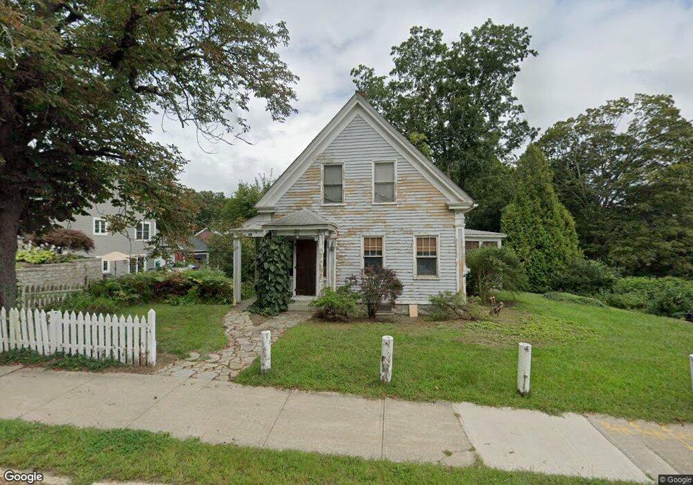
51 N Main St Uxbridge, MA 01569
Estimated Value: $417,000 - $449,000
4
Beds
2
Baths
1,368
Sq Ft
$317/Sq Ft
Est. Value
About This Home
This home is located at 51 N Main St, Uxbridge, MA 01569 and is currently estimated at $434,221, approximately $317 per square foot. 51 N Main St is a home located in Worcester County with nearby schools including Uxbridge High School, Our Lady of the Valley Regional School, and Whitinsville Christian School.
Ownership History
Date
Name
Owned For
Owner Type
Purchase Details
Closed on
Jul 14, 1993
Sold by
Mccue Joseph W and Mccue Pauline
Bought by
Wheelock Strickland and Wheelock Maxine
Current Estimated Value
Home Financials for this Owner
Home Financials are based on the most recent Mortgage that was taken out on this home.
Original Mortgage
$115,550
Interest Rate
7.4%
Mortgage Type
Purchase Money Mortgage
Create a Home Valuation Report for This Property
The Home Valuation Report is an in-depth analysis detailing your home's value as well as a comparison with similar homes in the area
Home Values in the Area
Average Home Value in this Area
Purchase History
| Date | Buyer | Sale Price | Title Company |
|---|---|---|---|
| Wheelock Strickland | $117,500 | -- |
Source: Public Records
Mortgage History
| Date | Status | Borrower | Loan Amount |
|---|---|---|---|
| Open | Wheelock Strickland | $111,500 | |
| Closed | Wheelock Strickland | $115,550 |
Source: Public Records
Tax History Compared to Growth
Tax History
| Year | Tax Paid | Tax Assessment Tax Assessment Total Assessment is a certain percentage of the fair market value that is determined by local assessors to be the total taxable value of land and additions on the property. | Land | Improvement |
|---|---|---|---|---|
| 2025 | $45 | $344,300 | $139,100 | $205,200 |
| 2024 | $4,136 | $320,100 | $127,500 | $192,600 |
| 2023 | $4,110 | $294,600 | $115,900 | $178,700 |
| 2022 | $3,940 | $259,900 | $105,100 | $154,800 |
| 2021 | $4,037 | $255,200 | $100,400 | $154,800 |
| 2020 | $3,956 | $236,300 | $101,100 | $135,200 |
| 2019 | $3,862 | $222,600 | $93,700 | $128,900 |
| 2018 | $3,759 | $218,900 | $93,700 | $125,200 |
| 2017 | $3,668 | $216,300 | $87,600 | $128,700 |
| 2016 | $3,533 | $201,100 | $86,000 | $115,100 |
| 2015 | $3,461 | $198,900 | $86,000 | $112,900 |
Source: Public Records
Map
Nearby Homes
- 72 Homeward Ave
- 48 Homeward Ave
- 24 Olde Canal Way Unit 24
- 24 Road Ahr
- 20 Nature View Dr Unit 20
- 113 Rogerson Crossing Unit 113
- 307 N Main St
- 36 Elm St
- 3 Strathmore Shire Unit A
- 256 Mendon St
- 128 Mantell Rd
- 37 Elizabeth St
- The Contemporary Villager Plan at Patriot's Landing
- Karenrose Sunnery Plan at Patriot's Landing
- 46 Pouts Ln Unit 46
- 288 High St
- Layla Plan at Pine Ridge
- Ashley Plan at Pine Ridge
- Lily Plan at Pine Ridge
- Brooklyn Plan at Pine Ridge
- 55 N Main St
- 55 N Main St Unit A
- 55 N Main St Unit 55A
- 55 N Main St Unit 1
- 47 N Main St
- 52 N Main St
- 59 N Main St
- 41 N Main St
- 41 N Main St Unit 2
- 58 N Main St
- 58 N Main St Unit 62-7
- 58 N Main St Unit 62-2
- 44 N Main St
- 63 N Main St
- 39 N Main St
- 37 N Main St
- 65 N Main St
- 62 N Main St
- Lot 4 Ricca Way
- Lot 19 Maslow's Way Unit 55