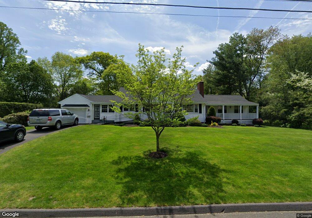
51 Rangely Dr Trumbull, CT 06611
West Trumbull NeighborhoodEstimated Value: $455,000 - $664,000
2
Beds
3
Baths
1,722
Sq Ft
$331/Sq Ft
Est. Value
About This Home
This home is located at 51 Rangely Dr, Trumbull, CT 06611 and is currently estimated at $570,064, approximately $331 per square foot. 51 Rangely Dr is a home located in Fairfield County with nearby schools including Jane Ryan School, Madison Middle School, and Trumbull High School.
Ownership History
Date
Name
Owned For
Owner Type
Purchase Details
Closed on
Mar 19, 2025
Sold by
Cormier Frances
Bought by
Paolini Anne
Current Estimated Value
Purchase Details
Closed on
Jul 1, 1998
Sold by
Dodzian Gertrude
Bought by
Cormier-Carrol Frances and Carroll Kenneth
Home Financials for this Owner
Home Financials are based on the most recent Mortgage that was taken out on this home.
Original Mortgage
$154,850
Interest Rate
7.04%
Mortgage Type
Unknown
Create a Home Valuation Report for This Property
The Home Valuation Report is an in-depth analysis detailing your home's value as well as a comparison with similar homes in the area
Home Values in the Area
Average Home Value in this Area
Purchase History
| Date | Buyer | Sale Price | Title Company |
|---|---|---|---|
| Paolini Anne | -- | None Available | |
| Paolini Anne | -- | None Available | |
| Cormier-Carrol Frances | $163,000 | -- | |
| Cormier-Carrol Frances | $163,000 | -- |
Source: Public Records
Mortgage History
| Date | Status | Borrower | Loan Amount |
|---|---|---|---|
| Previous Owner | Cormier-Carrol Frances | $185,210 | |
| Previous Owner | Cormier-Carrol Frances | $225,000 | |
| Previous Owner | Cormier-Carrol Frances | $154,850 |
Source: Public Records
Tax History
| Year | Tax Paid | Tax Assessment Tax Assessment Total Assessment is a certain percentage of the fair market value that is determined by local assessors to be the total taxable value of land and additions on the property. | Land | Improvement |
|---|---|---|---|---|
| 2025 | $9,234 | $251,300 | $155,260 | $96,040 |
| 2024 | $8,973 | $251,300 | $155,260 | $96,040 |
| 2023 | $8,830 | $251,300 | $155,260 | $96,040 |
| 2022 | $8,687 | $251,300 | $155,260 | $96,040 |
| 2021 | $7,572 | $208,250 | $129,360 | $78,890 |
| 2020 | $7,427 | $208,250 | $129,360 | $78,890 |
| 2018 | $7,261 | $208,250 | $129,360 | $78,890 |
| 2017 | $7,126 | $208,250 | $129,360 | $78,890 |
| 2016 | $6,943 | $208,250 | $129,360 | $78,890 |
| 2015 | $7,005 | $209,300 | $129,400 | $79,900 |
| 2014 | $6,857 | $209,300 | $129,400 | $79,900 |
Source: Public Records
Map
Nearby Homes
- 215 Fernwood Rd
- 40 Rose Terrace
- 26 Grove St
- 21 Histon Rd
- 253 Mayfield Dr Unit 253
- 177 Mayfield Dr
- lot 194 Prospect Ave
- 25 Plymouth Ave
- 71 Cider Mill Ln
- 4725 Madison Ave
- 18 Ridgebury Dr
- 39 Zephyr Rd
- Lot 31 Valley View Rd
- 0 Main St
- 132 Merrimac Dr
- 35 Sturbridge Rd
- 121 Campbell Rd
- 40 Toll House Ln
- 8 Raleigh Rd
- 3432 Old Town Rd
- 49 Revere Ln
- 55 Rangely Dr
- 43 Rangely Dr
- 46 Rangely Dr
- 42 Smith Place
- 45 Revere Ln
- 37 Smith Place
- 37 Smith Place Unit Place
- 42 Revere Ln
- 37 Rangely Dr
- 58 Rangely Dr
- 59 Rangely Dr
- 43 Glenbrook Rd
- 45 Glenbrook Rd
- 47 Glenbrook Rd
- 41 Revere Ln
- 40 Rangely Dr
- 33 Smith Place
- 51 Glenbrook Rd
- 23 Glenbrook Rd
Your Personal Tour Guide
Ask me questions while you tour the home.