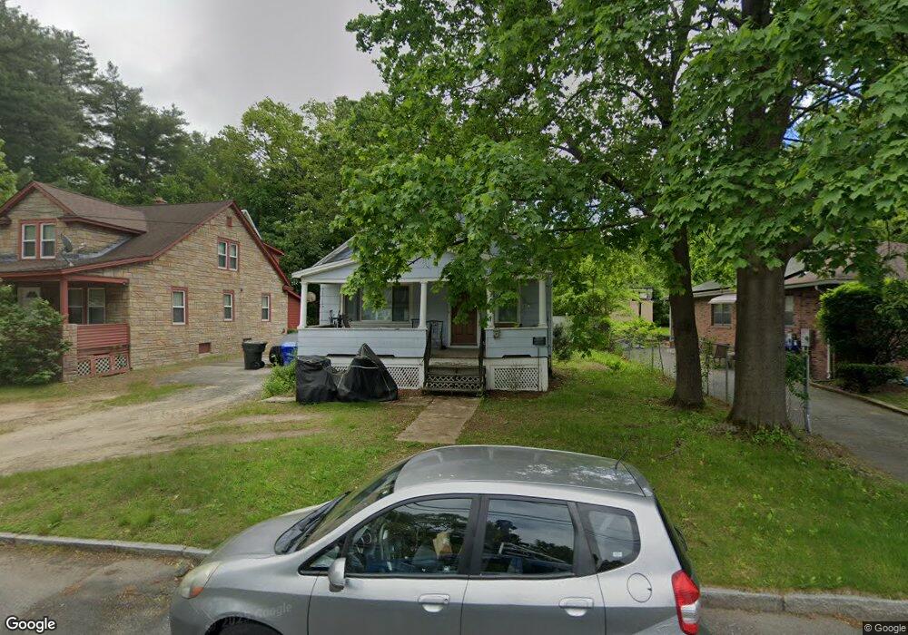
51 Rollins St Springfield, MA 01109
Pine Point NeighborhoodEstimated Value: $233,000 - $262,000
2
Beds
1
Bath
1,018
Sq Ft
$240/Sq Ft
Est. Value
About This Home
This home is located at 51 Rollins St, Springfield, MA 01109 and is currently estimated at $244,485, approximately $240 per square foot. 51 Rollins St is a home located in Hampden County with nearby schools including Thomas M Balliet Elementary School, John F. Kennedy Academy, and Springfield Central High School.
Ownership History
Date
Name
Owned For
Owner Type
Purchase Details
Closed on
Feb 11, 2011
Sold by
Lopez Jaime
Bought by
Springfield City Of
Current Estimated Value
Purchase Details
Closed on
Sep 18, 1992
Sold by
Usa Va
Bought by
Lopez Jaime
Home Financials for this Owner
Home Financials are based on the most recent Mortgage that was taken out on this home.
Original Mortgage
$59,400
Interest Rate
8.04%
Mortgage Type
Purchase Money Mortgage
Purchase Details
Closed on
Apr 24, 1992
Sold by
Croston Thomas R
Bought by
Carteret Sb
Create a Home Valuation Report for This Property
The Home Valuation Report is an in-depth analysis detailing your home's value as well as a comparison with similar homes in the area
Home Values in the Area
Average Home Value in this Area
Purchase History
| Date | Buyer | Sale Price | Title Company |
|---|---|---|---|
| Springfield City Of | $1,576 | -- | |
| Lopez Jaime | $60,000 | -- | |
| Carteret Sb | $66,000 | -- |
Source: Public Records
Mortgage History
| Date | Status | Borrower | Loan Amount |
|---|---|---|---|
| Previous Owner | Carteret Sb | $59,400 | |
| Previous Owner | Carteret Sb | $27,156 |
Source: Public Records
Tax History
| Year | Tax Paid | Tax Assessment Tax Assessment Total Assessment is a certain percentage of the fair market value that is determined by local assessors to be the total taxable value of land and additions on the property. | Land | Improvement |
|---|---|---|---|---|
| 2025 | $3,145 | $200,600 | $37,400 | $163,200 |
| 2024 | $3,003 | $187,000 | $37,400 | $149,600 |
| 2023 | $2,622 | $153,800 | $33,100 | $120,700 |
| 2022 | $2,458 | $130,600 | $31,000 | $99,600 |
| 2021 | $2,183 | $115,500 | $28,200 | $87,300 |
| 2020 | $2,142 | $109,700 | $28,200 | $81,500 |
| 2019 | $2,086 | $106,000 | $29,200 | $76,800 |
| 2018 | $2,045 | $103,900 | $29,200 | $74,700 |
| 2017 | $2,047 | $104,100 | $32,100 | $72,000 |
| 2016 | $1,905 | $96,900 | $32,100 | $64,800 |
| 2015 | $1,926 | $97,900 | $32,100 | $65,800 |
Source: Public Records
Map
Nearby Homes
- 55 Rollins St
- 43 Rollins St
- 50 Woodruff St
- 67 Rollins St
- 58 Rollins St
- 50 Rollins St
- 42 Rollins St
- 73 Rollins St
- 31 Rollins St
- 31 Rolling Pines Dr
- 0 Woodruff St (Ns) L:128 Unit 73010729
- 0 Woodruff St (Ns) L:128 Unit 72886021
- 0 Woodruff St (Ns) L:128
- 68 Rollins St
- 0 Woodruff St (Ns) L:126 Unit 71452243
- 23 Rollins St
- 39 Begley St
- 69 Hobson St
- 19 Rollins St
- 5 Crittenden St
Your Personal Tour Guide
Ask me questions while you tour the home.