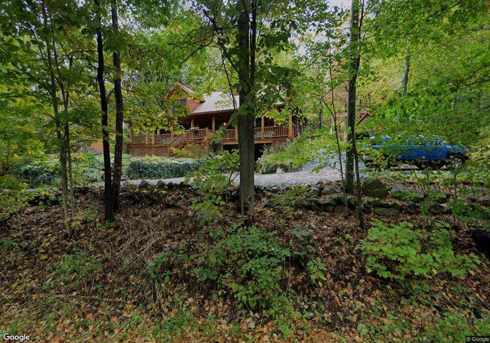
51 Rowley Hill Rd Sterling, MA 01564
Estimated Value: $644,195 - $768,000
3
Beds
3
Baths
1,826
Sq Ft
$383/Sq Ft
Est. Value
About This Home
This home is located at 51 Rowley Hill Rd, Sterling, MA 01564 and is currently estimated at $700,049, approximately $383 per square foot. 51 Rowley Hill Rd is a home located in Worcester County with nearby schools including Wachusett Regional High School.
Ownership History
Date
Name
Owned For
Owner Type
Purchase Details
Closed on
Oct 22, 2018
Sold by
Mckeehan James H and Anderson Andrea J
Bought by
Anderson Mckeehan Lt
Current Estimated Value
Purchase Details
Closed on
Sep 2, 2003
Sold by
Minardi Jolene M and Minardi Neil A
Bought by
Mckeehan Andrea J and Mckeehan James H
Home Financials for this Owner
Home Financials are based on the most recent Mortgage that was taken out on this home.
Original Mortgage
$322,150
Interest Rate
5.69%
Mortgage Type
Purchase Money Mortgage
Purchase Details
Closed on
Nov 8, 2000
Sold by
Murray Donlin K
Bought by
Cloverleaf Rt and Goneau Stephen T
Purchase Details
Closed on
Apr 6, 1999
Sold by
K & K Diversified
Bought by
Minardi Neil A and Minardi Jolene M
Create a Home Valuation Report for This Property
The Home Valuation Report is an in-depth analysis detailing your home's value as well as a comparison with similar homes in the area
Home Values in the Area
Average Home Value in this Area
Purchase History
We collect this data history from publicly available records. To have your information removed, we recommend requesting removal directly through your county’s website.
| Date | Buyer | Sale Price | Title Company |
|---|---|---|---|
| Anderson Mckeehan Lt | -- | -- | |
| Mckeehan Andrea J | $379,000 | -- | |
| Cloverleaf Rt | $90,000 | -- | |
| Minardi Neil A | $66,000 | -- |
Source: Public Records
Mortgage History
We collect this data history from publicly available records. To have your information removed, we recommend requesting removal directly through your county’s website.
| Date | Status | Borrower | Loan Amount |
|---|---|---|---|
| Previous Owner | Minardi Neil A | $285,500 | |
| Previous Owner | Mckeehan Andrea J | $322,150 | |
| Previous Owner | Minardi Neil A | $252,750 | |
| Previous Owner | Minardi Neil A | $100,000 |
Source: Public Records
Tax History
| Year | Tax Paid | Tax Assessment Tax Assessment Total Assessment is a certain percentage of the fair market value that is determined by local assessors to be the total taxable value of land and additions on the property. | Land | Improvement |
|---|---|---|---|---|
| 2025 | $8,363 | $649,300 | $130,800 | $518,500 |
| 2024 | $7,810 | $586,800 | $130,800 | $456,000 |
| 2023 | $8,009 | $560,100 | $130,800 | $429,300 |
| 2022 | $7,308 | $479,200 | $118,900 | $360,300 |
| 2021 | $7,406 | $448,300 | $118,900 | $329,400 |
| 2020 | $6,857 | $407,900 | $118,900 | $289,000 |
| 2019 | $6,585 | $381,300 | $118,900 | $262,400 |
| 2018 | $6,181 | $352,400 | $119,200 | $233,200 |
| 2017 | $5,871 | $325,600 | $110,300 | $215,300 |
| 2016 | $5,506 | $300,400 | $110,300 | $190,100 |
| 2015 | $5,363 | $310,200 | $114,700 | $195,500 |
| 2014 | $5,252 | $310,200 | $114,700 | $195,500 |
Source: Public Records
Map
Nearby Homes
- 5 Pine Woods Ln
- 134 Leominster Rd
- 1B Patriots Way Unit B
- 140 Leominster Rd
- 5 James Patten Dr
- 4 Ashton Ln
- 45 Neylon St
- 81 Clinton Rd
- 88 Clinton Rd
- 9 Leos Way
- 4 Jewett Rd Unit 4
- 6 Jewett Rd Unit 6
- 32-50 Flanagan Hill Rd
- 223 Worcester Rd
- 9 Cole Rd
- 197 Greenland Rd
- 279 Redemption Rock Trail
- 609 Willard St
- 503 Hilltop Rd
- 176 Mary Catherine Dr
Your Personal Tour Guide
Ask me questions while you tour the home.