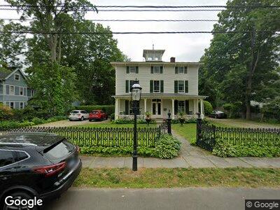
51 Spruce St Unit 2 Southport, CT 06890
Southport NeighborhoodEstimated Value: $865,000 - $1,367,000
3
Beds
3
Baths
2,032
Sq Ft
$498/Sq Ft
Est. Value
About This Home
This home is located at 51 Spruce St Unit 2, Southport, CT 06890 and is currently estimated at $1,012,521, approximately $498 per square foot. 51 Spruce St Unit 2 is a home located in Fairfield County with nearby schools including Mill Hill School, Roger Ludlowe Middle School, and Fairfield Ludlowe High School.
Ownership History
Date
Name
Owned For
Owner Type
Purchase Details
Closed on
May 29, 2009
Sold by
Zalon Paul and Ei Susan M
Bought by
Ijams John H and Ijams Sarah B
Current Estimated Value
Home Financials for this Owner
Home Financials are based on the most recent Mortgage that was taken out on this home.
Original Mortgage
$417,000
Interest Rate
4.87%
Purchase Details
Closed on
Apr 29, 1993
Sold by
Reid Anne M
Bought by
Zalon Paul and Ei Susan M
Create a Home Valuation Report for This Property
The Home Valuation Report is an in-depth analysis detailing your home's value as well as a comparison with similar homes in the area
Home Values in the Area
Average Home Value in this Area
Purchase History
| Date | Buyer | Sale Price | Title Company |
|---|---|---|---|
| Ijams John H | $645,000 | -- | |
| Ijams John H | $645,000 | -- | |
| Zalon Paul | $250,000 | -- | |
| Zalon Paul | $250,000 | -- |
Source: Public Records
Mortgage History
| Date | Status | Borrower | Loan Amount |
|---|---|---|---|
| Open | Zalon Paul | $135,000 | |
| Closed | Zalon Paul | $417,000 | |
| Previous Owner | Zalon Paul | $191,000 |
Source: Public Records
Tax History Compared to Growth
Tax History
| Year | Tax Paid | Tax Assessment Tax Assessment Total Assessment is a certain percentage of the fair market value that is determined by local assessors to be the total taxable value of land and additions on the property. | Land | Improvement |
|---|---|---|---|---|
| 2024 | $8,878 | $318,220 | $0 | $318,220 |
| 2023 | $8,754 | $318,220 | $0 | $318,220 |
| 2022 | $8,668 | $318,220 | $0 | $318,220 |
| 2021 | $8,552 | $316,960 | $0 | $316,960 |
| 2020 | $8,356 | $311,920 | $0 | $311,920 |
| 2019 | $8,356 | $311,920 | $0 | $311,920 |
| 2018 | $8,222 | $311,920 | $0 | $311,920 |
| 2017 | $8,054 | $311,920 | $0 | $311,920 |
| 2016 | $7,938 | $311,920 | $0 | $311,920 |
| 2015 | $8,170 | $329,560 | $0 | $329,560 |
| 2014 | $8,041 | $329,560 | $0 | $329,560 |
Source: Public Records
Map
Nearby Homes
- 450 Center St Unit 1
- 142 Main St
- 668 Kings Hwy W
- 57 Southport Woods Dr Unit 57
- 346 Taintor Dr
- 132 Pequot Ave
- 987 Pequot Ave
- 950 Mill Hill Terrace
- 131 Sasco Hill Rd
- 24 Tide Mill Terrace
- 325 Lansdowne Unit 325
- 91 Open Gate Ln
- 15 Westfair Dr
- 355 Greens Farms Rd
- 828 Sasco Hill Rd
- 342 Greens Farms Rd
- 260 Range Rd
- 81 Southfield Rd
- 66 Flax Rd
- 122 Old Rd
- 51 Spruce St Unit 2
- 51 Spruce St Unit 1
- 33 Spruce St
- 53 Spruce St
- 46 Spruce St
- 71 Spruce St
- 26 Spruce St
- 44 Spruce St
- 83 Spruce St
- 62 2fl Spruce St
- 62 Spruce St
- 62 Spruce St S
- 62 Spruce St Unit 2nd
- 62 Spruce St Unit 1st
- 101 Spruce St
- 10 Spruce St Unit 1
- 10 Spruce St
- 100 Spruce St
- 80 Spruce St
- 80 Spruce St Unit 3rd Flr