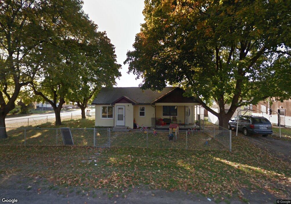
510 7th St E Polson, MT 59860
Estimated Value: $256,000 - $316,000
1
Bed
1
Bath
672
Sq Ft
$422/Sq Ft
Est. Value
About This Home
This home is located at 510 7th St E, Polson, MT 59860 and is currently estimated at $283,828, approximately $422 per square foot. 510 7th St E is a home located in Lake County with nearby schools including Cherry Valley School, Linderman Elementary School, and Polson Middle School (7-8).
Ownership History
Date
Name
Owned For
Owner Type
Purchase Details
Closed on
Feb 16, 2017
Sold by
Frandsen Douglas C and Frandsen Phillip Andrea
Bought by
510 Poulson Holding Llc
Current Estimated Value
Purchase Details
Closed on
Jun 8, 2016
Sold by
First Citizens Bank
Bought by
Polson Holdings Llc
Create a Home Valuation Report for This Property
The Home Valuation Report is an in-depth analysis detailing your home's value as well as a comparison with similar homes in the area
Home Values in the Area
Average Home Value in this Area
Purchase History
| Date | Buyer | Sale Price | Title Company |
|---|---|---|---|
| 510 Poulson Holding Llc | -- | None Available | |
| Polson Holdings Llc | -- | None Listed On Document |
Source: Public Records
Tax History
| Year | Tax Paid | Tax Assessment Tax Assessment Total Assessment is a certain percentage of the fair market value that is determined by local assessors to be the total taxable value of land and additions on the property. | Land | Improvement |
|---|---|---|---|---|
| 2025 | $1,304 | $251,600 | $0 | $0 |
| 2024 | $1,577 | $176,000 | $0 | $0 |
| 2023 | $1,477 | $176,000 | $0 | $0 |
| 2022 | $1,409 | $141,500 | $0 | $0 |
| 2021 | $1,347 | $141,500 | $0 | $0 |
| 2020 | $1,224 | $109,800 | $0 | $0 |
| 2019 | $1,234 | $109,800 | $0 | $0 |
| 2018 | $1,133 | $100,500 | $0 | $0 |
| 2017 | $940 | $100,500 | $0 | $0 |
| 2016 | $968 | $87,700 | $0 | $0 |
| 2015 | $935 | $87,700 | $0 | $0 |
| 2014 | $695 | $48,230 | $0 | $0 |
Source: Public Records
Map
Nearby Homes
- 608 6th St E
- 602 5th Ave E
- 707 5th Ave E
- 904 4th St E
- 604 10th Ave E Unit D
- 604 10th Ave E Unit B
- 604 10th Ave E Unit H
- 604 10th Ave E Unit G
- 604 10th Ave E Unit E
- 604 10th Ave E
- 604 10th Ave E Unit F
- 604 10th Ave E Unit C
- 604 10th Ave E Unit A
- 404 3rd Ave E
- 603 12th Ave E
- 1104 5th St E
- 6 Weber Ave
- 304 11th Ave E
- 404 12th Ave E
- 50300 Us Highway 93 Unit 33
Your Personal Tour Guide
Ask me questions while you tour the home.