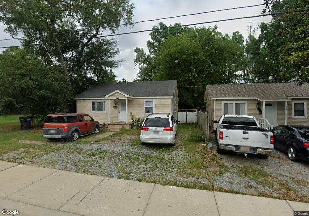
510 Algood St Unit 512 Benton, AR 72015
Estimated Value: $78,000 - $206,000
--
Bed
1
Bath
825
Sq Ft
$156/Sq Ft
Est. Value
About This Home
This home is located at 510 Algood St Unit 512, Benton, AR 72015 and is currently estimated at $128,565, approximately $155 per square foot. 510 Algood St Unit 512 is a home located in Saline County with nearby schools including Angie Grant Elementary School, Benton Middle School, and Benton Junior High School.
Ownership History
Date
Name
Owned For
Owner Type
Purchase Details
Closed on
Aug 1, 2023
Sold by
Nelson Travis
Bought by
Diaz Tania and Melara Nancy
Current Estimated Value
Purchase Details
Closed on
Jul 20, 2012
Sold by
Nelson Polly A and Nelson Travis F
Bought by
Nelson Travis F
Purchase Details
Closed on
Mar 6, 2003
Bought by
Nelson
Purchase Details
Closed on
Dec 2, 2002
Bought by
Shelnutt
Create a Home Valuation Report for This Property
The Home Valuation Report is an in-depth analysis detailing your home's value as well as a comparison with similar homes in the area
Home Values in the Area
Average Home Value in this Area
Purchase History
| Date | Buyer | Sale Price | Title Company |
|---|---|---|---|
| Diaz Tania | $58,500 | None Listed On Document | |
| Nelson Travis F | -- | None Available | |
| Nelson Travis F | -- | None Available | |
| Nelson | $42,000 | -- | |
| Nelson | $45,000 | -- | |
| Shelnutt | -- | -- | |
| Death Cert Harold | -- | -- |
Source: Public Records
Tax History Compared to Growth
Tax History
| Year | Tax Paid | Tax Assessment Tax Assessment Total Assessment is a certain percentage of the fair market value that is determined by local assessors to be the total taxable value of land and additions on the property. | Land | Improvement |
|---|---|---|---|---|
| 2025 | $640 | $11,551 | $1,500 | $10,051 |
| 2024 | $1,224 | $22,288 | $3,000 | $19,288 |
| 2023 | $1,104 | $22,288 | $3,000 | $19,288 |
| 2022 | $1,012 | $22,288 | $3,000 | $19,288 |
| 2021 | $920 | $16,600 | $1,600 | $15,000 |
| 2020 | $920 | $16,600 | $1,600 | $15,000 |
| 2019 | $920 | $16,600 | $1,600 | $15,000 |
| 2018 | $918 | $16,600 | $1,600 | $15,000 |
| 2017 | $918 | $16,600 | $1,600 | $15,000 |
| 2016 | $866 | $15,270 | $1,600 | $13,670 |
| 2015 | $851 | $15,270 | $1,600 | $13,670 |
| 2014 | -- | $15,270 | $1,600 | $13,670 |
Source: Public Records
Map
Nearby Homes
- 507 Algood St
- 1304 Gray St
- 712 S Border St
- 806 Columbia Ave
- 1910 Harmon Dr
- 1022 E Sevier St
- 802 Columbia Ave
- 517 Bowers Dr
- 391 Genesis Dr
- 1007 Montclair St
- 715 Rosewood Dr
- 1310 E North St
- 721 Edgehill Dr
- 707 Sunset
- 503 S 1st St
- 508 Pleasant Ridge Dr
- 424 E Sevier St
- 000 Palm St
- 720 Oakwood
- 1121 Stewart
- 500 Algood St
- 0 Algood Dr
- Lot 2R Algood Dr
- Lot 1R Algood Dr
- 516 Algood St
- 505 Algood St
- 517 Algood St
- 509 Algood St
- 420 Algood St
- 419 Algood St
- 109 Talbert Ln
- 501 Algood St
- 1601 Hudson St
- 412 Algood St
- 409 Algood St
- 1603 Hudson St
- 0 Talbert Ln Unit Hudson
- 0 Edison Corner of Benton Pkwy Unit 17029910
- 401 Algood St
- S Gibson Ave