Estimated Value: $117,191 - $154,000
--
Bed
--
Bath
1,138
Sq Ft
$121/Sq Ft
Est. Value
About This Home
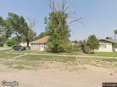
This home is located at 510 Gordon St, Wiley, CO 81092 and is currently estimated at $137,548, approximately $120 per square foot. 510 Gordon St is a home with nearby schools including Wiley Elementary School and Wiley Junior/Senior High School.
Ownership History
Date
Name
Owned For
Owner Type
Purchase Details
Closed on
Dec 20, 2019
Sold by
Queen Abraham J
Bought by
Eastin Brittni and Eastin John L
Current Estimated Value
Home Financials for this Owner
Home Financials are based on the most recent Mortgage that was taken out on this home.
Original Mortgage
$27,833
Outstanding Balance
$19,744
Interest Rate
3.6%
Mortgage Type
Unknown
Estimated Equity
$123,018
Purchase Details
Closed on
Nov 13, 2006
Sold by
Price Amy L
Bought by
Queen Abraham J
Home Financials for this Owner
Home Financials are based on the most recent Mortgage that was taken out on this home.
Original Mortgage
$53,040
Interest Rate
6.28%
Mortgage Type
New Conventional
Purchase Details
Closed on
Apr 14, 2006
Sold by
Price Amy L and Estate Of Frank W Price
Bought by
Price Amy L
Purchase Details
Closed on
Jul 16, 2004
Sold by
Campbell Clyde Allen and Leonard Ruby F
Bought by
Price Frank W
Purchase Details
Closed on
Jul 17, 1978
Sold by
Cook Esther O
Bought by
Campbell Clyde R and Campbell Ruth M
Create a Home Valuation Report for This Property
The Home Valuation Report is an in-depth analysis detailing your home's value as well as a comparison with similar homes in the area
Home Values in the Area
Average Home Value in this Area
Purchase History
| Date | Buyer | Sale Price | Title Company |
|---|---|---|---|
| Eastin Brittni | $70,000 | None Available | |
| Queen Abraham J | $52,000 | None Available | |
| Price Amy L | -- | None Available | |
| Price Frank W | $30,000 | -- | |
| Campbell Clyde R | $19,780,700 | -- |
Source: Public Records
Mortgage History
| Date | Status | Borrower | Loan Amount |
|---|---|---|---|
| Open | Eastin Brittni | $27,833 | |
| Previous Owner | Queen Abraham J | $53,040 | |
| Previous Owner | Queen Abraham J | $1,591 |
Source: Public Records
Tax History Compared to Growth
Tax History
| Year | Tax Paid | Tax Assessment Tax Assessment Total Assessment is a certain percentage of the fair market value that is determined by local assessors to be the total taxable value of land and additions on the property. | Land | Improvement |
|---|---|---|---|---|
| 2024 | $233 | $0 | $0 | $0 |
| 2023 | $233 | $33,519 | $4,462 | $29,056 |
| 2022 | $551 | $33,519 | $4,462 | $29,056 |
| 2021 | $561 | $5,336 | $710 | $4,626 |
| 2020 | $208 | $1,994 | $710 | $1,284 |
| 2019 | $208 | $1,791 | $638 | $1,153 |
| 2018 | $245 | $2,105 | $643 | $1,462 |
| 2017 | $201 | $2,105 | $643 | $1,462 |
| 2016 | $263 | $2,751 | $710 | $2,041 |
| 2015 | $255 | $2,751 | $710 | $2,041 |
| 2014 | $228 | $2,462 | $710 | $1,752 |
Source: Public Records
Map
Nearby Homes
- 36645 County Road 35
- 34973 County Road Pp
- 3621 U S 50
- 34469 County Rd Rr
- 34888 Us Highway 50
- 7384 Colorado 196
- 7350 Us Hwy 50
- TBD Rodeo Dr W
- Lot TBD Rodeo Dr W
- 102 S 12th St
- 310 N 6th St
- 308 W Poplar St
- 504 S 12th St
- 511 S 12th St
- 701 W Oak St
- 710 W Park St
- N/A No Site Address
- 909 S 10th St
- 1206 S 12th St
- 710 S 7th St