Estimated Value: $116,154 - $190,000
--
Bed
1
Bath
1,196
Sq Ft
$137/Sq Ft
Est. Value
About This Home
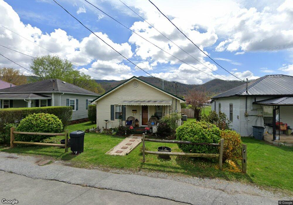
This home is located at 510 Holston Ave, Erwin, TN 37650 and is currently estimated at $163,789, approximately $136 per square foot. 510 Holston Ave is a home located in Unicoi County with nearby schools including Unicoi Community Learning Center, Love Chapel Elementary School, and Unicoi County Middle School.
Ownership History
Date
Name
Owned For
Owner Type
Purchase Details
Closed on
Nov 6, 2024
Sold by
Hughes Donna C and Atkins Donna M
Bought by
Atkins William C and Atkins Donna M
Current Estimated Value
Home Financials for this Owner
Home Financials are based on the most recent Mortgage that was taken out on this home.
Original Mortgage
$78,500
Outstanding Balance
$75,604
Interest Rate
5.41%
Mortgage Type
Credit Line Revolving
Estimated Equity
$88,185
Create a Home Valuation Report for This Property
The Home Valuation Report is an in-depth analysis detailing your home's value as well as a comparison with similar homes in the area
Home Values in the Area
Average Home Value in this Area
Purchase History
| Date | Buyer | Sale Price | Title Company |
|---|---|---|---|
| Atkins William C | -- | Title365 | |
| Atkins William C | -- | Title365 | |
| Atkins William C | -- | Title365 |
Source: Public Records
Mortgage History
| Date | Status | Borrower | Loan Amount |
|---|---|---|---|
| Open | Atkins William C | $78,500 | |
| Closed | Atkins William C | $78,500 |
Source: Public Records
Tax History Compared to Growth
Tax History
| Year | Tax Paid | Tax Assessment Tax Assessment Total Assessment is a certain percentage of the fair market value that is determined by local assessors to be the total taxable value of land and additions on the property. | Land | Improvement |
|---|---|---|---|---|
| 2024 | $467 | $17,900 | $1,875 | $16,025 |
| 2023 | $467 | $17,900 | $0 | $0 |
| 2022 | $699 | $17,900 | $1,875 | $16,025 |
| 2021 | $628 | $13,325 | $1,650 | $11,675 |
| 2020 | $606 | $13,325 | $1,650 | $11,675 |
| 2019 | $606 | $13,325 | $1,650 | $11,675 |
| 2018 | $553 | $13,325 | $1,650 | $11,675 |
| 2017 | $551 | $13,325 | $1,650 | $11,675 |
| 2016 | $592 | $14,450 | $1,650 | $12,800 |
| 2015 | $544 | $14,450 | $0 | $0 |
| 2014 | $544 | $14,450 | $0 | $0 |
Source: Public Records
Map
Nearby Homes
- 126 Ervin Loop
- 107 Ervin Loop
- 715 Ohio Ave
- 511 Coffee St
- 610 Carolina Ave
- 620 Carolina Ave
- Tbd Tennessee Rd
- 111 Parsley St
- 101 Spar Mill Rd
- 134 Parsley St
- 403 Clinchfield Ave
- 80 Jones Rd
- Tbd 2 Luttrell St
- 322 Carolina Ave
- 206 Sycamore St
- 723 Love St
- 219 Clinchfield Ave
- 215 Clinchfield Ave
- 204 Clinchfield Ave
- 315 Love St
- 514 Holston Ave
- 506 Holston Ave
- 516 Holston Ave
- 808 Broyles Ave
- 520 Holston Ave
- 522 Holston Ave
- 511 Holston Ave
- 112 Ervin Loop
- 118 Ervin Loop
- 104 Ervin Loop
- 142 Ervin Loop
- 138 Ervin Loop
- 136 Ervin Loop
- 130 Ervin Loop
- 144 Ervin Loop
- 110 Ervin Loop
- 125 Ervin Loop
- 106 Ervin Loop
- 122 Ervin Loop
- 120 Ervin Loop