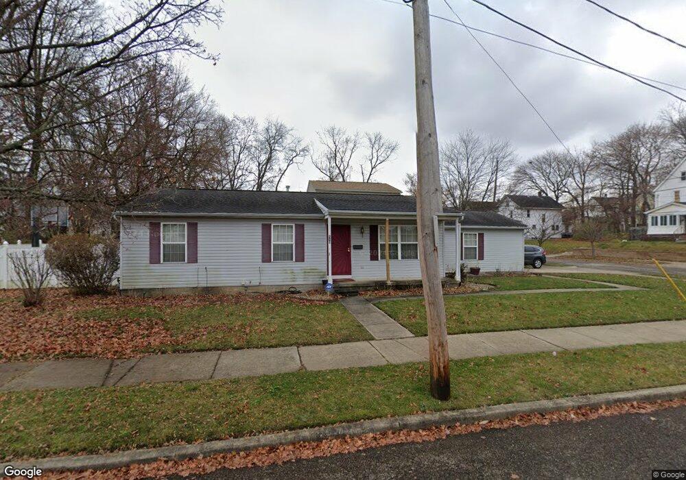
510 Howe St Akron, OH 44307
Sherbondy Hill NeighborhoodEstimated Value: $76,000 - $122,000
3
Beds
2
Baths
1,092
Sq Ft
$93/Sq Ft
Est. Value
About This Home
This home is located at 510 Howe St, Akron, OH 44307 and is currently estimated at $101,882, approximately $93 per square foot. 510 Howe St is a home located in Summit County with nearby schools including St. Bernard-St. Mary Elementary School.
Ownership History
Date
Name
Owned For
Owner Type
Purchase Details
Closed on
Dec 19, 2000
Sold by
Urban Neighborhood Development Corp
Bought by
Meadows Veronica A
Current Estimated Value
Home Financials for this Owner
Home Financials are based on the most recent Mortgage that was taken out on this home.
Original Mortgage
$69,200
Outstanding Balance
$25,739
Interest Rate
7.83%
Estimated Equity
$76,143
Purchase Details
Closed on
Apr 17, 2000
Sold by
Urban Neighborhood Development Corp
Bought by
Urban Neighborhood Development Corp
Create a Home Valuation Report for This Property
The Home Valuation Report is an in-depth analysis detailing your home's value as well as a comparison with similar homes in the area
Home Values in the Area
Average Home Value in this Area
Purchase History
| Date | Buyer | Sale Price | Title Company |
|---|---|---|---|
| Meadows Veronica A | $74,200 | Endress/Lawyers Title | |
| Urban Neighborhood Development Corp | -- | Endress/Lawyers Title |
Source: Public Records
Mortgage History
| Date | Status | Borrower | Loan Amount |
|---|---|---|---|
| Open | Meadows Veronica A | $69,200 | |
| Closed | Meadows Veronica A | $5,000 |
Source: Public Records
Tax History Compared to Growth
Tax History
| Year | Tax Paid | Tax Assessment Tax Assessment Total Assessment is a certain percentage of the fair market value that is determined by local assessors to be the total taxable value of land and additions on the property. | Land | Improvement |
|---|---|---|---|---|
| 2025 | $1,048 | $16,146 | $3,882 | $12,264 |
| 2024 | $1,048 | $16,146 | $3,882 | $12,264 |
| 2023 | $1,048 | $16,146 | $3,882 | $12,264 |
| 2022 | $841 | $9,500 | $2,286 | $7,214 |
| 2021 | $841 | $9,500 | $2,286 | $7,214 |
| 2020 | $832 | $9,500 | $2,290 | $7,210 |
| 2019 | $1,088 | $12,270 | $3,150 | $9,120 |
| 2018 | $1,076 | $12,270 | $3,150 | $9,120 |
| 2017 | $1,110 | $12,270 | $3,150 | $9,120 |
| 2016 | $1,110 | $12,540 | $3,150 | $9,390 |
| 2015 | $1,110 | $12,540 | $3,150 | $9,390 |
| 2014 | $1,102 | $12,540 | $3,150 | $9,390 |
| 2013 | $1,092 | $12,670 | $3,150 | $9,520 |
Source: Public Records
Map
Nearby Homes
- 1001 Celina Ave
- 949 Raymond St
- 1132 Bristol Terrace
- 1063 Raymond St
- 677 Vernon Odom Blvd
- 364 Campbell St
- 721 Vernon Odom Blvd
- 737 Vernon Odom Blvd
- 817 Raymond St
- 794 Ruth Ave
- 1174 La Croix Ave
- 776 Krause Ct
- 834 Kenyon St
- 738 Longview Ave
- 985 Diana Ave
- 639 Bellevue Ave
- 963 Penn Ave
- 699 Fultz St
- 564 Euclid Ave
- 670 Euclid Ave
- 999 Moeller Ave
- 507 Howe St
- 496 Howe St
- 1007 Moeller Ave
- 1004 Lane St
- 988 Moeller Ave
- 495 Howe St
- 994 Moeller Ave
- 1010 Lane St
- 979 Moeller Ave
- 990 Moeller Ave
- 1000 Moeller Ave
- 1013 Moeller Ave
- 984 Moeller Ave
- 982 Lane St
- 980 Moeller Ave
- 1008 Moeller Ave
- 1017 Moeller Ave
- 975 Moeller Ave
- 1012 Moeller Ave