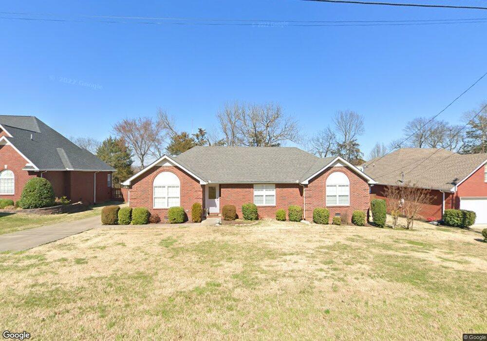
510 Johnstown Dr Smyrna, TN 37167
Estimated Value: $374,009 - $470,000
--
Bed
3
Baths
1,846
Sq Ft
$235/Sq Ft
Est. Value
About This Home
This home is located at 510 Johnstown Dr, Smyrna, TN 37167 and is currently estimated at $434,502, approximately $235 per square foot. 510 Johnstown Dr is a home located in Rutherford County with nearby schools including Rocky Fork Elementary School, Rocky Fork Middle School, and Smyrna High School.
Ownership History
Date
Name
Owned For
Owner Type
Purchase Details
Closed on
Feb 18, 2003
Sold by
Johns John M and Johns Florence C
Bought by
Galloway and Nancy
Current Estimated Value
Home Financials for this Owner
Home Financials are based on the most recent Mortgage that was taken out on this home.
Original Mortgage
$144,000
Outstanding Balance
$61,581
Interest Rate
5.93%
Mortgage Type
Purchase Money Mortgage
Estimated Equity
$372,921
Create a Home Valuation Report for This Property
The Home Valuation Report is an in-depth analysis detailing your home's value as well as a comparison with similar homes in the area
Home Values in the Area
Average Home Value in this Area
Purchase History
| Date | Buyer | Sale Price | Title Company |
|---|---|---|---|
| Galloway | $151,637 | -- |
Source: Public Records
Mortgage History
| Date | Status | Borrower | Loan Amount |
|---|---|---|---|
| Open | Galloway | $144,000 |
Source: Public Records
Tax History Compared to Growth
Tax History
| Year | Tax Paid | Tax Assessment Tax Assessment Total Assessment is a certain percentage of the fair market value that is determined by local assessors to be the total taxable value of land and additions on the property. | Land | Improvement |
|---|---|---|---|---|
| 2025 | $2,061 | $85,800 | $13,750 | $72,050 |
| 2024 | $2,061 | $85,800 | $13,750 | $72,050 |
| 2023 | $2,061 | $85,800 | $13,750 | $72,050 |
| 2022 | $1,838 | $85,800 | $13,750 | $72,050 |
| 2021 | $1,832 | $62,725 | $10,500 | $52,225 |
| 2020 | $1,832 | $62,725 | $10,500 | $52,225 |
| 2019 | $1,832 | $62,725 | $10,500 | $52,225 |
| 2018 | $1,757 | $62,725 | $0 | $0 |
| 2017 | $1,667 | $46,775 | $0 | $0 |
| 2016 | $1,667 | $46,775 | $0 | $0 |
| 2015 | $1,667 | $46,775 | $0 | $0 |
| 2014 | $1,163 | $46,775 | $0 | $0 |
| 2013 | -- | $45,600 | $0 | $0 |
Source: Public Records
Map
Nearby Homes
- 502 Johnstown Dr
- 650 Spring Hill Dr
- 715 Saint Francis Ave
- 532 Johnstown Dr
- 400 Megan Dr
- 800 Bromley Ct
- 540 Johnstown Dr
- 804 Bromley Ct
- 502 Saint Francis Ave
- 374 Rock Springs Rd
- 416 Mountain View Ct
- 508 Williamsport Dr
- 103 Crestside Ct
- 506 Mountain View Ct
- 508 Mountain View Ct
- 305 Nasturtium Way
- 107 Crestside Ct
- 510 Mountain View Ct
- 421 Saint Francis Ave
- 610 Spring Hill Dr
- 508 Johnstown Dr
- 512 Johnstown Dr
- 514 Johnstown Dr
- 506 Johnstown Dr
- 511 Johnstown Dr
- 513 Johnstown Dr
- 509 Johnstown Dr
- 515 Johnstown Dr
- 516 Johnstown Dr
- 504 Johnstown Dr
- 507 Johnstown Dr
- 517 Johnstown Dr
- 726 Saint Francis Ave
- 518 Johnstown Dr
- 724 Saint Francis Ave
- 519 Johnstown Dr
- 728 Saint Francis Ave
- 505 Johnstown Dr
- 722 Saint Francis Ave
- 521 Johnstown Dr