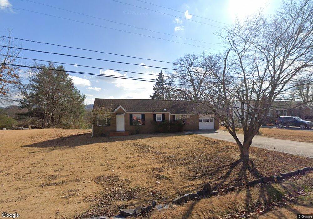
510 Oakcrest Rd Knoxville, TN 37912
Uptown Knoxville NeighborhoodEstimated Value: $194,000 - $289,000
2
Beds
1
Bath
1,120
Sq Ft
$220/Sq Ft
Est. Value
About This Home
This home is located at 510 Oakcrest Rd, Knoxville, TN 37912 and is currently estimated at $245,918, approximately $219 per square foot. 510 Oakcrest Rd is a home located in Knox County with nearby schools including Sterchi Elementary School, Gresham Middle School, and Central High School.
Ownership History
Date
Name
Owned For
Owner Type
Purchase Details
Closed on
Aug 27, 2013
Sold by
Large Carl Dewayne
Bought by
Mcginnis Melissa
Current Estimated Value
Purchase Details
Closed on
Dec 6, 2004
Sold by
Large Jerry F and Messer Barbara
Bought by
Large Carl Dewayne
Home Financials for this Owner
Home Financials are based on the most recent Mortgage that was taken out on this home.
Original Mortgage
$61,800
Interest Rate
5.09%
Mortgage Type
New Conventional
Create a Home Valuation Report for This Property
The Home Valuation Report is an in-depth analysis detailing your home's value as well as a comparison with similar homes in the area
Home Values in the Area
Average Home Value in this Area
Purchase History
| Date | Buyer | Sale Price | Title Company |
|---|---|---|---|
| Mcginnis Melissa | $65,000 | Tallent Title Group Inc | |
| Large Carl Dewayne | -- | -- |
Source: Public Records
Mortgage History
| Date | Status | Borrower | Loan Amount |
|---|---|---|---|
| Previous Owner | Large Carl Dewayne | $61,800 |
Source: Public Records
Tax History Compared to Growth
Tax History
| Year | Tax Paid | Tax Assessment Tax Assessment Total Assessment is a certain percentage of the fair market value that is determined by local assessors to be the total taxable value of land and additions on the property. | Land | Improvement |
|---|---|---|---|---|
| 2024 | $891 | $24,025 | $0 | $0 |
| 2023 | $891 | $24,025 | $0 | $0 |
| 2022 | $891 | $24,025 | $0 | $0 |
| 2021 | $1,060 | $23,125 | $0 | $0 |
| 2020 | $1,060 | $23,125 | $0 | $0 |
| 2019 | $1,060 | $23,125 | $0 | $0 |
| 2018 | $1,060 | $23,125 | $0 | $0 |
| 2017 | $1,060 | $23,125 | $0 | $0 |
| 2016 | $1,044 | $0 | $0 | $0 |
| 2015 | $1,044 | $0 | $0 | $0 |
| 2014 | $1,044 | $0 | $0 | $0 |
Source: Public Records
Map
Nearby Homes
- 5704 Lutie Rd
- 421 Oakcrest Rd
- 847 Sterchi Park Way Unit H847
- 509 Cedar Ln
- 408 Oakcrest Rd
- 715 Cedar Ln Unit 118
- 715 Cedar Ln Unit 129
- 805 Cedar Ln Unit C10
- 603 Henrietta Dr
- 5915 Nature Ln
- 6005 Stratford Park Blvd
- 724 Graham Way Unit 121
- 4901 Coy Way
- 5701 Central Avenue Pike
- 509 Highland Dr
- 207 N Laurel Cir
- 747 High Point Way Unit 22
- 0 Oaklett Dr Unit 1284831
- 1100 Cedar Ln
- 209 S Laurel Cir
- 508 Oakcrest Rd
- 512 Oakcrest Rd
- 514 Oakcrest Rd
- 506 Oakcrest Rd
- 605 Tillman Rd
- 601 Tillman Rd
- 509 Oakcrest Rd
- 609 Tillman Rd
- 517 Tillman Rd
- 507 Oakcrest Rd
- 516 Oakcrest Rd
- 5419 Sanford Rd
- 504 Oakcrest Rd
- 5415 Sanford Rd
- 613 Tillman Rd
- 513 Oakcrest Rd
- 513 Tillman Rd
- 505 Oakcrest Rd
- 5312 N Ozark Rd
- 5709 Sanford Rd