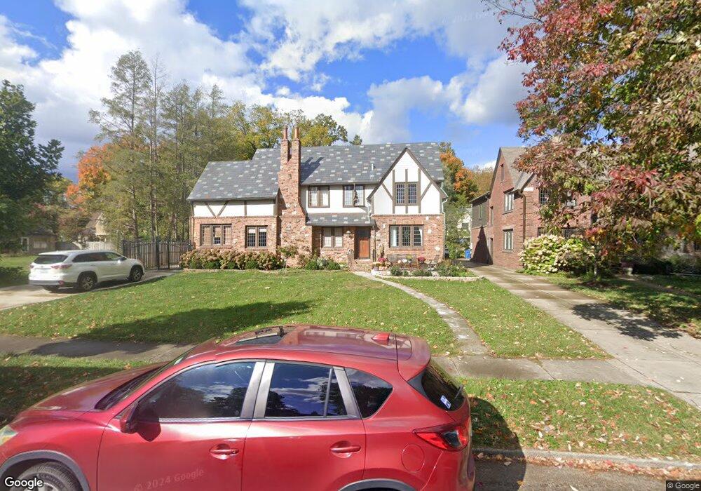
510 W Hampton Dr Indianapolis, IN 46208
Butler-Tarkington/Rocky Ripple NeighborhoodEstimated Value: $520,000 - $714,005
4
Beds
3
Baths
3,950
Sq Ft
$158/Sq Ft
Est. Value
About This Home
This home is located at 510 W Hampton Dr, Indianapolis, IN 46208 and is currently estimated at $624,251, approximately $158 per square foot. 510 W Hampton Dr is a home located in Marion County with nearby schools including James Whitcomb Riley School 43, Robert Lee Frost School 106, and Charles Warren Fairbanks School 105.
Ownership History
Date
Name
Owned For
Owner Type
Purchase Details
Closed on
Jan 20, 2010
Sold by
Crean Mary C
Bought by
Mitchell Michael K and Mitchell Sara A
Current Estimated Value
Home Financials for this Owner
Home Financials are based on the most recent Mortgage that was taken out on this home.
Original Mortgage
$240,000
Outstanding Balance
$156,933
Interest Rate
4.87%
Mortgage Type
New Conventional
Estimated Equity
$467,318
Create a Home Valuation Report for This Property
The Home Valuation Report is an in-depth analysis detailing your home's value as well as a comparison with similar homes in the area
Home Values in the Area
Average Home Value in this Area
Purchase History
| Date | Buyer | Sale Price | Title Company |
|---|---|---|---|
| Mitchell Michael K | -- | None Available |
Source: Public Records
Mortgage History
| Date | Status | Borrower | Loan Amount |
|---|---|---|---|
| Open | Mitchell Michael K | $240,000 |
Source: Public Records
Tax History Compared to Growth
Tax History
| Year | Tax Paid | Tax Assessment Tax Assessment Total Assessment is a certain percentage of the fair market value that is determined by local assessors to be the total taxable value of land and additions on the property. | Land | Improvement |
|---|---|---|---|---|
| 2024 | $5,258 | $426,700 | $87,800 | $338,900 |
| 2023 | $5,258 | $426,700 | $87,800 | $338,900 |
| 2022 | $5,031 | $443,800 | $87,800 | $356,000 |
| 2021 | $4,689 | $387,200 | $49,200 | $338,000 |
| 2020 | $4,572 | $376,300 | $49,200 | $327,100 |
| 2019 | $4,742 | $382,400 | $49,200 | $333,200 |
| 2018 | $4,147 | $331,600 | $49,200 | $282,400 |
| 2017 | $3,627 | $327,900 | $49,200 | $278,700 |
| 2016 | $3,478 | $322,000 | $49,200 | $272,800 |
| 2014 | $4,531 | $414,400 | $49,200 | $365,200 |
| 2013 | $3,920 | $374,400 | $49,200 | $325,200 |
Source: Public Records
Map
Nearby Homes
- 302 W Hampton Dr
- 260 W 44th St
- 714 Berkley Rd
- 4625 Rookwood Ave
- 4643 Rookwood Ave
- 315 W 43rd St
- 244 W 43rd St
- 4701 Rookwood Ave
- 4619 Boulevard Place
- 398 W 47th St
- 322 W 47th St
- 140 W Hampton Dr
- 4129 Cornelius Ave
- 134 W 44th St
- 530 W 41st St
- 422 W 41st St
- 4078 Rookwood Ave
- 4155 Graceland Ave
- 4061 Byram Ave
- 4652 N Kenwood Ave
- 502 W Hampton Dr
- 509 Blue Ridge Rd
- 530 W Hampton Dr
- 501 Blue Ridge Rd
- 480 W Hampton Dr
- 505 W Hampton Dr
- 445 Blue Ridge Rd
- 444 W Hampton Dr
- 435 Blue Ridge Rd
- 447 W Hampton Dr
- 439 W Hampton Dr
- 432 W Hampton Dr
- 510 W 44th St
- 520 W 44th St
- 504 W 44th St
- 510 Blue Ridge Rd
- 502 Blue Ridge Rd
- 431 Blue Ridge Rd
- 530 W 44th St
- 526 Blue Ridge Rd