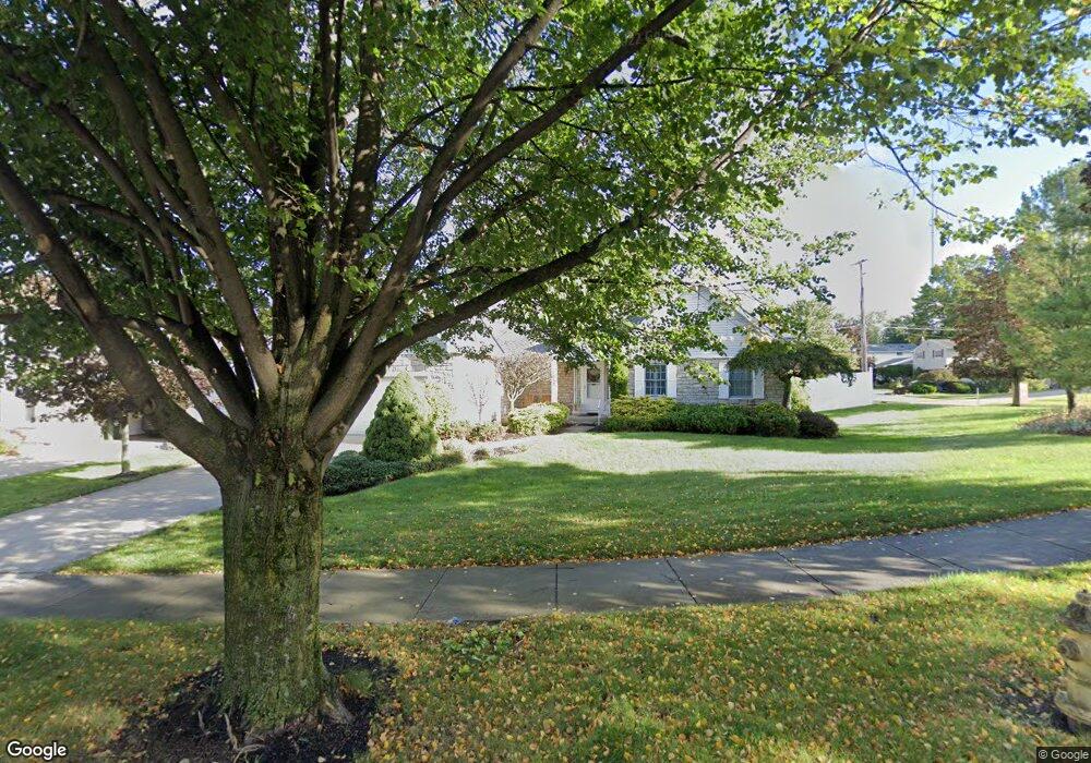
5100 Andover Dr Cleveland, OH 44134
Estimated Value: $314,000 - $377,000
3
Beds
2
Baths
1,932
Sq Ft
$172/Sq Ft
Est. Value
About This Home
This home is located at 5100 Andover Dr, Cleveland, OH 44134 and is currently estimated at $333,245, approximately $172 per square foot. 5100 Andover Dr is a home located in Cuyahoga County with nearby schools including Green Valley Elementary School, Normandy High School, and Hillside Middle School.
Ownership History
Date
Name
Owned For
Owner Type
Purchase Details
Closed on
Jul 30, 1999
Sold by
Kovar Joseph F and Kappus Daniel E
Bought by
Olszonowicz Theresa
Current Estimated Value
Home Financials for this Owner
Home Financials are based on the most recent Mortgage that was taken out on this home.
Original Mortgage
$50,000
Interest Rate
7.69%
Purchase Details
Closed on
Jul 16, 1992
Bought by
Kovar Joseph F and Kovar Dorothe M
Purchase Details
Closed on
Jan 1, 1990
Bought by
Bennett Const Inc
Create a Home Valuation Report for This Property
The Home Valuation Report is an in-depth analysis detailing your home's value as well as a comparison with similar homes in the area
Home Values in the Area
Average Home Value in this Area
Purchase History
| Date | Buyer | Sale Price | Title Company |
|---|---|---|---|
| Olszonowicz Theresa | $190,000 | Guardian Title | |
| Kovar Joseph F | $144,600 | -- | |
| Bennett Const Inc | -- | -- |
Source: Public Records
Mortgage History
| Date | Status | Borrower | Loan Amount |
|---|---|---|---|
| Previous Owner | Olszonowicz Theresa | $50,000 |
Source: Public Records
Tax History
| Year | Tax Paid | Tax Assessment Tax Assessment Total Assessment is a certain percentage of the fair market value that is determined by local assessors to be the total taxable value of land and additions on the property. | Land | Improvement |
|---|---|---|---|---|
| 2025 | $5,402 | $104,125 | $21,140 | $82,985 |
| 2024 | $5,763 | $104,125 | $21,140 | $82,985 |
| 2023 | $4,932 | $78,690 | $21,040 | $57,650 |
| 2022 | $4,916 | $78,680 | $21,040 | $57,650 |
| 2021 | $5,060 | $78,680 | $21,040 | $57,650 |
| 2020 | $4,697 | $66,120 | $17,680 | $48,440 |
| 2019 | $4,514 | $188,900 | $50,500 | $138,400 |
| 2018 | $4,299 | $66,120 | $17,680 | $48,440 |
| 2017 | $4,220 | $58,280 | $16,000 | $42,280 |
| 2016 | $4,194 | $58,280 | $16,000 | $42,280 |
| 2015 | $4,180 | $58,280 | $16,000 | $42,280 |
| 2014 | $4,180 | $60,100 | $16,490 | $43,610 |
Source: Public Records
Map
Nearby Homes
- 6140 Kelley Ln
- 4790 W Sprague Rd
- 4418 Stary Dr
- 7770 Arbor Way Unit O36
- 7790 Arbor Way Unit M31
- 8137 State Rd
- 7791 Ridge Rd
- L 8E S South Pointe Ln
- 8428 Ridge Rd
- 7663 Lime Ln
- 2915 Friar Dr
- 8320 Craigleigh Dr
- 7791 Hoertz Rd
- 5810 Ely Vista Dr
- 8267 Pinehurst Dr
- 8201 Royalview Dr
- 7550 Daytona Dr
- 6924 Day Dr
- 7408 Wake Robin Dr
- 7217 Lakeview Dr
- 5152 Andover Dr
- 7700 Roeper Rd
- 5101 Sequoia Dr
- 5204 Andover Dr
- 5121 Sequoia Dr
- 5153 Andover Dr
- 5201 Sequoia Dr
- 7659 Roeper Rd
- 7641 Roeper Rd
- 7677 Roeper Rd
- 7712 Roeper Rd
- 5205 Andover Dr
- 5221 Sequoia Dr
- 5256 Andover Dr
- 7695 Roeper Rd
- 7637 Roeper Rd
- 5241 Sequoia Dr
- 5257 Andover Dr
- 5240 Huntington Reserve Dr
- 5190 Huntington Reserve Dr
Your Personal Tour Guide
Ask me questions while you tour the home.