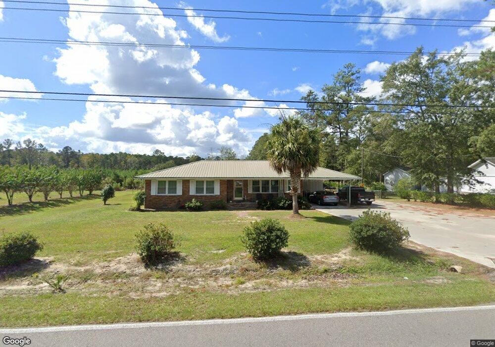
5101 Kent Rd Andrews, SC 29510
Estimated Value: $146,470 - $170,000
Studio
--
Bath
1,370
Sq Ft
$114/Sq Ft
Est. Value
About This Home
This home is located at 5101 Kent Rd, Andrews, SC 29510 and is currently estimated at $156,118, approximately $113 per square foot. 5101 Kent Rd is a home located in Georgetown County with nearby schools including Andrews Elementary School, Rosemary Middle School, and Andrews High School.
Ownership History
Date
Name
Owned For
Owner Type
Purchase Details
Closed on
Dec 6, 2022
Sold by
Pope Phillip R
Bought by
Philip R Pope Revocable Living Trust
Current Estimated Value
Purchase Details
Closed on
May 17, 2017
Sold by
Phillip R Pope
Bought by
Harrington Randy
Home Financials for this Owner
Home Financials are based on the most recent Mortgage that was taken out on this home.
Original Mortgage
$25,000
Interest Rate
4.05%
Purchase Details
Closed on
Jun 11, 2009
Sold by
Pope Phillip Reed
Bought by
Pope Phillip Reed
Purchase Details
Closed on
Aug 2, 2006
Sold by
Pope Phillip Reed
Bought by
Pope Phillip Reed
Purchase Details
Closed on
Mar 1, 2002
Sold by
Reed Pope Phillip
Bought by
Pope Phillip R
Create a Home Valuation Report for This Property
The Home Valuation Report is an in-depth analysis detailing your home's value as well as a comparison with similar homes in the area
Purchase History
| Date | Buyer | Sale Price | Title Company |
|---|---|---|---|
| Philip R Pope Revocable Living Trust | -- | -- | |
| Harrington Randy | -- | -- | |
| Pope Phillip Reed | $33,354 | -- | |
| Pope Phillip Reed | $33,000 | None Available | |
| Pope Phillip R | $41,500 | -- |
Source: Public Records
Mortgage History
| Date | Status | Borrower | Loan Amount |
|---|---|---|---|
| Previous Owner | Harrington Randy | $25,000 | |
| Previous Owner | Harrington Randy | -- |
Source: Public Records
Tax History
| Year | Tax Paid | Tax Assessment Tax Assessment Total Assessment is a certain percentage of the fair market value that is determined by local assessors to be the total taxable value of land and additions on the property. | Land | Improvement |
|---|---|---|---|---|
| 2025 | $351 | $3,905 | $537 | $3,368 |
| 2024 | $351 | $3,400 | $560 | $2,840 |
| 2023 | $298 | $3,400 | $560 | $2,840 |
| 2022 | $281 | $3,400 | $560 | $2,840 |
| 2021 | $276 | $3,396 | $560 | $2,836 |
| 2020 | $276 | $3,396 | $560 | $2,836 |
| 2019 | $271 | $3,368 | $560 | $2,808 |
| 2018 | $278 | $33,680 | $0 | $0 |
| 2017 | $166 | $33,680 | $0 | $0 |
| 2016 | $402 | $3,368 | $0 | $0 |
| 2015 | $399 | $0 | $0 | $0 |
| 2014 | $1,140 | $81,400 | $14,000 | $67,400 |
| 2012 | -- | $81,400 | $14,000 | $67,400 |
Source: Public Records
Map
Nearby Homes
- 160 Leadwood St
- 85 Blackjack Ln
- 140 Leadwood St
- 142 Desurrency Ct
- 7.90 Acres-TBD Puncheon Creek Dr
- 793 Puncheon Creek Dr
- 520 Deer Spring Loop
- 12155 Gapway Rd
- 73 Newton Trail
- 53 Newton Trail
- 43 Newton Trail
- 33 Newton Trail
- 23 Newton Trail
- 23 Newton Trail Unit 23, 33, 43, 53, 73 N
- 0 Rd
- 121 Feather Dr
- TBD Georgetown Hwy
- 101 Feather Dr
- 754 Kent Rd
- 8 Clair St
- 5008 Kent Rd
- 5248 Kent Rd
- 455 County Road S-22-821
- 0 County Road S-22-821
- 399 County Road S-22-821
- 23 Slash St
- 22 Slash St
- 5293 Kent Rd
- 0 Tbd Kent Rd Unit 2222925
- 5284 Kent Rd
- 4877 Kent Rd
- 4877 Kent Rd
- 4877 Kent Rd
- 5316 Kent Rd
- 5316 Kent Rd
- 95 Slash St
- 221 Glass Ave
- 159 Glass Ave
- 5358 Kent Rd
- 4823 Kent Rd