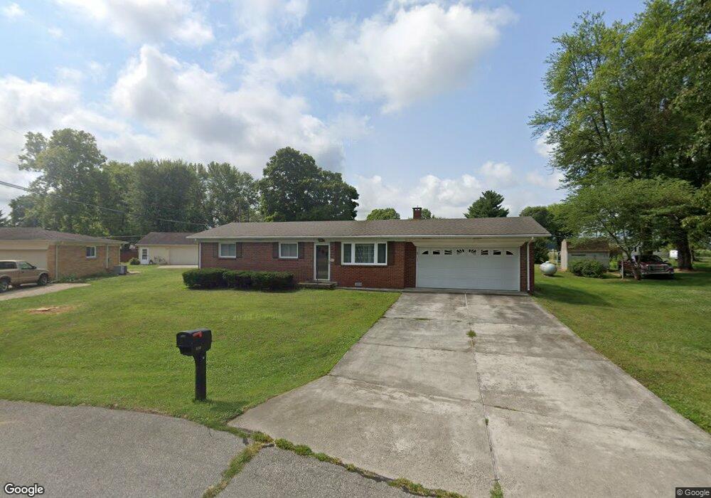
5103 E Karlsway Dr Columbus, IN 47201
Estimated Value: $258,000 - $272,000
3
Beds
2
Baths
1,734
Sq Ft
$153/Sq Ft
Est. Value
About This Home
This home is located at 5103 E Karlsway Dr, Columbus, IN 47201 and is currently estimated at $266,133, approximately $153 per square foot. 5103 E Karlsway Dr is a home located in Bartholomew County with nearby schools including Rockcreek Elementary School, Northside Middle School, and Columbus East High School.
Ownership History
Date
Name
Owned For
Owner Type
Purchase Details
Closed on
Aug 4, 2021
Sold by
Hole Brian S
Bought by
Hole Ryan S and Szyszkiewicz Taylor R
Current Estimated Value
Purchase Details
Closed on
Jul 30, 2021
Sold by
Grant Jennifer L
Bought by
Hole Brian S
Purchase Details
Closed on
Dec 2, 2015
Sold by
Christman Betty D and Christman Larry D
Bought by
Christman Betty D
Purchase Details
Closed on
Jun 17, 2005
Sold by
Hole James E and Hole Phyllis A
Bought by
Grant Jennifer L and Hole Brian S
Create a Home Valuation Report for This Property
The Home Valuation Report is an in-depth analysis detailing your home's value as well as a comparison with similar homes in the area
Home Values in the Area
Average Home Value in this Area
Purchase History
| Date | Buyer | Sale Price | Title Company |
|---|---|---|---|
| Hole Ryan S | -- | None Available | |
| Hole Brian S | -- | None Available | |
| Christman Betty D | -- | Attorney | |
| Grant Jennifer L | -- | None Available |
Source: Public Records
Tax History Compared to Growth
Tax History
| Year | Tax Paid | Tax Assessment Tax Assessment Total Assessment is a certain percentage of the fair market value that is determined by local assessors to be the total taxable value of land and additions on the property. | Land | Improvement |
|---|---|---|---|---|
| 2024 | $1,395 | $217,500 | $36,300 | $181,200 |
| 2023 | $1,433 | $217,400 | $36,300 | $181,100 |
| 2022 | $1,385 | $198,000 | $36,300 | $161,700 |
| 2021 | $1,418 | $179,000 | $20,700 | $158,300 |
| 2020 | $966 | $132,400 | $20,700 | $111,700 |
| 2019 | $854 | $132,400 | $20,700 | $111,700 |
| 2018 | $763 | $122,200 | $20,700 | $101,500 |
| 2017 | $769 | $123,300 | $19,600 | $103,700 |
| 2016 | $689 | $115,300 | $19,600 | $95,700 |
| 2014 | $831 | $128,000 | $19,600 | $108,400 |
Source: Public Records
Map
Nearby Homes
- 4725 S 250 E
- 3660 E 300 S
- 6594 S Jonesville Rd
- 6354 S Jonesville Rd
- 1001 E 450 S
- 4110 E 200 S
- 403 Railroad St
- 5974 S Jonesville Rd
- 9500 E 600 S
- 181 W 550 S
- 23A E 750 S
- 234 Lincoln St
- 619 Falcon Dr
- 141 Dawson St
- 11775 E State Road 7
- 2 W Cr 990 North Tract "H"
- 1 W Cr 990 North Tract "G"
- 729 Glendale Dr
- 523 Fairview Dr
- 2905 Kentucky Ave
- 5123 E Karlsway Dr
- 5063 E Karlsway Dr
- 7303 S Artesian Dr
- 7283 S Artesian Dr
- 7221 S 250 E
- 5163 E Karlsway Dr
- 7343 S Artesian Dr
- 5122 E Karlsway Dr
- 7181 S 250 E
- 5162 E Karlsway Dr
- 5193 E Karlsway Dr
- 7230 S Artesian Dr
- 5192 E Karlsway Dr
- 5131 E Forster Ave
- 5074 E Forster Ave
- 5223 E Karlsway Dr
- 7271 S 250 E
- 7290 S Artesian Dr