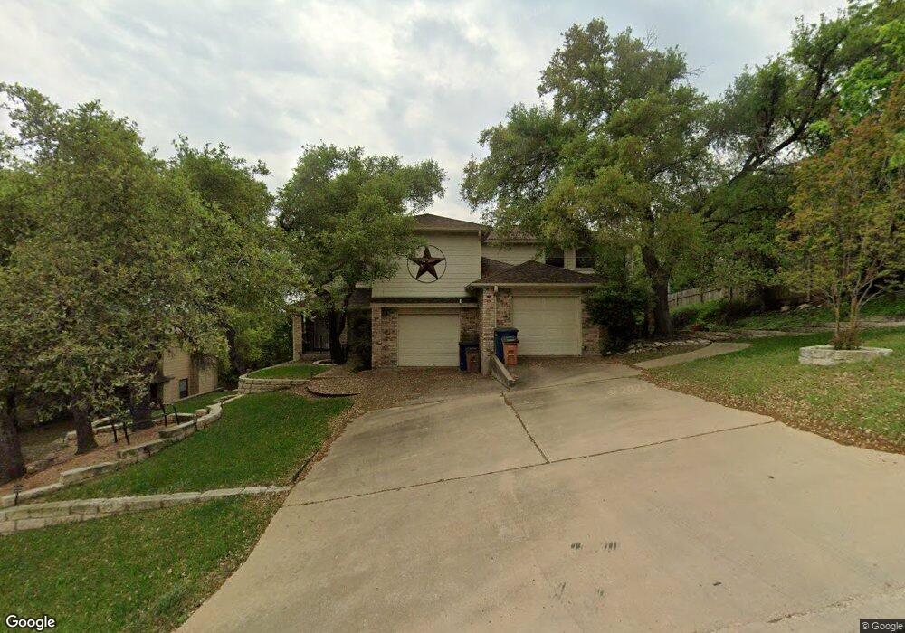
5103 Smokey Valley Unit A Austin, TX 78731
Cat Mountain NeighborhoodEstimated Value: $716,000 - $1,189,000
2
Beds
3
Baths
2,326
Sq Ft
$392/Sq Ft
Est. Value
About This Home
This home is located at 5103 Smokey Valley Unit A, Austin, TX 78731 and is currently estimated at $912,232, approximately $392 per square foot. 5103 Smokey Valley Unit A is a home located in Travis County with nearby schools including Doss Elementary School, Murchison Middle School, and Anderson High School.
Ownership History
Date
Name
Owned For
Owner Type
Purchase Details
Closed on
Nov 22, 2011
Sold by
Chafin Charles Weldon and Cha Lola
Bought by
Weldon Chaffin Ronald Lowell and Charles Weldon & Lola Sherrod Chaffin Tr
Current Estimated Value
Purchase Details
Closed on
Feb 22, 2011
Sold by
Fritsch Michael A and Fritsch Lisa D
Bought by
Charles Weldon & Lola Sherrod Chaffin Tr
Purchase Details
Closed on
Sep 28, 2000
Sold by
Holub Conlan Patricia C and Holub Conlan Sandra
Bought by
Fritsch Michael A and Fritsch Lisa D
Home Financials for this Owner
Home Financials are based on the most recent Mortgage that was taken out on this home.
Original Mortgage
$238,000
Interest Rate
7.97%
Mortgage Type
Purchase Money Mortgage
Create a Home Valuation Report for This Property
The Home Valuation Report is an in-depth analysis detailing your home's value as well as a comparison with similar homes in the area
Home Values in the Area
Average Home Value in this Area
Purchase History
| Date | Buyer | Sale Price | Title Company |
|---|---|---|---|
| Weldon Chaffin Ronald Lowell | -- | None Available | |
| Charles Weldon & Lola Sherrod Chaffin Tr | -- | Atc | |
| Fritsch Michael A | -- | Texas Professional Title Inc |
Source: Public Records
Mortgage History
| Date | Status | Borrower | Loan Amount |
|---|---|---|---|
| Previous Owner | Fritsch Michael A | $238,000 |
Source: Public Records
Tax History
| Year | Tax Paid | Tax Assessment Tax Assessment Total Assessment is a certain percentage of the fair market value that is determined by local assessors to be the total taxable value of land and additions on the property. | Land | Improvement |
|---|---|---|---|---|
| 2025 | $14,220 | $694,834 | $593,510 | $101,324 |
| 2023 | $16,689 | $922,433 | $660,000 | $262,433 |
| 2022 | $19,856 | $1,005,410 | $660,000 | $345,410 |
| 2021 | $15,487 | $711,500 | $440,000 | $271,500 |
| 2020 | $11,554 | $538,700 | $440,000 | $98,700 |
| 2018 | $12,066 | $545,000 | $440,000 | $105,000 |
| 2017 | $10,170 | $456,028 | $220,000 | $236,028 |
| 2016 | $9,311 | $417,486 | $220,000 | $197,486 |
| 2015 | $9,043 | $387,484 | $220,000 | $167,484 |
| 2014 | $9,043 | $380,000 | $242,000 | $138,000 |
Source: Public Records
Map
Nearby Homes
- 6905 Ladera Norte
- 4906 Bob Cat Run
- 5206 Backtrail Dr
- 7111 Valburn Dr
- 5500 Cedro Trail
- 6601 N Capital of Texas Hwy
- 4324 Far Blvd W
- 7643 Parkview Cir
- 6804 N Capital of Texas Hwy Unit 824
- 6804 N Capital of Texas Hwy Unit 622
- 6804 N Capital of Texas Hwy Unit 226
- 6804 N Capital of Texas Hwy Unit 812
- 6804 N Capital of Texas Hwy Unit 125
- 7211 Lakewood Dr Unit E118
- 7507 Downridge Dr
- 7205 Waldon Dr Unit N208
- 6702-6712 N Capital of Texas Hwy
- 4202 N Hills Dr
- 6000 Shepherd Mountain Cove Unit 1710
- 6000 Shepherd Mountain Cove Unit 503
- 5103 Smokey Valley Unit B
- 5103 Smokey Valley
- 5101 Smokey Valley
- 6603 Ladera Norte
- 6601 Ladera Norte
- 5007 Smokey Valley Unit A
- 5007 Smokey Valley Unit B
- 5007 Smokey Valley
- 6700 Ohenry Cove Unit B
- 6700 Ohenry Cove
- 5102 Smokey Valley
- 5100 Smokey Valley Unit B
- 5100 Smokey Valley
- 6701 Ladera Norte
- 6527 Ladera Norte
- 6525 Ladera Norte
- 6706 Ohenry Cove
- 5005 Smokey Valley Unit B
- 5005 Smokey Valley
- 5005 Smokey Valley Unit A
Your Personal Tour Guide
Ask me questions while you tour the home.