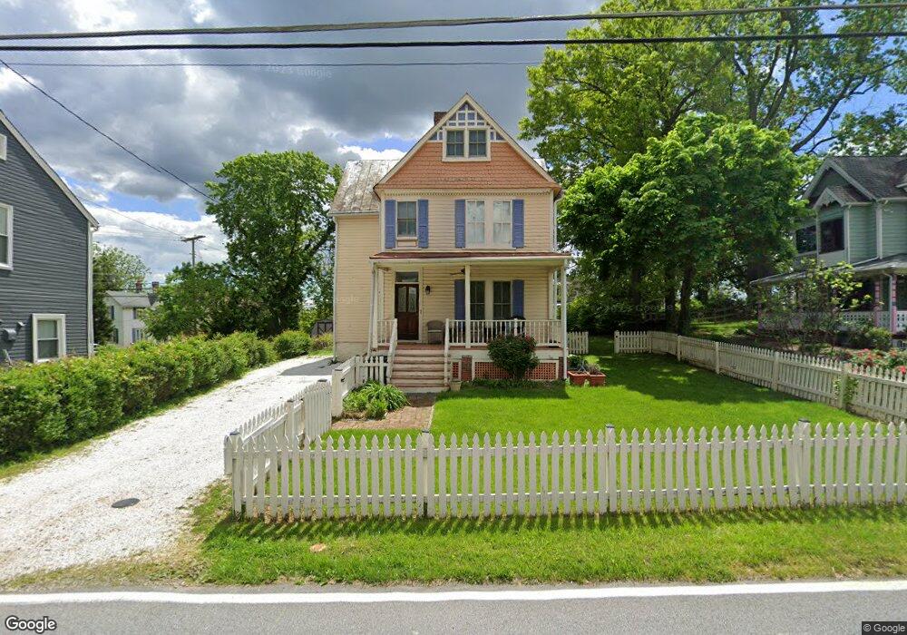
5105 S Rolling Rd Halethorpe, MD 21227
Estimated Value: $343,000 - $397,000
Studio
2
Baths
1,600
Sq Ft
$233/Sq Ft
Est. Value
About This Home
This home is located at 5105 S Rolling Rd, Halethorpe, MD 21227 and is currently estimated at $373,448, approximately $233 per square foot. 5105 S Rolling Rd is a home located in Baltimore County with nearby schools including Relay Elementary School, Arbutus Middle School, and Lansdowne High School.
Ownership History
Date
Name
Owned For
Owner Type
Purchase Details
Closed on
Jun 29, 1998
Sold by
Roberts Dale Charles
Bought by
Roberts Dale Charles and Fishman Ann Maureen
Current Estimated Value
Purchase Details
Closed on
Jan 26, 1995
Sold by
Pulver Scott A
Bought by
Roberts Dale C
Home Financials for this Owner
Home Financials are based on the most recent Mortgage that was taken out on this home.
Original Mortgage
$135,000
Interest Rate
9.24%
Purchase Details
Closed on
Sep 12, 1990
Sold by
Bartlett Letitia K
Bought by
Pulver Scott A
Create a Home Valuation Report for This Property
The Home Valuation Report is an in-depth analysis detailing your home's value as well as a comparison with similar homes in the area
Home Values in the Area
Average Home Value in this Area
Purchase History
| Date | Buyer | Sale Price | Title Company |
|---|---|---|---|
| Roberts Dale Charles | -- | -- | |
| Roberts Dale C | $150,000 | -- | |
| Pulver Scott A | $112,500 | -- |
Source: Public Records
Mortgage History
| Date | Status | Borrower | Loan Amount |
|---|---|---|---|
| Previous Owner | Roberts Dale C | $135,000 |
Source: Public Records
Tax History
| Year | Tax Paid | Tax Assessment Tax Assessment Total Assessment is a certain percentage of the fair market value that is determined by local assessors to be the total taxable value of land and additions on the property. | Land | Improvement |
|---|---|---|---|---|
| 2025 | $4,056 | $284,167 | -- | -- |
| 2024 | $4,056 | $266,000 | $83,600 | $182,400 |
| 2023 | $1,830 | $263,700 | $0 | $0 |
| 2022 | $3,584 | $261,400 | $0 | $0 |
| 2021 | $680 | $259,100 | $83,600 | $175,500 |
| 2020 | $680 | $247,833 | $0 | $0 |
| 2019 | $3,221 | $236,567 | $0 | $0 |
| 2018 | $3,391 | $225,300 | $83,600 | $141,700 |
| 2017 | $3,252 | $224,067 | $0 | $0 |
| 2016 | $2,833 | $222,833 | $0 | $0 |
| 2015 | $2,833 | $221,600 | $0 | $0 |
| 2014 | $2,833 | $221,600 | $0 | $0 |
Source: Public Records
Map
Nearby Homes
- 5816 Richardson Mews Square
- 19 Piedmont Ct
- 25 W W End Ct
- 16 W End Ct
- 20 Deer Run Ct Unit F
- 901 Grovehill Rd
- 927 Grovehill Rd
- 1027 Downton Rd
- 1015 Stormont Cir
- 1078 Downton Rd
- 933 Elm Rd
- 4624 Magnolia Ave
- 1710H Selma Ave
- 4606 Ridge Ave
- 6037 Claire Dr
- 5605 Oregon Ave
- 1207 Brewster St
- 1125 Furnace Rd
- 5522 Ashbourne Rd
- 1816 Fairview Ave
- 5101 S Rolling Rd
- 5109 S Rolling Rd
- 1710 Arlington Ave
- 1707 Arlington Ave
- 5112 S Rolling Rd
- 1620 S Rolling Rd
- 5025 Cedar Ave
- 1703 Arlington Ave
- 1705 Arlington Ave
- 5113 S Rolling Rd
- 5114 S Rolling Rd
- 1709 Arlington Ave
- 5119 S Rolling Rd
- 1608 Linden Ln
- 1605 S Rolling Rd
- 1711 Arlington Ave
- 5117 S Rolling Rd
- 1701 Willis Dr
- 1705 Willis Dr
- 1715 Arlington Ave
Your Personal Tour Guide
Ask me questions while you tour the home.