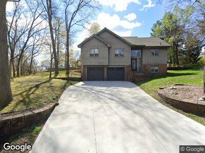
5105 Wah Ta Wah Dr Clarkston, MI 48348
Estimated Value: $333,429 - $421,000
3
Beds
3
Baths
1,841
Sq Ft
$200/Sq Ft
Est. Value
About This Home
This home is located at 5105 Wah Ta Wah Dr, Clarkston, MI 48348 and is currently estimated at $368,357, approximately $200 per square foot. 5105 Wah Ta Wah Dr is a home located in Oakland County with nearby schools including Everest Academy.
Ownership History
Date
Name
Owned For
Owner Type
Purchase Details
Closed on
Mar 9, 2005
Sold by
Parenti Stephanie V and Strat Stephanie V
Bought by
Strat Michael
Current Estimated Value
Purchase Details
Closed on
Dec 5, 2003
Sold by
Bachrack Marcus and Shirshun Jennifer
Bought by
Strat Michael
Purchase Details
Closed on
Mar 4, 1999
Sold by
Mccarty Patrick J
Bought by
Bachrack Marcus
Home Financials for this Owner
Home Financials are based on the most recent Mortgage that was taken out on this home.
Original Mortgage
$16,000
Interest Rate
7.05%
Mortgage Type
Purchase Money Mortgage
Create a Home Valuation Report for This Property
The Home Valuation Report is an in-depth analysis detailing your home's value as well as a comparison with similar homes in the area
Home Values in the Area
Average Home Value in this Area
Purchase History
| Date | Buyer | Sale Price | Title Company |
|---|---|---|---|
| Strat Michael | -- | First American Title Ins Co | |
| Strat Michael | $265,000 | First American Title | |
| Bachrack Marcus | $183,900 | -- |
Source: Public Records
Mortgage History
| Date | Status | Borrower | Loan Amount |
|---|---|---|---|
| Open | Strat Michael T | $220,102 | |
| Closed | Strat Michael | $38,600 | |
| Closed | Strat Michael T | $200,000 | |
| Previous Owner | Bachrack Marcus | $16,000 |
Source: Public Records
Tax History Compared to Growth
Tax History
| Year | Tax Paid | Tax Assessment Tax Assessment Total Assessment is a certain percentage of the fair market value that is determined by local assessors to be the total taxable value of land and additions on the property. | Land | Improvement |
|---|---|---|---|---|
| 2024 | $1,566 | $141,100 | $26,300 | $114,800 |
| 2023 | $2,112 | $122,900 | $24,800 | $98,100 |
| 2022 | $2,467 | $112,900 | $23,000 | $89,900 |
| 2021 | $2,505 | $112,400 | $22,800 | $89,600 |
| 2020 | $1,367 | $99,500 | $18,400 | $81,100 |
| 2018 | $3,344 | $100,900 | $17,500 | $83,400 |
| 2015 | -- | $82,100 | $0 | $0 |
| 2014 | -- | $79,300 | $0 | $0 |
| 2011 | -- | $65,600 | $0 | $0 |
Source: Public Records
Map
Nearby Homes
- 8840 Minne Wanna Rd
- 4985 Mohawk Ave
- 5001 Forest Valley Dr
- 0 Thendara Blvd Unit 20250006134
- 9550 Colgate Ave
- 9514 Cornell Ave
- 4738 Goodale Ave
- 9602 Cornell Ave
- 4915 Clarkston Rd
- 809 Hawksmoore Dr
- LOT #36 Stonewall E
- 4965 Crestview Dr
- 00 Pine Knob Rd
- 5462 Boyne Highland Trail
- 9311 Whipple Shores Dr
- 000 Klais Dr
- 00 Clarkston Rd
- 9382 Sashabaw Rd
- 9920 Sashabaw Rd
- 000 Blueridge
- 5105 Wah Ta Wah Dr
- 5086 Tiohero Blvd
- 5097 Wah Ta Wah Dr
- 5109 Wah Ta Wah Dr
- 000 Wah-Ta-wah
- 5074 Tiohero Blvd
- 5113 Wah Ta Wah Dr
- 5113 Wah-Ta-wah
- 5100 Wah Ta Wah Dr
- 5091 Wah Ta Wah Dr
- 5108 Tiohero Blvd
- 5085 Tiohero Blvd
- 8960 Michigamme Rd
- 5075 Tiohero Blvd
- 5093 Tiohero Blvd
- 5117 Wah Ta Wah Dr
- 5080 Wah Ta Wah Dr
- 5105 Tiohero Blvd
- 5057 Tiohero Blvd
- 5077 Algonquin Blvd