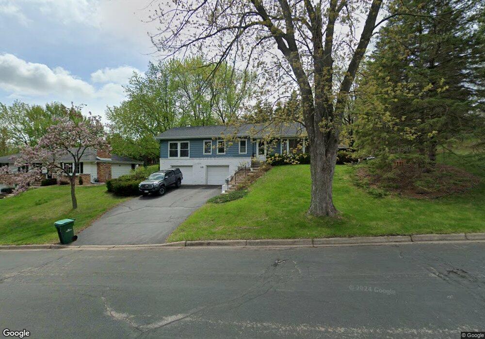
5109 W 92nd St Bloomington, MN 55437
West Bloomington NeighborhoodEstimated Value: $414,718 - $568,000
3
Beds
2
Baths
1,478
Sq Ft
$321/Sq Ft
Est. Value
About This Home
This home is located at 5109 W 92nd St, Bloomington, MN 55437 and is currently estimated at $474,180, approximately $320 per square foot. 5109 W 92nd St is a home located in Hennepin County with nearby schools including Normandale Hills Elementary School, Oak Grove Middle School, and Jefferson Senior High School.
Ownership History
Date
Name
Owned For
Owner Type
Purchase Details
Closed on
Sep 9, 2011
Sold by
Germain Frederick H and Germain Lorna J
Bought by
Gibbs Paul C and Gibbs Rochelle Ann Germain
Current Estimated Value
Home Financials for this Owner
Home Financials are based on the most recent Mortgage that was taken out on this home.
Original Mortgage
$204,323
Interest Rate
4.32%
Mortgage Type
FHA
Purchase Details
Closed on
Feb 1, 2011
Sold by
France 98 Llc
Bought by
Great Western Bank
Create a Home Valuation Report for This Property
The Home Valuation Report is an in-depth analysis detailing your home's value as well as a comparison with similar homes in the area
Home Values in the Area
Average Home Value in this Area
Purchase History
| Date | Buyer | Sale Price | Title Company |
|---|---|---|---|
| Gibbs Paul C | $238,000 | None Available | |
| Great Western Bank | $15,431,804 | -- |
Source: Public Records
Mortgage History
| Date | Status | Borrower | Loan Amount |
|---|---|---|---|
| Previous Owner | Gibbs Paul C | $204,323 | |
| Closed | Great Western Bank | -- |
Source: Public Records
Tax History Compared to Growth
Tax History
| Year | Tax Paid | Tax Assessment Tax Assessment Total Assessment is a certain percentage of the fair market value that is determined by local assessors to be the total taxable value of land and additions on the property. | Land | Improvement |
|---|---|---|---|---|
| 2024 | $5,166 | $405,800 | $140,300 | $265,500 |
| 2023 | $4,869 | $404,400 | $143,000 | $261,400 |
| 2022 | $4,173 | $397,800 | $132,200 | $265,600 |
| 2021 | $3,823 | $331,100 | $123,400 | $207,700 |
| 2020 | $3,940 | $308,500 | $120,000 | $188,500 |
| 2019 | $3,659 | $308,800 | $120,000 | $188,800 |
| 2018 | $3,833 | $283,900 | $132,400 | $151,500 |
| 2017 | $3,307 | $254,900 | $118,800 | $136,100 |
| 2016 | $3,488 | $254,600 | $119,900 | $134,700 |
| 2015 | $3,566 | $250,600 | $115,300 | $135,300 |
| 2014 | -- | $220,400 | $111,800 | $108,600 |
Source: Public Records
Map
Nearby Homes
- 4617 Southmore Dr
- 9018 Kell Cir
- 9365 Nesbitt Rd
- 9728 Palmer Cir
- 5312 Highpointe Terrace
- 5624 Hyland Courts Dr
- 4533 W 85th St
- 5325 Highpointe Terrace Unit 4325
- 5509 Hyland Courts Dr
- 5481 Hyland Courts Dr
- 6101 W 94th St
- 5469 Hyland Courts Dr
- 8441 Irwin Rd Unit 202
- 8441 Irwin Rd Unit 110
- 8611 Chalet Rd
- 8549 Irwin Rd Unit 239
- 4109 W 84th St
- 3801 W 98th St Unit 402
- 3816 W 84th St
- 5140 W 102nd St Unit 110
- 5101 W 92nd St
- 5117 W 92nd St
- 5203 W 92nd Street Cir
- 5201 W 92nd Street Cir
- 5100 W 92nd St
- 5116 W 92nd St
- 5108 W 92nd St
- 5205 W 92nd Street Cir
- 5200 W 92nd St
- 5016 Kingsdale Dr
- 9116 Poplar Bridge Rd
- 5207 W 92nd Street Cir
- 9143 Poplar Bridge Rd
- 5017 Kingsdale Dr
- 5208 W 92nd St
- 5209 W 92nd Street Cir
- 5216 W 92nd St
- 9209 Poplar Bridge Rd
- 5008 Kingsdale Dr
- 9108 Poplar Bridge Rd