Estimated Value: $1,563,616 - $1,726,000
5
Beds
4
Baths
2,732
Sq Ft
$592/Sq Ft
Est. Value
About This Home
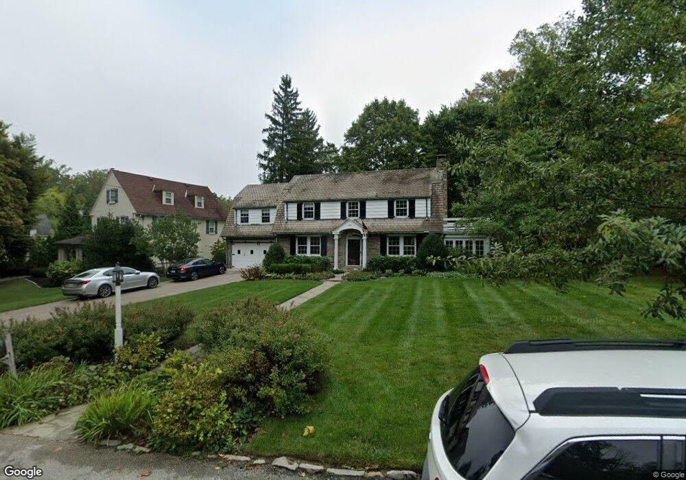
This home is located at 511 Askin Rd, Wayne, PA 19087 and is currently estimated at $1,618,654, approximately $592 per square foot. 511 Askin Rd is a home located in Delaware County with nearby schools including Wayne Elementary School, Radnor Middle School, and Radnor Senior High School.
Ownership History
Date
Name
Owned For
Owner Type
Purchase Details
Closed on
Jun 29, 2007
Sold by
Addis Kent B and Addis Susan C
Bought by
Addis Kent R and Addis Susan C
Current Estimated Value
Purchase Details
Closed on
Jul 15, 2005
Sold by
Chadwick Charles B and Chadwick Benjamin B
Bought by
Addis Kent B and Addis Susan C
Home Financials for this Owner
Home Financials are based on the most recent Mortgage that was taken out on this home.
Original Mortgage
$359,000
Interest Rate
5.84%
Mortgage Type
Fannie Mae Freddie Mac
Create a Home Valuation Report for This Property
The Home Valuation Report is an in-depth analysis detailing your home's value as well as a comparison with similar homes in the area
Home Values in the Area
Average Home Value in this Area
Purchase History
| Date | Buyer | Sale Price | Title Company |
|---|---|---|---|
| Addis Kent R | -- | None Available | |
| Addis Kent B | $635,000 | None Available |
Source: Public Records
Mortgage History
| Date | Status | Borrower | Loan Amount |
|---|---|---|---|
| Previous Owner | Addis Kent B | $359,000 |
Source: Public Records
Tax History
| Year | Tax Paid | Tax Assessment Tax Assessment Total Assessment is a certain percentage of the fair market value that is determined by local assessors to be the total taxable value of land and additions on the property. | Land | Improvement |
|---|---|---|---|---|
| 2025 | $17,221 | $851,770 | $287,760 | $564,010 |
| 2024 | $17,221 | $851,770 | $287,760 | $564,010 |
| 2023 | $16,539 | $851,770 | $287,760 | $564,010 |
| 2022 | $16,358 | $851,770 | $287,760 | $564,010 |
| 2021 | $26,276 | $851,770 | $287,760 | $564,010 |
| 2020 | $10,966 | $315,240 | $140,570 | $174,670 |
| 2019 | $10,657 | $315,240 | $140,570 | $174,670 |
| 2018 | $10,448 | $315,240 | $0 | $0 |
| 2017 | $10,229 | $315,240 | $0 | $0 |
| 2016 | $1,730 | $315,240 | $0 | $0 |
| 2015 | $1,765 | $315,240 | $0 | $0 |
| 2014 | $1,730 | $315,240 | $0 | $0 |
Source: Public Records
Map
Nearby Homes
- 24 Orchard Ln
- 848 Parkes Run Ln
- 770 & 768 Parkes Run Ln
- 421 Midland Ave
- 500 E Lancaster Ave Unit 111A
- 658 Brooke Rd
- 0 Greenwell Ln
- 427 E Lancaster Ave Unit 1202
- 300 Iron Works Way Unit 326
- 228 S Radnor Chester Rd
- 220 Radnor Chester Rd
- 423 Maplewood Ave
- 216 Bloomingdale Ave
- 260 N Aberdeen Ave
- 625 Conestoga Rd
- 203 Church St
- 458 Huston Rd
- 541 Atterbury Rd
- 412 Fairview Dr
- 118 W Beechtree Ln
Your Personal Tour Guide
Ask me questions while you tour the home.