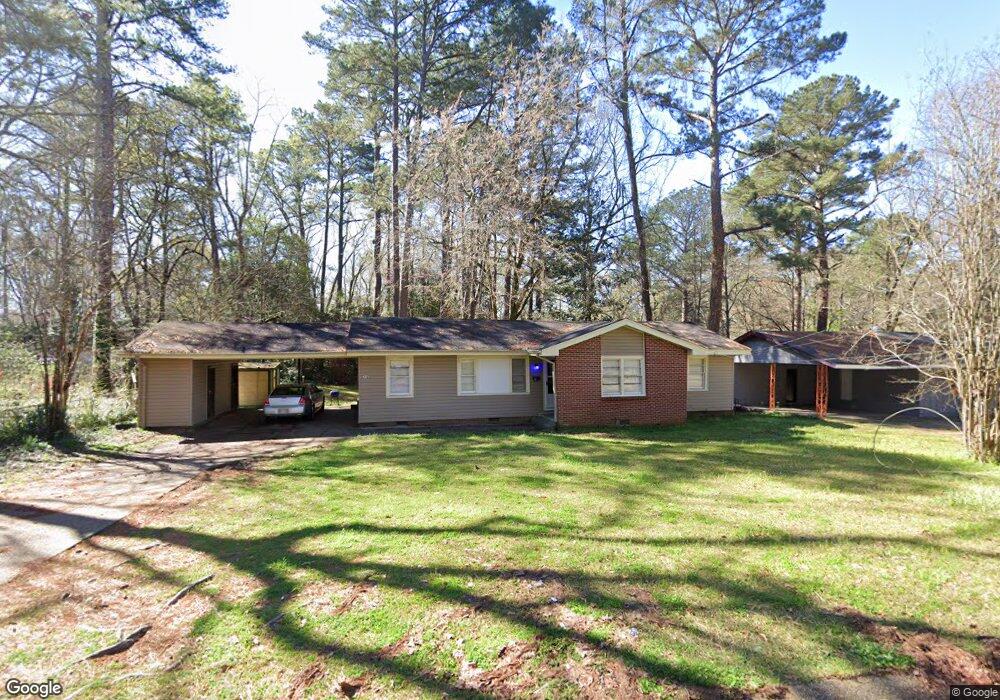
511 Daniel Cir Unit 1 Jackson, MS 39212
South Jackson NeighborhoodEstimated Value: $61,954 - $69,000
4
Beds
2
Baths
1,529
Sq Ft
$43/Sq Ft
Est. Value
About This Home
This home is located at 511 Daniel Cir Unit 1, Jackson, MS 39212 and is currently estimated at $65,489, approximately $42 per square foot. 511 Daniel Cir Unit 1 is a home located in Hinds County with nearby schools including Reimagine Prep Middle School.
Ownership History
Date
Name
Owned For
Owner Type
Purchase Details
Closed on
May 3, 2017
Sold by
Usa Regrowth Fund Llc
Bought by
Barlow Jonathan
Current Estimated Value
Home Financials for this Owner
Home Financials are based on the most recent Mortgage that was taken out on this home.
Original Mortgage
$44,000
Outstanding Balance
$36,591
Interest Rate
4.1%
Mortgage Type
New Conventional
Estimated Equity
$28,898
Purchase Details
Closed on
Aug 3, 2016
Sold by
Sarang Llc
Bought by
Usa Regrowth Fund Llc
Purchase Details
Closed on
Apr 26, 2011
Sold by
Anderson Gary Kendall and Anderson Mary Jo
Bought by
Samuel Shonda
Home Financials for this Owner
Home Financials are based on the most recent Mortgage that was taken out on this home.
Original Mortgage
$58,000
Interest Rate
4.85%
Create a Home Valuation Report for This Property
The Home Valuation Report is an in-depth analysis detailing your home's value as well as a comparison with similar homes in the area
Home Values in the Area
Average Home Value in this Area
Purchase History
| Date | Buyer | Sale Price | Title Company |
|---|---|---|---|
| Barlow Jonathan | -- | None Available | |
| Usa Regrowth Fund Llc | -- | None Available | |
| Samuel Shonda | -- | -- |
Source: Public Records
Mortgage History
| Date | Status | Borrower | Loan Amount |
|---|---|---|---|
| Open | Barlow Jonathan | $44,000 | |
| Previous Owner | Samuel Shonda | $58,000 |
Source: Public Records
Tax History
| Year | Tax Paid | Tax Assessment Tax Assessment Total Assessment is a certain percentage of the fair market value that is determined by local assessors to be the total taxable value of land and additions on the property. | Land | Improvement |
|---|---|---|---|---|
| 2025 | $1,320 | $6,969 | $1,800 | $5,169 |
| 2024 | $1,320 | $6,828 | $1,800 | $5,028 |
| 2023 | $1,320 | $6,828 | $1,800 | $5,028 |
| 2022 | $1,314 | $6,828 | $1,800 | $5,028 |
| 2021 | $1,314 | $6,828 | $1,800 | $5,028 |
| 2020 | $1,297 | $6,782 | $1,800 | $4,982 |
| 2019 | $1,299 | $6,782 | $1,800 | $4,982 |
| 2018 | $1,284 | $6,782 | $1,800 | $4,982 |
| 2017 | $1,251 | $6,782 | $1,800 | $4,982 |
| 2016 | $1,251 | $6,782 | $1,800 | $4,982 |
| 2015 | $618 | $4,459 | $1,200 | $3,259 |
| 2014 | $617 | $4,459 | $1,200 | $3,259 |
Source: Public Records
Map
Nearby Homes
- 3129 Adrienne Dr
- 2834 Glenderry St
- 677 Woody Dr
- 1249 Marydale Dr
- 145 W Woodcrest Dr
- 2842 Teresa Dr
- 154 E Woodcrest Dr
- 3143 Shirley Dr
- 2815 Tara Rd
- 2806 Tara Rd
- 3155 Shirley Dr
- 920 Woody Dr
- 3148 Sylvester Dr
- 181 E Woodcrest Dr
- 3103 Woodside Dr
- 2732 Teresa Dr
- 3305 Meadow Ln
- 3315 Rosemary Ave
- 2725 Charleston Dr
- 2704 Shannon St
- 511 Daniel Cir
- 523 Daniel Cir
- 3105 Adrienne Dr
- 3110 Peterson Dr
- 3117 Adrienne Dr
- 536 Daniel Cir
- 3100 Peterson Dr
- 3118 Peterson Dr
- 536 Daniel Cir
- 520 Daniel Cir
- 542 Daniel Cir
- 547 Daniel Cir
- 3106 Adrienne Dr
- 506 Daniel Cir
- 3109 Peterson Dr
- 3114 Adrienne Dr
- 3126 Peterson Dr
- 550 Daniel Cir
- 3122 Adrienne Dr
- 504 Daniel Cir
Your Personal Tour Guide
Ask me questions while you tour the home.