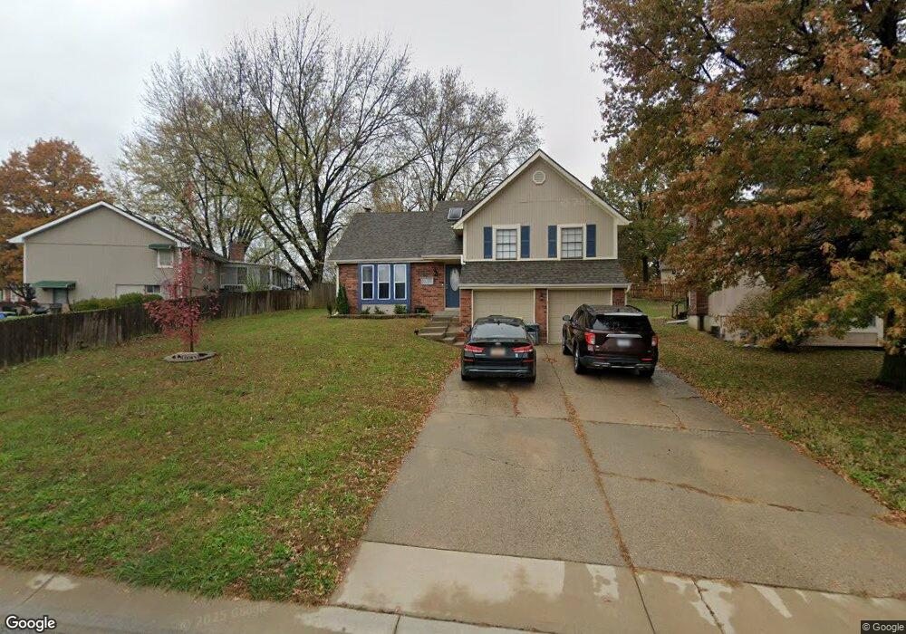
511 Forestglen Ln Lansing, KS 66043
Estimated Value: $269,000 - $295,000
4
Beds
3
Baths
1,226
Sq Ft
$232/Sq Ft
Est. Value
About This Home
This home is located at 511 Forestglen Ln, Lansing, KS 66043 and is currently estimated at $283,980, approximately $231 per square foot. 511 Forestglen Ln is a home located in Leavenworth County with nearby schools including Lansing Elementary School, Lansing Middle 6-8, and Lansing High 9-12.
Ownership History
Date
Name
Owned For
Owner Type
Purchase Details
Closed on
Sep 12, 2019
Sold by
Kristin Coon
Bought by
Coon Stuart L
Current Estimated Value
Purchase Details
Closed on
Jun 28, 2019
Sold by
Coon Stuart L
Bought by
Cook Tyler D and Cook Leah R
Home Financials for this Owner
Home Financials are based on the most recent Mortgage that was taken out on this home.
Original Mortgage
$145,000
Interest Rate
4%
Mortgage Type
VA
Purchase Details
Closed on
Apr 22, 2008
Sold by
Secretary Of Veterans Affairs
Bought by
Coon Stuart L
Create a Home Valuation Report for This Property
The Home Valuation Report is an in-depth analysis detailing your home's value as well as a comparison with similar homes in the area
Home Values in the Area
Average Home Value in this Area
Purchase History
| Date | Buyer | Sale Price | Title Company |
|---|---|---|---|
| Coon Stuart L | -- | New Title Company Name | |
| Cook Tyler D | -- | New Title Company Name | |
| Coon Stuart L | $123,500 | Mccaffree-Short Title Co Inc |
Source: Public Records
Mortgage History
| Date | Status | Borrower | Loan Amount |
|---|---|---|---|
| Previous Owner | Cook Tyler D | $145,000 | |
| Closed | Coon Stuart L | $98,800 |
Source: Public Records
Tax History
| Year | Tax Paid | Tax Assessment Tax Assessment Total Assessment is a certain percentage of the fair market value that is determined by local assessors to be the total taxable value of land and additions on the property. | Land | Improvement |
|---|---|---|---|---|
| 2025 | $3,317 | $28,656 | $5,587 | $23,069 |
| 2024 | $3,317 | $26,781 | $4,356 | $22,425 |
| 2023 | $3,317 | $25,751 | $4,356 | $21,395 |
| 2022 | $2,611 | $23,410 | $3,503 | $19,907 |
| 2021 | $2,611 | $18,259 | $3,503 | $14,756 |
| 2020 | $2,463 | $16,967 | $3,551 | $13,416 |
| 2019 | $2,696 | $18,515 | $3,551 | $14,964 |
| 2018 | $2,454 | $16,888 | $2,911 | $13,977 |
| 2017 | $2,277 | $15,654 | $2,911 | $12,743 |
| 2016 | $2,278 | $15,654 | $2,911 | $12,743 |
| 2015 | $2,271 | $15,654 | $2,911 | $12,743 |
| 2014 | $2,224 | $15,654 | $2,911 | $12,743 |
Source: Public Records
Map
Nearby Homes
- 218 E Kay St
- 202 S Main St
- 124 S Main St
- 922 Southfork St
- 129 Crestview Ct
- 811 4-H Rd
- 111 Southfork Rd
- 20958 Ida St
- 130 Hampton Ct
- 189 Canyon View Dr
- 26731 147th St
- 00000 Brookwood St
- 114 Emile St
- 875 Clearview Dr
- 13788 McIntyre1 Rd
- 13788 Mcintyre Rd
- 13788 McIntyre2 Rd
- 1322 Rock Creek Ct
- 1221 S Desoto Rd
- 898 Clearview Dr
- 509 Forestglen Ln
- 507 Forestglen Ln
- 515 Forestglen Ln
- 412 Hithergreen Dr
- 414 Hithergreen Dr
- 410 Hithergreen Dr
- 416 Hithergreen Dr
- 408 Hithergreen Dr
- 510 Forest Glen Ln
- 505 Forestglen Ln
- 512 Forestglen Ln
- 519 Forestglen Ln
- 514 Forestglen Ln
- 510 Forestglen Ln
- 418 Hithergreen Dr
- 406 Hithergreen Dr
- 516 Forestglen Ln
- 508 Forestglen Ln
- 503 Forestglen Ln
- 518 Forestglen Ln
Your Personal Tour Guide
Ask me questions while you tour the home.