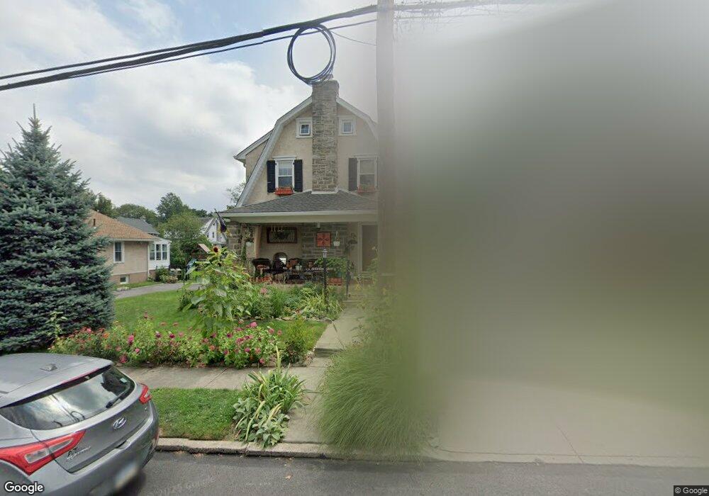
511 Kathmere Rd Havertown, PA 19083
Estimated Value: $518,000 - $607,000
4
Beds
2
Baths
1,536
Sq Ft
$364/Sq Ft
Est. Value
About This Home
This home is located at 511 Kathmere Rd, Havertown, PA 19083 and is currently estimated at $559,426, approximately $364 per square foot. 511 Kathmere Rd is a home located in Delaware County with nearby schools including Chatham Park Elementary School, Haverford Middle School, and Haverford Senior High School.
Ownership History
Date
Name
Owned For
Owner Type
Purchase Details
Closed on
Jun 9, 2008
Sold by
Carroll Kevin M and Carroll Colleen M
Bought by
Rabadam Frank B and Shepard Rabadam Elizabeth A
Current Estimated Value
Home Financials for this Owner
Home Financials are based on the most recent Mortgage that was taken out on this home.
Original Mortgage
$279,000
Outstanding Balance
$179,764
Interest Rate
6.13%
Mortgage Type
Purchase Money Mortgage
Estimated Equity
$379,662
Purchase Details
Closed on
Aug 24, 1994
Sold by
Wells David S and Wells Ellen R
Bought by
Carroll Kevin M and Carroll Colleen M
Home Financials for this Owner
Home Financials are based on the most recent Mortgage that was taken out on this home.
Original Mortgage
$148,200
Interest Rate
8.65%
Create a Home Valuation Report for This Property
The Home Valuation Report is an in-depth analysis detailing your home's value as well as a comparison with similar homes in the area
Home Values in the Area
Average Home Value in this Area
Purchase History
| Date | Buyer | Sale Price | Title Company |
|---|---|---|---|
| Rabadam Frank B | $310,000 | None Available | |
| Carroll Kevin M | $156,000 | T A Title Insurance Company |
Source: Public Records
Mortgage History
| Date | Status | Borrower | Loan Amount |
|---|---|---|---|
| Open | Rabadam Frank B | $279,000 | |
| Previous Owner | Carroll Kevin M | $148,200 |
Source: Public Records
Tax History Compared to Growth
Tax History
| Year | Tax Paid | Tax Assessment Tax Assessment Total Assessment is a certain percentage of the fair market value that is determined by local assessors to be the total taxable value of land and additions on the property. | Land | Improvement |
|---|---|---|---|---|
| 2025 | $8,597 | $338,250 | $96,510 | $241,740 |
| 2024 | $8,597 | $334,340 | $96,510 | $237,830 |
| 2023 | $8,352 | $334,340 | $96,510 | $237,830 |
| 2022 | $8,157 | $334,340 | $96,510 | $237,830 |
| 2021 | $13,289 | $334,340 | $96,510 | $237,830 |
| 2020 | $6,436 | $138,480 | $48,870 | $89,610 |
| 2019 | $6,318 | $138,480 | $48,870 | $89,610 |
| 2018 | $6,209 | $138,480 | $0 | $0 |
| 2017 | $6,078 | $138,480 | $0 | $0 |
| 2016 | $760 | $138,480 | $0 | $0 |
| 2015 | $760 | $138,480 | $0 | $0 |
| 2014 | $760 | $138,480 | $0 | $0 |
Source: Public Records
Map
Nearby Homes
- 524 Sagamore Rd
- 501 E Manoa Rd
- 204 E Manoa Rd
- 755 Lawson Ave
- 100 Brookline Blvd
- 210 Farnham Rd
- 231 Hastings Ave
- 304 Earlington Rd
- 2313 Haverford Rd
- 26 E Turnbull Ave
- 421 E Eagle Rd
- 214 Brentwood Rd
- 2222 Bryn Mawr Ave
- 128 Campbell Ave
- 1216 Darby Rd
- 16 Chelten Rd
- 2 D E Manoa St
- 5 W Turnbull Ave
- 2321 Bryn Mawr Ave
- 2418 Rosewood Ln
- 507 Kathmere Rd
- 515 Kathmere Rd
- 503 Kathmere Rd
- 521 Kathmere Rd
- 510 Brookline Blvd
- 508 Brookline Blvd
- 502 Brookline Blvd
- 510 Kathmere Rd
- 506 Kathmere Rd
- 516 Kathmere Rd
- 502 Kathmere Rd
- 525 Kathmere Rd
- 435 Kathmere Rd
- 500 Kathmere Rd
- 520 Kathmere Rd
- 524 Brookline Blvd
- 531 Kathmere Rd
- 436 Brookline Blvd
- 526 Kathmere Rd
- 528 Brookline Blvd