511 W Broad Ave Doerun, GA 31744
Estimated payment $1,689/month
Highlights
- Cottage
- Porch
- Bathtub with Shower
- Fireplace
- Built-In Features
- Property is near schools
About This Home
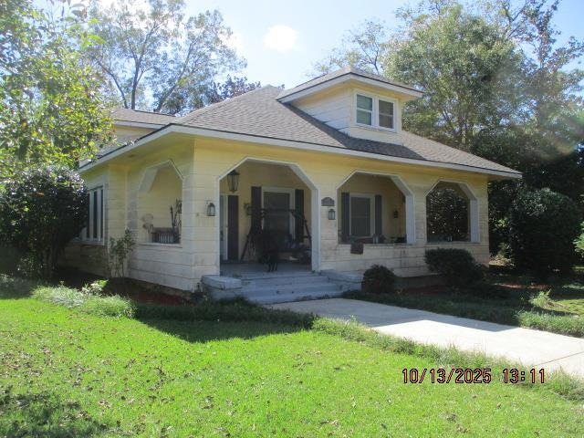
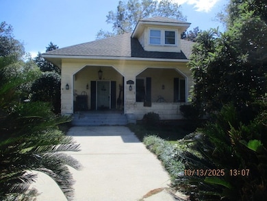
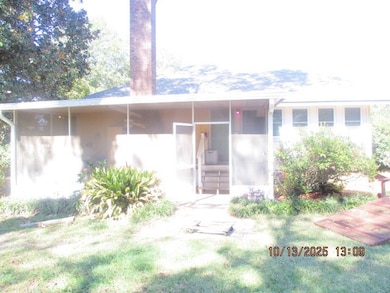
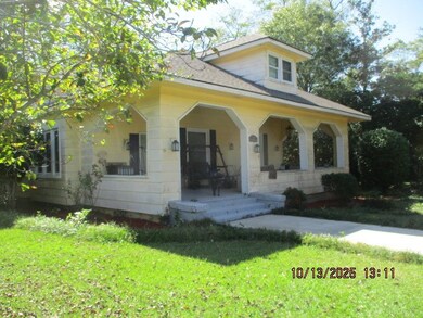
Unique opportunity in the heart of Doerun! This 2.17 acre rectangular corner lot offers three roadway access points with frontage on GA Hwy 133, GA Hwy 270, and Myers St. Currently zoned residential with the option to rezone as C3 commercial, the property features a 2,748 SF, 1.5-story home with 3 bedrooms and 2.5 baths. Surrounded by ongoing area development, this location offers endless potential for business or investment.
Listing Agent
Norris Bishop Realty, LLC Brokerage Phone: 2298901186 Listed on: 10/13/2025
Home Details
Home Type
- Single Family
Est. Annual Taxes
- $1,922
Year Built
- Built in 1955
Lot Details
- 2.17 Acre Lot
- Historic Home
Home Design
- Cottage
- Shingle Roof
- Lead Paint Disclosure
Interior Spaces
- 2,748 Sq Ft Home
- 2-Story Property
- Built-In Features
- Sheet Rock Walls or Ceilings
- Fireplace
- Crawl Space
Flooring
- Laminate
- Vinyl
Bedrooms and Bathrooms
- 3 Bedrooms
- Bathtub with Shower
Additional Features
- Porch
- Property is near schools
- Central Heating and Cooling System
Map
Home Values in the Area
Average Home Value in this Area
Tax History
| Year | Tax Paid | Tax Assessment Tax Assessment Total Assessment is a certain percentage of the fair market value that is determined by local assessors to be the total taxable value of land and additions on the property. | Land | Improvement |
|---|---|---|---|---|
| 2024 | $1,922 | $74,374 | $4,737 | $69,637 |
| 2023 | $1,922 | $51,013 | $4,737 | $46,276 |
| 2022 | $1,382 | $46,628 | $4,737 | $41,891 |
| 2021 | $1,225 | $40,460 | $4,737 | $35,723 |
| 2020 | $1,248 | $40,460 | $4,737 | $35,723 |
| 2019 | $1,361 | $39,963 | $4,737 | $35,226 |
| 2018 | $1,297 | $38,369 | $2,795 | $35,574 |
| 2017 | $1,217 | $37,999 | $2,795 | $35,204 |
| 2016 | $1,242 | $36,756 | $2,122 | $34,634 |
| 2015 | $899 | $28,363 | $2,122 | $26,241 |
| 2014 | -- | $28,363 | $2,122 | $26,241 |
| 2013 | -- | $28,362 | $2,121 | $26,241 |
Property History
| Date | Event | Price | List to Sale | Price per Sq Ft | Prior Sale |
|---|---|---|---|---|---|
| 10/13/2025 10/13/25 | For Sale | $290,000 | +249.4% | $106 / Sq Ft | |
| 04/25/2019 04/25/19 | Sold | $83,000 | -- | $30 / Sq Ft | View Prior Sale |
| 03/05/2019 03/05/19 | Pending | -- | -- | -- |
Purchase History
| Date | Type | Sale Price | Title Company |
|---|---|---|---|
| Warranty Deed | $83,000 | -- | |
| Foreclosure Deed | $97,500 | -- | |
| Warranty Deed | $95,000 | -- | |
| Deed | -- | -- |
Mortgage History
| Date | Status | Loan Amount | Loan Type |
|---|---|---|---|
| Open | $81,496 | FHA |
Source: Moultrie Board of REALTORS®
MLS Number: 913445
APN: D001-408
- 417 W Bay Ave
- 715 W Robinson Ave
- 104 Union Ln
- 318 E Culpepper Ave
- 825 N Green St
- 512 Hagin Still Rd
- 0 Sam Sells Rd
- 2329 Evergreen Rd
- 340 Belk Rd
- 1791 Funston Sigsbee Rd
- 4735 Doerun Norman Park Rd
- 1485 Bay Rd
- 712 Blackberry Rd
- 4409 Georgia 112
- 156 E Maple St
- 0 Brest Station Rd Unit 10642758
- 155 S Kreuger St
- 378 Old S R 33
- 9765 Morey Hill Rd
- 330/332 Debbie Ln
- 516 Georgia 133
- 227 2nd Ave SE
- 20 7th St NE
- 841 E Central Ave
- 1515 4th Ave NE
- 315 15th St SE
- 711 W Pine St
- 517 26th Ave SE
- 2809 5th St SE
- 1600 Antioch Rd Unit Antioch
- 3109 Veterans Pkwy S
- 320 Campbell Dr
- 401 Us Highway 19 S
- 108 Gatewood Dr
- 810 Mayhan St
- 500 Pinson Rd
- 2414 Brierwood Dr
- 2415 Brierwood Dr
- 333 S Mock Rd
- 538 Southgate Ave


