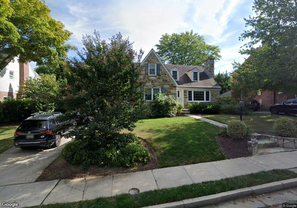
511 Worcester Rd Towson, MD 21286
Estimated Value: $600,000 - $895,000
Studio
3
Baths
2,834
Sq Ft
$276/Sq Ft
Est. Value
About This Home
This home is located at 511 Worcester Rd, Towson, MD 21286 and is currently estimated at $782,828, approximately $276 per square foot. 511 Worcester Rd is a home located in Baltimore County with nearby schools including Stoneleigh Elementary School, Dumbarton Middle School, and Towson High Law & Public Policy.
Ownership History
Date
Name
Owned For
Owner Type
Purchase Details
Closed on
Aug 16, 2001
Sold by
Jones Mark W
Bought by
Menefee Lawrence A and Menefee Angelica J
Current Estimated Value
Purchase Details
Closed on
Jan 3, 1995
Sold by
Smith Dan T
Bought by
Jones Mark W
Home Financials for this Owner
Home Financials are based on the most recent Mortgage that was taken out on this home.
Original Mortgage
$179,900
Interest Rate
9.2%
Purchase Details
Closed on
Aug 31, 1987
Sold by
Ravekes John E
Bought by
Smith Dan T
Create a Home Valuation Report for This Property
The Home Valuation Report is an in-depth analysis detailing your home's value as well as a comparison with similar homes in the area
Home Values in the Area
Average Home Value in this Area
Purchase History
| Date | Buyer | Sale Price | Title Company |
|---|---|---|---|
| Menefee Lawrence A | $311,000 | -- | |
| Jones Mark W | $199,900 | -- | |
| Smith Dan T | $185,000 | -- |
Source: Public Records
Mortgage History
| Date | Status | Borrower | Loan Amount |
|---|---|---|---|
| Previous Owner | Jones Mark W | $179,900 |
Source: Public Records
Tax History
| Year | Tax Paid | Tax Assessment Tax Assessment Total Assessment is a certain percentage of the fair market value that is determined by local assessors to be the total taxable value of land and additions on the property. | Land | Improvement |
|---|---|---|---|---|
| 2025 | $9,604 | $771,700 | $138,000 | $633,700 |
| 2024 | $9,604 | $731,167 | $0 | $0 |
| 2023 | $4,529 | $690,633 | $0 | $0 |
| 2022 | $8,639 | $650,100 | $129,600 | $520,500 |
| 2021 | $8,138 | $630,733 | $0 | $0 |
| 2020 | $8,138 | $611,367 | $0 | $0 |
| 2019 | $7,864 | $592,000 | $129,600 | $462,400 |
| 2018 | $7,616 | $582,167 | $0 | $0 |
| 2017 | $7,400 | $572,333 | $0 | $0 |
| 2016 | $5,855 | $562,500 | $0 | $0 |
| 2015 | $5,855 | $555,233 | $0 | $0 |
| 2014 | $5,855 | $547,967 | $0 | $0 |
Source: Public Records
Map
Nearby Homes
- 517 Worcester Rd
- 609 Stevenson Ln
- 310 Worthington Rd
- 624 Fairway Dr
- 7404 Knollwood Rd
- 335 Old Trail Rd
- 501 Stoneleigh Rd
- 150 Marburth Ave
- 31 Meridian Ln
- 12 Stone Ridge Ct
- 212 E Burke Ave
- 664 Regester Ave
- 224 E Burke Ave
- 202 Wilden Dr
- 6923 Summit Cir
- 214 Murdock Rd
- 229 Murdock Rd
- 119 E Susquehanna Ave
- 625 Dunkirk Rd
- 806 Forest Rd
- 509 Worcester Rd
- 513 Worcester Rd
- 507 Worcester Rd
- 512 Yarmouth Rd
- 515 Worcester Rd
- 1 Aintree Rd
- 510 Yarmouth Rd
- 514 Yarmouth Rd
- 508 Yarmouth Rd
- 516 Yarmouth Rd
- 505 Worcester Rd
- 3 Aintree Rd
- 504 Worcester Rd
- 518 Yarmouth Rd
- 506 Yarmouth Rd
- 4 Aintree Rd
- 600 Worcester Rd
- 503 Worcester Rd
- 5 Aintree Rd
- 520 Yarmouth Rd
Your Personal Tour Guide
Ask me questions while you tour the home.