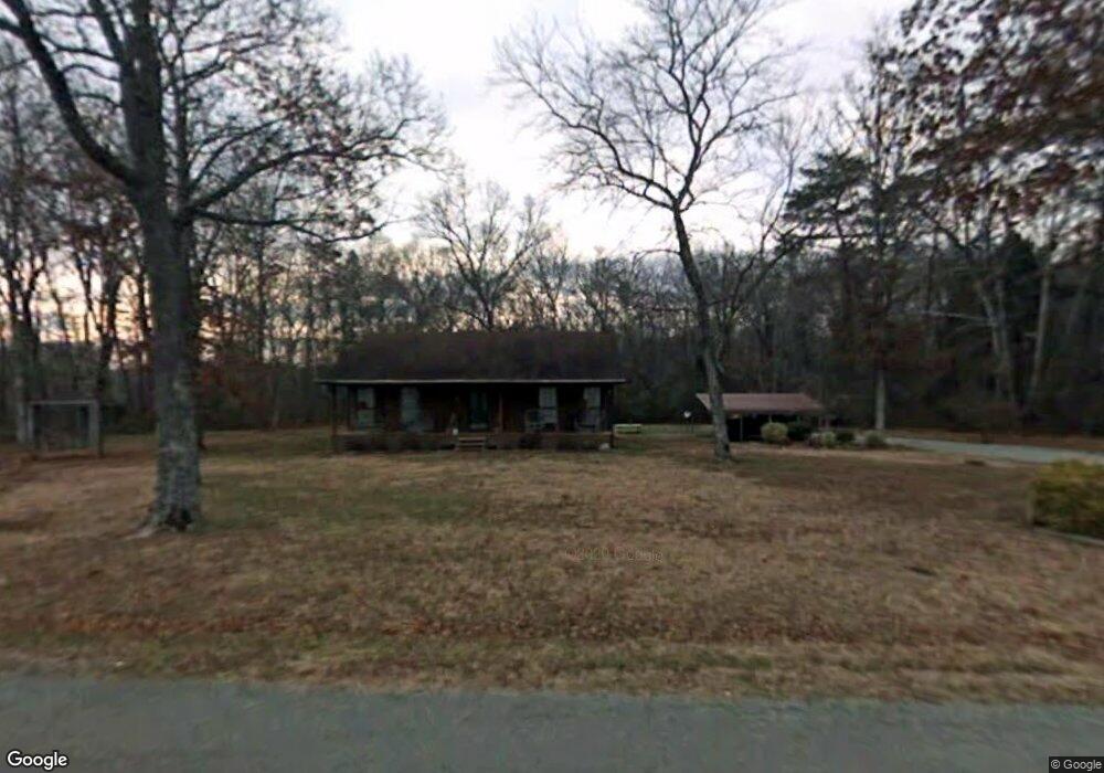
5111 Double S Rd Dayton, TN 37321
Estimated Value: $274,000 - $338,000
--
Bed
2
Baths
1,435
Sq Ft
$214/Sq Ft
Est. Value
About This Home
This home is located at 5111 Double S Rd, Dayton, TN 37321 and is currently estimated at $306,487, approximately $213 per square foot. 5111 Double S Rd is a home located in Rhea County with nearby schools including Rhea County High School.
Ownership History
Date
Name
Owned For
Owner Type
Purchase Details
Closed on
Dec 7, 2016
Sold by
Shipley Arthur Jack
Bought by
Cochran Tonya L and Cochran Barry F
Current Estimated Value
Home Financials for this Owner
Home Financials are based on the most recent Mortgage that was taken out on this home.
Original Mortgage
$136,363
Outstanding Balance
$110,280
Interest Rate
3.57%
Mortgage Type
New Conventional
Estimated Equity
$196,207
Purchase Details
Closed on
Oct 29, 2009
Sold by
Keylon Cindy
Bought by
Shipley Arthur Jack
Purchase Details
Closed on
Apr 16, 2007
Bought by
Cindy Keylon
Create a Home Valuation Report for This Property
The Home Valuation Report is an in-depth analysis detailing your home's value as well as a comparison with similar homes in the area
Home Values in the Area
Average Home Value in this Area
Purchase History
| Date | Buyer | Sale Price | Title Company |
|---|---|---|---|
| Cochran Tonya L | $135,000 | -- | |
| Shipley Arthur Jack | $120,000 | -- | |
| Cindy Keylon | -- | -- |
Source: Public Records
Mortgage History
| Date | Status | Borrower | Loan Amount |
|---|---|---|---|
| Open | Cochran Tonya L | $136,363 |
Source: Public Records
Tax History Compared to Growth
Tax History
| Year | Tax Paid | Tax Assessment Tax Assessment Total Assessment is a certain percentage of the fair market value that is determined by local assessors to be the total taxable value of land and additions on the property. | Land | Improvement |
|---|---|---|---|---|
| 2024 | $580 | $43,025 | $5,250 | $37,775 |
| 2023 | $602 | $26,700 | $3,650 | $23,050 |
| 2022 | $602 | $26,700 | $3,650 | $23,050 |
| 2021 | $602 | $26,700 | $3,650 | $23,050 |
| 2020 | $602 | $26,700 | $3,650 | $23,050 |
| 2019 | $617 | $27,375 | $3,650 | $23,725 |
| 2018 | $516 | $23,475 | $3,675 | $19,800 |
| 2017 | $516 | $23,475 | $3,675 | $19,800 |
| 2016 | $516 | $23,475 | $3,675 | $19,800 |
| 2015 | $492 | $23,475 | $3,675 | $19,800 |
| 2014 | $477 | $22,750 | $3,675 | $19,075 |
| 2013 | -- | $22,750 | $3,675 | $19,075 |
Source: Public Records
Map
Nearby Homes
- 4344 Double Rd S
- 295 Sky Dr
- 3 Cottonport Rd
- 170 Blue Sky Dr
- 0 Blue Sky Dr Unit RTC2918178
- 0 Blue Sky Dr Unit 1515026
- 0 Blue Sky Dr Unit 1515024
- 0 Blue Sky Dr Unit RTC2918163
- 0 Blue Sky Dr Unit RTC2918162
- 0 Blue Sky Dr Unit 1515023
- 0 Blue Sky Dr Unit 1515022
- 165 Blue Sky Dr
- 595 New Union Cir
- 66 New Union Rd
- 410 Pioneer Trail
- 974 Grassy Branch Rd
- 0 New Bethel Rd Unit 1318405
- 0 New Bethel Rd Unit RTC3014253
- 0 New Bethel Rd Unit 1522095
- 00 Scoggins Ln