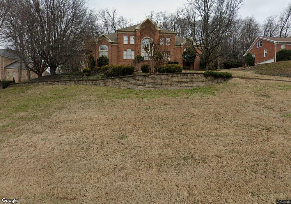
5112 Heathrow Blvd Brentwood, TN 37027
Estimated Value: $1,887,864 - $2,263,000
--
Bed
6
Baths
4,797
Sq Ft
$448/Sq Ft
Est. Value
About This Home
This home is located at 5112 Heathrow Blvd, Brentwood, TN 37027 and is currently estimated at $2,150,216, approximately $448 per square foot. 5112 Heathrow Blvd is a home located in Williamson County with nearby schools including Scales Elementary School, Brentwood Middle School, and Brentwood High School.
Ownership History
Date
Name
Owned For
Owner Type
Purchase Details
Closed on
Aug 27, 2003
Sold by
Taylor Rodney J and Taylor Jean A
Bought by
Elder Annette and Glather Gerald
Current Estimated Value
Home Financials for this Owner
Home Financials are based on the most recent Mortgage that was taken out on this home.
Original Mortgage
$499,120
Outstanding Balance
$211,774
Interest Rate
5.12%
Mortgage Type
Purchase Money Mortgage
Estimated Equity
$1,938,442
Purchase Details
Closed on
Sep 18, 2000
Sold by
Taylor Rodney J and Taylor Jean A
Bought by
Rodney J & Jean A Taylor Living Trust
Create a Home Valuation Report for This Property
The Home Valuation Report is an in-depth analysis detailing your home's value as well as a comparison with similar homes in the area
Home Values in the Area
Average Home Value in this Area
Purchase History
| Date | Buyer | Sale Price | Title Company |
|---|---|---|---|
| Elder Annette | $623,900 | -- | |
| Rodney J & Jean A Taylor Living Trust | -- | -- |
Source: Public Records
Mortgage History
| Date | Status | Borrower | Loan Amount |
|---|---|---|---|
| Open | Elder Annette | $499,120 |
Source: Public Records
Tax History Compared to Growth
Tax History
| Year | Tax Paid | Tax Assessment Tax Assessment Total Assessment is a certain percentage of the fair market value that is determined by local assessors to be the total taxable value of land and additions on the property. | Land | Improvement |
|---|---|---|---|---|
| 2025 | $601 | $424,375 | $125,000 | $299,375 |
| 2024 | $601 | $294,425 | $87,500 | $206,925 |
| 2023 | $601 | $294,425 | $87,500 | $206,925 |
| 2022 | $6,389 | $294,425 | $87,500 | $206,925 |
| 2021 | $6,389 | $294,425 | $87,500 | $206,925 |
| 2020 | $6,082 | $235,700 | $43,750 | $191,950 |
| 2019 | $6,082 | $235,700 | $43,750 | $191,950 |
| 2018 | $5,917 | $235,700 | $43,750 | $191,950 |
| 2017 | $5,869 | $235,700 | $43,750 | $191,950 |
| 2016 | $0 | $235,700 | $43,750 | $191,950 |
| 2015 | -- | $199,700 | $43,750 | $155,950 |
| 2014 | $879 | $199,700 | $43,750 | $155,950 |
Source: Public Records
Map
Nearby Homes
- 915 Calloway Dr
- 5014 Mountview Place
- 5113 W Concord Rd
- 1215 Brentwood Ln
- 1204 Brentwood Ln
- 824 Princeton Hills Dr
- 5013 Woodland Hills Dr
- 1213 Brentwood Ln
- 7091 Anna Dr
- 1112 Franklin Rd
- 5172 Remington Dr
- 1101 Mccall Ct
- 855 Windstone Blvd
- 704 Princeton Hills Dr
- 761 Sinclair Cir
- 700 Princeton Hills Dr
- 721 Princeton Hills Dr
- 7100 Anna James Ct
- 850 Anna James Ct
- 5154 Hereford Ct
- 5114 Heathrow Blvd
- 5110 Heathrow Blvd
- 5113 Heathrow Blvd
- 5108 Heathrow Blvd
- 5116 Heathrow Blvd
- 5109 Heathrow Blvd
- 5115 Heathrow Blvd
- 5118 Heathrow Blvd
- 5110 Jackson Ln
- 5117 Heathrow Blvd
- 5108 Jackson Ln
- 1004 Stuart Ln
- 5105 Heathrow Blvd
- 920 Stuart Ln
- 5106 Jackson Ln
- 5137 Walnut Park Dr
- 5145 Walnut Park Dr
- 1006 Stuart Ln
- 5104 Heathrow Blvd
- 5133 Walnut Park Dr