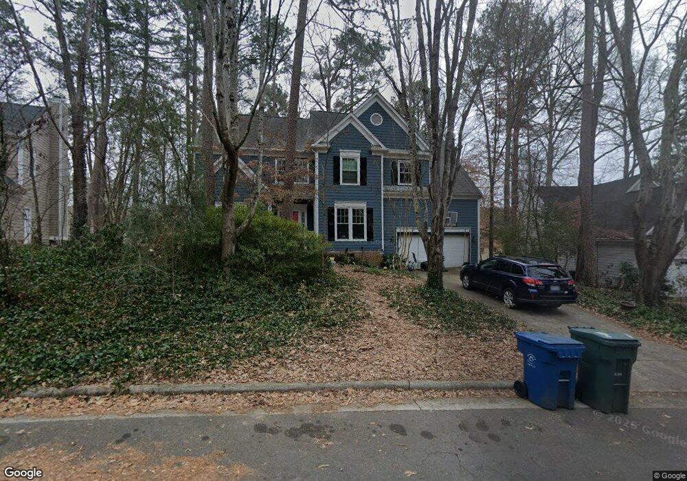
5113 Brookstone Dr Durham, NC 27713
Woodcroft NeighborhoodEstimated Value: $553,000 - $602,000
4
Beds
3
Baths
2,679
Sq Ft
$212/Sq Ft
Est. Value
About This Home
This home is located at 5113 Brookstone Dr, Durham, NC 27713 and is currently estimated at $568,843, approximately $212 per square foot. 5113 Brookstone Dr is a home located in Durham County with nearby schools including Southwest Elementary School, Morehead Montessori, and Sherwood Githens Middle.
Ownership History
Date
Name
Owned For
Owner Type
Purchase Details
Closed on
Feb 26, 2018
Sold by
Corrado Michael L and Corrado Gail A
Bought by
Derouse Jason C and Derousie Rebecca M Sanford
Current Estimated Value
Home Financials for this Owner
Home Financials are based on the most recent Mortgage that was taken out on this home.
Original Mortgage
$251,920
Outstanding Balance
$214,108
Interest Rate
4.04%
Mortgage Type
New Conventional
Estimated Equity
$354,735
Create a Home Valuation Report for This Property
The Home Valuation Report is an in-depth analysis detailing your home's value as well as a comparison with similar homes in the area
Home Values in the Area
Average Home Value in this Area
Purchase History
| Date | Buyer | Sale Price | Title Company |
|---|---|---|---|
| Derouse Jason C | $315,000 | None Available |
Source: Public Records
Mortgage History
| Date | Status | Borrower | Loan Amount |
|---|---|---|---|
| Open | Derouse Jason C | $251,920 |
Source: Public Records
Tax History Compared to Growth
Tax History
| Year | Tax Paid | Tax Assessment Tax Assessment Total Assessment is a certain percentage of the fair market value that is determined by local assessors to be the total taxable value of land and additions on the property. | Land | Improvement |
|---|---|---|---|---|
| 2025 | $5,179 | $522,444 | $135,300 | $387,144 |
| 2024 | $4,454 | $319,327 | $55,395 | $263,932 |
| 2023 | $4,183 | $319,327 | $55,395 | $263,932 |
| 2022 | $4,087 | $319,327 | $55,395 | $263,932 |
| 2021 | $4,068 | $319,327 | $55,395 | $263,932 |
| 2020 | $3,972 | $319,327 | $55,395 | $263,932 |
| 2019 | $3,972 | $319,327 | $55,395 | $263,932 |
| 2018 | $3,866 | $284,970 | $43,085 | $241,885 |
| 2017 | $3,837 | $284,970 | $43,085 | $241,885 |
| 2016 | $3,708 | $302,934 | $43,085 | $259,849 |
| 2015 | $3,899 | $281,647 | $43,953 | $237,694 |
| 2014 | $3,899 | $281,647 | $43,953 | $237,694 |
Source: Public Records
Map
Nearby Homes
- 5219 Oakbrook Dr
- 3702 Chimney Ridge Place Unit 8
- 4016 Blakeford Dr
- 3 Falcon Nest Ct
- 121 Long Shadow Place
- 118 Old Maple Ln
- 116 Long Shadow Place
- 3706 Chimney Ridge Place Unit 8
- 10 Hickorywood Square
- 4 Applewood Square
- 8 Briarfield Ct
- 7 Applewood Square
- 108 Hollow Oak Dr
- 107 Weathersfield Dr
- 12 Citation Dr
- 4904 Victoria Dr
- 4012 Kettering Dr
- 517 Woodwinds Dr
- 7 Old Towne Place
- 616 Cross Timbers Dr
- 5201 Brookstone Dr
- 5111 Brookstone Dr
- 5212 Oakbrook Dr
- 5214 Oakbrook Dr
- 5210 Oakbrook Dr
- 5109 Brookstone Dr
- 5203 Brookstone Dr
- 5220 Oakbrook Dr
- 5112 Brookstone Dr
- 5202 Brookstone Dr
- 5208 Oakbrook Dr
- 5110 Brookstone Dr
- 5107 Brookstone Dr
- 5222 Oakbrook Dr
- 5205 Brookstone Dr
- 5204 Brookstone Dr
- 5206 Oakbrook Dr
- 5108 Brookstone Dr
- 5224 Oakbrook Dr
- 5105 Brookstone Dr