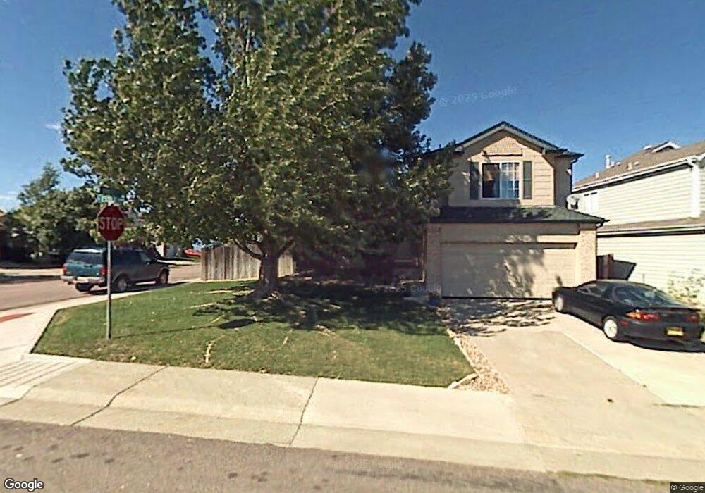
5113 E Essex Ave Castle Rock, CO 80104
Founders Village NeighborhoodEstimated Value: $525,000 - $560,000
3
Beds
3
Baths
1,956
Sq Ft
$278/Sq Ft
Est. Value
About This Home
This home is located at 5113 E Essex Ave, Castle Rock, CO 80104 and is currently estimated at $543,527, approximately $277 per square foot. 5113 E Essex Ave is a home located in Douglas County with nearby schools including Rock Ridge Elementary School, Mesa Middle School, and Douglas County High School.
Ownership History
Date
Name
Owned For
Owner Type
Purchase Details
Closed on
Mar 25, 2011
Sold by
Rabat Omar and Rabat Rose
Bought by
Federal Home Loan Mortgage Corp
Current Estimated Value
Home Financials for this Owner
Home Financials are based on the most recent Mortgage that was taken out on this home.
Original Mortgage
$144,248
Interest Rate
4.98%
Mortgage Type
FHA
Purchase Details
Closed on
Feb 22, 2011
Sold by
Federal Home Loan Mortgage Corporation
Bought by
Wyatt William
Home Financials for this Owner
Home Financials are based on the most recent Mortgage that was taken out on this home.
Original Mortgage
$144,248
Interest Rate
4.98%
Mortgage Type
FHA
Purchase Details
Closed on
Jul 10, 2006
Sold by
Martin Dan M
Bought by
Rabat Omar
Home Financials for this Owner
Home Financials are based on the most recent Mortgage that was taken out on this home.
Original Mortgage
$184,000
Interest Rate
7.5%
Mortgage Type
Unknown
Purchase Details
Closed on
Feb 23, 1998
Sold by
Martin Dan M and Martin Jodi R
Bought by
Martin Dan M
Home Financials for this Owner
Home Financials are based on the most recent Mortgage that was taken out on this home.
Original Mortgage
$117,000
Interest Rate
7.13%
Purchase Details
Closed on
Aug 29, 1996
Sold by
Munroe Robert E and Lou Mary Lou
Bought by
Martin Dan M and Martin Jodi R
Home Financials for this Owner
Home Financials are based on the most recent Mortgage that was taken out on this home.
Original Mortgage
$116,000
Interest Rate
8.27%
Purchase Details
Closed on
Feb 28, 1994
Sold by
Richmond Homes Inc Ii
Bought by
Munroe Robert E and Munroe Mary Lou
Home Financials for this Owner
Home Financials are based on the most recent Mortgage that was taken out on this home.
Original Mortgage
$96,350
Interest Rate
6.95%
Purchase Details
Closed on
Dec 28, 1989
Sold by
Mdc Land Corp
Bought by
Richmond American Homes Colorado Inc Ii
Create a Home Valuation Report for This Property
The Home Valuation Report is an in-depth analysis detailing your home's value as well as a comparison with similar homes in the area
Home Values in the Area
Average Home Value in this Area
Purchase History
| Date | Buyer | Sale Price | Title Company |
|---|---|---|---|
| Federal Home Loan Mortgage Corp | -- | None Available | |
| Wyatt William | $148,000 | None Available | |
| Rabat Omar | $230,000 | Stewart Title Of Colorado | |
| Martin Dan M | -- | -- | |
| Martin Dan M | $132,000 | Land Title | |
| Munroe Robert E | $120,450 | Land Title | |
| Richmond American Homes Colorado Inc Ii | -- | -- |
Source: Public Records
Mortgage History
| Date | Status | Borrower | Loan Amount |
|---|---|---|---|
| Previous Owner | Wyatt William | $144,248 | |
| Previous Owner | Rabat Omar | $184,000 | |
| Previous Owner | Martin Dan M | $117,000 | |
| Previous Owner | Martin Dan M | $116,000 | |
| Previous Owner | Munroe Robert E | $96,350 |
Source: Public Records
Tax History Compared to Growth
Tax History
| Year | Tax Paid | Tax Assessment Tax Assessment Total Assessment is a certain percentage of the fair market value that is determined by local assessors to be the total taxable value of land and additions on the property. | Land | Improvement |
|---|---|---|---|---|
| 2024 | $5,552 | $37,490 | $8,220 | $29,270 |
| 2023 | $5,585 | $37,490 | $8,220 | $29,270 |
| 2022 | $3,876 | $24,480 | $6,080 | $18,400 |
| 2021 | $3,947 | $24,480 | $6,080 | $18,400 |
| 2020 | $3,771 | $24,070 | $5,180 | $18,890 |
| 2019 | $3,773 | $24,070 | $5,180 | $18,890 |
| 2018 | $3,228 | $20,440 | $4,010 | $16,430 |
| 2017 | $3,108 | $20,440 | $4,010 | $16,430 |
| 2016 | $2,601 | $17,860 | $3,900 | $13,960 |
| 2015 | $2,634 | $17,860 | $3,900 | $13,960 |
| 2014 | $2,203 | $14,340 | $3,420 | $10,920 |
Source: Public Records
Map
Nearby Homes
- 576 S Lindsey St
- 596 S Lindsey St
- 5181 Devon Ave
- 510 Fairhaven St
- 630 Fairhaven St
- 5282 Devon Ave
- 5230 E Kensington Ave
- 176 S Pembrook St
- 321 Lockwood St
- 1025 S Lindsey St
- 378 Benton St
- 4590 Wakefield Ave
- NA Ridge Rd
- 4947 Stoneham Ave
- 1005 Parsons Ave
- 5428 Suffolk Ave
- 4937 Parsons Way
- 157 S Quicksilver Ave
- 5323 E Sandpiper Ave
- 1183 Parsons Ave
- 5113 Essex Ave
- 5133 Essex Ave
- 5153 Essex Ave
- 5153 E Essex Ave
- 5102 Devon Ave
- 5122 E Devon Ave
- 5122 Devon Ave
- 566 S Lindsey St
- 5142 Devon Ave
- 5173 E Essex Ave
- 5173 Essex Ave
- 535 S Lindsey St
- 555 S Lindsey St
- 5144 Essex Ave
- 5144 E Essex Ave
- 525 S Lindsey St
- 565 S Lindsey St
- 5162 Devon Ave
- 5164 Essex Ave
- 505 S Lindsey St