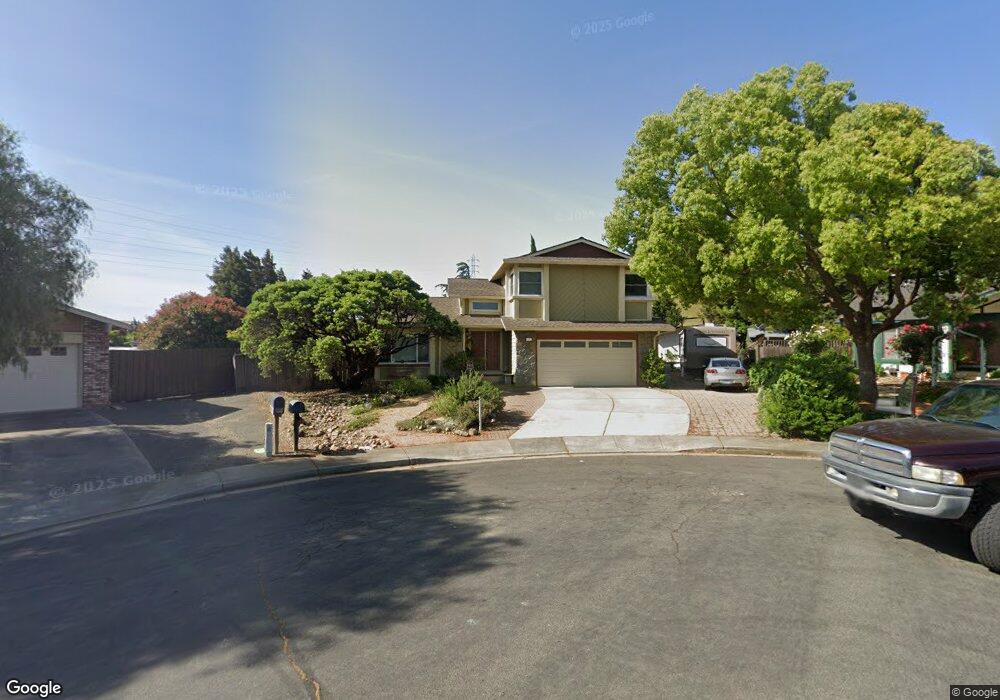
5113 Ramsgate Ct Fairfield, CA 94534
Estimated Value: $514,000 - $663,507
3
Beds
3
Baths
1,923
Sq Ft
$302/Sq Ft
Est. Value
About This Home
This home is located at 5113 Ramsgate Ct, Fairfield, CA 94534 and is currently estimated at $580,627, approximately $301 per square foot. 5113 Ramsgate Ct is a home located in Solano County with nearby schools including Oakbrook Academy of the Arts, Green Valley Middle School, and Angelo Rodriguez High School.
Ownership History
Date
Name
Owned For
Owner Type
Purchase Details
Closed on
Dec 28, 2018
Sold by
Smith Bradley E and Smith Nicole P
Bought by
Perata Smith Bradley Ellis and Perata Smith Nicole
Current Estimated Value
Purchase Details
Closed on
Jun 26, 2018
Sold by
Smith Mark H and Smith Sheila K
Bought by
Smith Bradley E and Smith Nicole P
Home Financials for this Owner
Home Financials are based on the most recent Mortgage that was taken out on this home.
Original Mortgage
$207,000
Outstanding Balance
$179,793
Interest Rate
4.6%
Mortgage Type
New Conventional
Estimated Equity
$400,834
Create a Home Valuation Report for This Property
The Home Valuation Report is an in-depth analysis detailing your home's value as well as a comparison with similar homes in the area
Purchase History
| Date | Buyer | Sale Price | Title Company |
|---|---|---|---|
| Perata Smith Bradley Ellis | -- | None Available | |
| Smith Bradley E | $265,000 | Old Republic Title Co |
Source: Public Records
Mortgage History
| Date | Status | Borrower | Loan Amount |
|---|---|---|---|
| Open | Smith Bradley E | $207,000 |
Source: Public Records
Tax History
| Year | Tax Paid | Tax Assessment Tax Assessment Total Assessment is a certain percentage of the fair market value that is determined by local assessors to be the total taxable value of land and additions on the property. | Land | Improvement |
|---|---|---|---|---|
| 2025 | $3,112 | $277,395 | $69,344 | $208,051 |
| 2024 | $3,112 | $271,957 | $67,985 | $203,972 |
| 2023 | $3,017 | $266,625 | $66,652 | $199,973 |
| 2022 | $2,980 | $261,398 | $65,346 | $196,052 |
| 2021 | $2,951 | $256,273 | $64,065 | $192,208 |
| 2020 | $2,882 | $253,647 | $63,409 | $190,238 |
| 2019 | $2,812 | $248,674 | $62,166 | $186,508 |
| 2018 | $2,820 | $243,799 | $60,948 | $182,851 |
| 2017 | $2,688 | $239,019 | $59,753 | $179,266 |
| 2016 | $2,663 | $234,333 | $58,582 | $175,751 |
| 2015 | $2,485 | $230,815 | $57,703 | $173,112 |
| 2014 | $2,461 | $226,294 | $56,573 | $169,721 |
Source: Public Records
Map
Nearby Homes
- 5100 Ramsgate Ct
- 680 Vintage Ct
- 4881 Regency Place
- 4817 Dolce Ct
- 1132 Courtland Ct
- 848 Crescendo St
- 4924 Fairmont Ct
- 4732 Opus Cir
- 741 Greentree Cir
- 5227 Waterleaf Ln
- 680 Silver Lake Dr
- 4758 Antelope Cir
- 0 McGary Rd Unit 325089430
- 1844 Stockbridge Dr
- 2149 Saddlebred Dr
- 5305 Gather Way
- 5257 Venus Dr
- 562 Citadel Ct
- 4455 Meadow Valley Cir
- 4109 Cedarvale Ct
- 5107 Ramsgate Ct
- 5118 Ramsgate Ct
- 845 Spindrift Place
- 5112 Ramsgate Ct
- 851 Spindrift Place
- 5106 Ramsgate Ct
- 5040 Lakeview Cir
- 5044 Lakeview Cir
- 5038 Lakeview Cir
- 905 Lakeview Ct
- 839 Spindrift Place
- 5036 Lakeview Cir
- 844 Spindrift Place
- 5046 Lakeview Cir
- 850 Spindrift Place
- 5034 Lakeview Cir
- 838 Spindrift Place
- 5048 Lakeview Cir
- 5032 Lakeview Cir
- 833 Spindrift Place
Your Personal Tour Guide
Ask me questions while you tour the home.