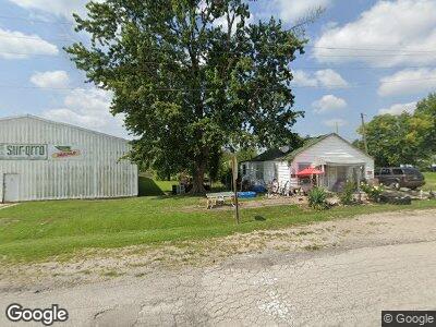
5115 E State Route F Cowgill, MO 64637
Estimated Value: $222,000 - $284,000
3
Beds
2
Baths
1,565
Sq Ft
$168/Sq Ft
Est. Value
About This Home
This home is located at 5115 E State Route F, Cowgill, MO 64637 and is currently estimated at $262,236, approximately $167 per square foot. 5115 E State Route F is a home located in Caldwell County with nearby schools including New York Elementary School.
Create a Home Valuation Report for This Property
The Home Valuation Report is an in-depth analysis detailing your home's value as well as a comparison with similar homes in the area
Home Values in the Area
Average Home Value in this Area
Mortgage History
| Date | Status | Borrower | Loan Amount |
|---|---|---|---|
| Closed | Kruse Henry Ross | $276,233 | |
| Closed | Kruse Henry R | $40,000 |
Source: Public Records
Tax History Compared to Growth
Tax History
| Year | Tax Paid | Tax Assessment Tax Assessment Total Assessment is a certain percentage of the fair market value that is determined by local assessors to be the total taxable value of land and additions on the property. | Land | Improvement |
|---|---|---|---|---|
| 2024 | $925 | $16,010 | $2,120 | $13,890 |
| 2023 | $923 | $16,010 | $2,120 | $13,890 |
| 2022 | $897 | $16,170 | $2,120 | $14,050 |
| 2021 | $900 | $16,170 | $2,120 | $14,050 |
| 2020 | $834 | $15,870 | $2,120 | $13,750 |
| 2019 | $824 | $15,870 | $2,120 | $13,750 |
| 2018 | $695 | $12,480 | $1,380 | $11,100 |
| 2017 | $695 | $12,480 | $1,380 | $11,100 |
| 2016 | -- | $12,290 | $1,190 | $11,100 |
| 2015 | -- | $12,290 | $1,190 | $11,100 |
| 2013 | -- | $12,990 | $420 | $12,570 |
Source: Public Records
Map
Nearby Homes
- 7226 E State Route F
- 0 SE Sparks Rd
- 0 U Hwy Unit HMS2542483
- 0 B Hwy Unit HMS2542493
- 2943 NE Turkey Rd
- 22805 B Hwy
- 0 NE State Highway B
- 6335 SE Oliver Rd
- 1034 NE State Route U N A
- 209 E Main St
- 4717 SE Yankee Ridge Rd
- 4560 NW Byard Rd
- 9503 SE Soo Line Dr
- 506 Bobcat Ave
- 405 N Murray Ave
- 305 N Co Road A
- 304 N Main St
- 708 S Davis St
- 207 E 4th St
- 0 SE Tait Park Dr