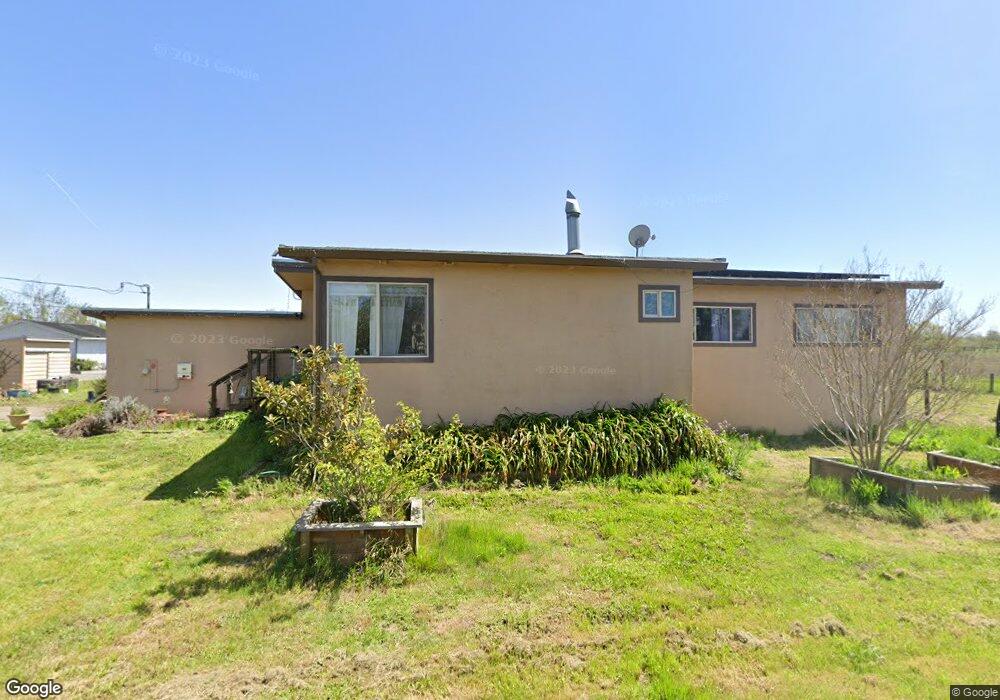
5115 Todd Rd Sebastopol, CA 95472
Estimated Value: $988,000 - $1,080,000
3
Beds
2
Baths
1,488
Sq Ft
$703/Sq Ft
Est. Value
About This Home
This home is located at 5115 Todd Rd, Sebastopol, CA 95472 and is currently estimated at $1,046,792, approximately $703 per square foot. 5115 Todd Rd is a home located in Sonoma County with nearby schools including Analy High School, Gravenstein Elementary School, and Sunridge Charter School.
Ownership History
Date
Name
Owned For
Owner Type
Purchase Details
Closed on
Nov 6, 2024
Sold by
Dewey Cheryl
Bought by
Cheryl Dee Dewey Living Trust and Dewey
Current Estimated Value
Purchase Details
Closed on
Jul 24, 2013
Sold by
Dewey Cheryl
Bought by
Dewey Cheryl
Purchase Details
Closed on
Oct 2, 2012
Sold by
Stewart Michael L
Bought by
Dewey Cheryl
Home Financials for this Owner
Home Financials are based on the most recent Mortgage that was taken out on this home.
Original Mortgage
$340,000
Interest Rate
3.43%
Mortgage Type
New Conventional
Purchase Details
Closed on
Aug 12, 2005
Sold by
Patt Michael D and Gualco Patt Julie Anne
Bought by
Dewey Michael L and Dewey Cheryl
Home Financials for this Owner
Home Financials are based on the most recent Mortgage that was taken out on this home.
Original Mortgage
$359,650
Interest Rate
5.56%
Mortgage Type
Fannie Mae Freddie Mac
Purchase Details
Closed on
May 25, 2003
Sold by
Patt Michael D and Gualco Patt Julie Anne
Bought by
Patt Michael D and Gualco Patt Julie Anne
Home Financials for this Owner
Home Financials are based on the most recent Mortgage that was taken out on this home.
Original Mortgage
$273,000
Interest Rate
5.71%
Mortgage Type
Balloon
Purchase Details
Closed on
Jul 26, 2001
Sold by
Patt Michael D and Gualco Patt Julie A
Bought by
Anne Patt Michael D and Anne Gaulco Patt Julie
Home Financials for this Owner
Home Financials are based on the most recent Mortgage that was taken out on this home.
Original Mortgage
$275,000
Interest Rate
6.62%
Purchase Details
Closed on
Jun 11, 2001
Sold by
Patt Michael D and Gualco Patt Julie A
Bought by
Patt Michael D and Gualco Patt Julie Anne
Home Financials for this Owner
Home Financials are based on the most recent Mortgage that was taken out on this home.
Original Mortgage
$275,000
Interest Rate
6.62%
Create a Home Valuation Report for This Property
The Home Valuation Report is an in-depth analysis detailing your home's value as well as a comparison with similar homes in the area
Purchase History
| Date | Buyer | Sale Price | Title Company |
|---|---|---|---|
| Cheryl Dee Dewey Living Trust | -- | None Listed On Document | |
| Cheryl Dee Dewey Living Trust | -- | None Listed On Document | |
| Dewey Cheryl | -- | None Available | |
| Dewey Cheryl | -- | First American Title Company | |
| Dewey Michael L | $634,000 | First American Title Co | |
| Patt Michael D | -- | Old Republic Title Co | |
| Patt Michael D | -- | Old Republic Title Co | |
| Anne Patt Michael D | -- | Fidelity National Title Co | |
| Patt Michael D | -- | Fidelity National Title Co | |
| Patt Michael D | -- | -- |
Source: Public Records
Mortgage History
| Date | Status | Borrower | Loan Amount |
|---|---|---|---|
| Previous Owner | Dewey Cheryl | $340,000 | |
| Previous Owner | Dewey Michael L | $359,650 | |
| Previous Owner | Patt Michael D | $273,000 | |
| Previous Owner | Patt Michael D | $275,000 | |
| Closed | Patt Michael D | $25,000 |
Source: Public Records
Tax History
| Year | Tax Paid | Tax Assessment Tax Assessment Total Assessment is a certain percentage of the fair market value that is determined by local assessors to be the total taxable value of land and additions on the property. | Land | Improvement |
|---|---|---|---|---|
| 2025 | $9,805 | $866,395 | $409,966 | $456,429 |
| 2024 | $9,805 | $849,408 | $401,928 | $447,480 |
| 2023 | $9,805 | $832,754 | $394,048 | $438,706 |
| 2022 | $9,463 | $816,426 | $386,322 | $430,104 |
| 2021 | $9,372 | $800,419 | $378,748 | $421,671 |
| 2020 | $9,377 | $792,213 | $374,865 | $417,348 |
| 2019 | $8,984 | $776,680 | $367,515 | $409,165 |
| 2018 | $8,851 | $761,452 | $360,309 | $401,143 |
| 2017 | $8,468 | $746,523 | $353,245 | $393,278 |
| 2016 | $7,958 | $698,000 | $330,000 | $368,000 |
| 2015 | $6,840 | $609,000 | $288,000 | $321,000 |
| 2014 | $6,247 | $555,000 | $263,000 | $292,000 |
Source: Public Records
Map
Nearby Homes
- 5111 Todd Rd
- 3790 Gravenstein Hwy S
- 3960 Llano Rd
- 5563 Mcfarlane Rd
- 5932 Fredricks Rd
- 6363 Pond Hollow Rd
- 1853 Cooper Rd
- 5408 Hessel Ave
- 4175 Woodworth Rd
- 447 Sparkes Rd
- 5186 Hwy 116 S
- 41 Sparkes Rd Unit 8
- 1979 Ludwig Ave
- 842 Buckley Dr
- 844 Buckley Dr
- 202 Pippen Ct
- 846 Buckley Dr
- 206 Pippen Ct
- 210 Pippen Ct
- 208 Pippen Ct
Your Personal Tour Guide
Ask me questions while you tour the home.