5117 Enterprise Rd Summit, MS 39666
Summit AreaEstimated Value: $143,010 - $317,000
About This Home
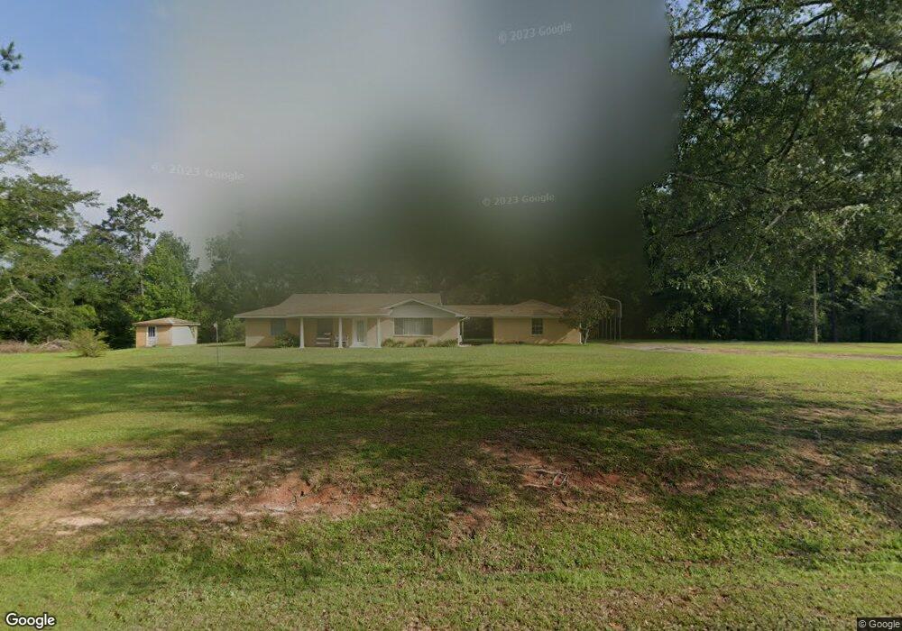
This home is located at 5117 Enterprise Rd, Summit, MS 39666 and is currently estimated at $210,253, approximately $95 per square foot. 5117 Enterprise Rd is a home with nearby schools including Otken Elementary School, Higgins Middle School, and Denman Junior High School.
Ownership History
We collect this data history from publicly available records. To have your information removed, we recommend requesting removal directly through your county’s website.
Purchase Details
Purchase Details
Purchase Details
Home Financials for this Owner
Home Financials are based on the most recent Mortgage that was taken out on this home.Purchase History
We collect this data history from publicly available records. To have your information removed, we recommend requesting removal directly through your county’s website.
| Date | Buyer | Sale Price | Title Company |
|---|---|---|---|
| -- | None Listed On Document | ||
| -- | None Available | ||
| -- | None Available |
Mortgage History
We collect this data history from publicly available records. To have your information removed, we recommend requesting removal directly through your county’s website.
| Date | Status | Borrower | Loan Amount |
|---|---|---|---|
| Previous Owner | $60,800 |
Tax History
We collect this data history from publicly available records. To have your information removed, we recommend requesting removal directly through your county’s website.
| Year | Tax Paid | Tax Assessment Tax Assessment Total Assessment is a certain percentage of the fair market value that is determined by local assessors to be the total taxable value of land and additions on the property. | Land | Improvement |
|---|---|---|---|---|
| 2025 | $1,331 | $9,891 | $0 | $0 |
| 2024 | $1,114 | $8,234 | $0 | $0 |
| 2023 | $1,097 | $8,235 | $0 | $0 |
| 2022 | $1,076 | $8,233 | $0 | $0 |
| 2021 | $1,072 | $8,234 | $0 | $0 |
| 2020 | $1,151 | $8,838 | $0 | $0 |
| 2019 | $1,120 | $8,839 | $0 | $0 |
| 2018 | $1,104 | $8,840 | $0 | $0 |
| 2017 | $1,112 | $8,839 | $0 | $0 |
| 2016 | $1,097 | $8,837 | $0 | $0 |
| 2015 | $1,971 | $8,744 | $0 | $0 |
| 2014 | -- | $8,742 | $0 | $0 |
| 2013 | -- | $8,741 | $0 | $0 |
Map
- 1034 Hope Dr
- TBD Mississippi 570
- 0 Mississippi 570
- 2194 Mississippi 570
- TBD Mississippi 570
- 3103 Mississippi 570
- 4164 Magnolia Pisgah Rd
- 3004 Delaware Ave
- 3000 Delaware Ave
- 0 Delaware
- 1090 Moak Rd
- 1021 Tyler Dr
- 501A Commanche Dr
- 1096 Highway 570 W
- 2104 Cheyenne Dr
- 1072 Brandon Dr
- 2039 Perrott Rd
- 000 Pike Point Place
- 0 Marilyn Butler Dr
- 0 Llewellyn Ave
- 5094 Enterprise Rd
- 5112 Enterprise Rd
- 5126 Enterprise Rd
- 1004 Delaney Dr
- 2117 Caston Rd
- 2127 Caston Rd
- 2133 Caston Rd
- 2126 Caston Rd
- 5148 Enterprise Rd
- 5160 Enterprise Rd
- 5135 Enterprise Rd
- 5175 Enterprise Rd
- 1010 Murry Rd
- 1014 Robinson Rd
- 1009 Broken Arrow Ln
- 5188 Enterprise Rd
- 5188 Enterprise Rd
- 1005 Smith Ln
- 5041 Enterprise Rd
- 5194 Enterprise Rd
Ask me questions while you tour the home.