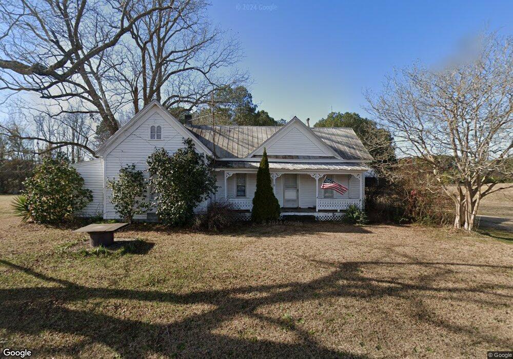
5119 Benson Hardee Rd Benson, NC 27504
Elevation NeighborhoodEstimated Value: $164,321 - $293,000
3
Beds
1
Bath
1,380
Sq Ft
$156/Sq Ft
Est. Value
About This Home
This home is located at 5119 Benson Hardee Rd, Benson, NC 27504 and is currently estimated at $214,830, approximately $155 per square foot. 5119 Benson Hardee Rd is a home with nearby schools including Benson Elementary School, Benson Middle School, and West Johnston High School.
Ownership History
Date
Name
Owned For
Owner Type
Purchase Details
Closed on
Sep 6, 2005
Sold by
Wilkins Leoma W and Wilkins Earnest
Bought by
Wilkins James E and Wilkins Linda S
Current Estimated Value
Home Financials for this Owner
Home Financials are based on the most recent Mortgage that was taken out on this home.
Original Mortgage
$42,300
Interest Rate
5.86%
Mortgage Type
Purchase Money Mortgage
Create a Home Valuation Report for This Property
The Home Valuation Report is an in-depth analysis detailing your home's value as well as a comparison with similar homes in the area
Home Values in the Area
Average Home Value in this Area
Purchase History
| Date | Buyer | Sale Price | Title Company |
|---|---|---|---|
| Wilkins James E | $44,500 | None Available |
Source: Public Records
Mortgage History
| Date | Status | Borrower | Loan Amount |
|---|---|---|---|
| Closed | Wilkins James E | $42,300 |
Source: Public Records
Tax History Compared to Growth
Tax History
| Year | Tax Paid | Tax Assessment Tax Assessment Total Assessment is a certain percentage of the fair market value that is determined by local assessors to be the total taxable value of land and additions on the property. | Land | Improvement |
|---|---|---|---|---|
| 2025 | $562 | $88,460 | $58,080 | $30,380 |
| 2024 | $443 | $54,680 | $27,590 | $27,090 |
| 2023 | $427 | $54,680 | $27,590 | $27,090 |
| 2022 | $448 | $54,680 | $27,590 | $27,090 |
| 2021 | $437 | $54,680 | $27,590 | $27,090 |
| 2020 | $454 | $54,680 | $27,590 | $27,090 |
| 2019 | $454 | $54,680 | $27,590 | $27,090 |
| 2018 | $388 | $45,590 | $21,780 | $23,810 |
| 2017 | $388 | $45,590 | $21,780 | $23,810 |
| 2016 | $388 | $45,590 | $21,780 | $23,810 |
| 2015 | $388 | $45,590 | $21,780 | $23,810 |
| 2014 | $388 | $45,590 | $21,780 | $23,810 |
Source: Public Records
Map
Nearby Homes
- 102 Foxtree Ct
- 526 Aquilla Rd
- 28 Sea Stellars Ct
- 28 Stellars Sea
- 471 Turlington Dr
- 1471 Aquilla Rd
- 94 Starry Sky Dr
- 209 Constellation Ct
- Cypress Plan at Black Forest Pointe
- Stanley Plan at Black Forest Pointe
- Wilmington Plan at Black Forest Pointe
- Ellerbe Plan at Black Forest Pointe
- Avery Plan at Black Forest Pointe
- Oxford Plan at Black Forest Pointe
- Raleigh Plan at Black Forest Pointe
- 235 Starry Sky Dr
- 299 Starry Sky Dr
- 18 Cedar Run Ct Unit 11
- 285 Trail
- 0 Memory Ln Unit 10135561
- 4989 Benson Hardee Rd
- 4989 Benson Hardee Rd
- 5156 Benson Hardee Rd
- 5178 Benson Hardee Rd
- 5075 Benson Hardee Rd
- 5269 Benson Hardee Rd
- 4958 Benson Hardee Rd
- 4920 Benson Hardee Rd
- 5039 Benson Hardee Rd
- 4888 Benson Hardee Rd
- 5432 Benson Hardee Rd
- 5492 Benson Hardee Rd
- 5472 Benson Hardee Rd
- 4755 Benson Hardee Rd
- 8196 Elevation Rd
- 5531 Benson Hardee Rd
- 5528 Benson Hardee Rd
- 8170 Elevation Rd
- 5657 Benson Hardee Rd Unit C
- 5657 Benson Hardee Rd Unit B