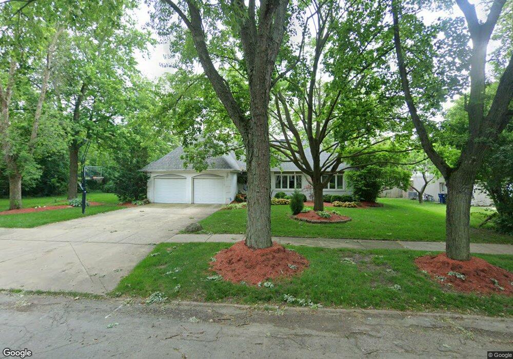
512 Bernie Ct Naperville, IL 60565
Meadow Glens NeighborhoodEstimated Value: $661,000 - $1,055,000
5
Beds
4
Baths
3,028
Sq Ft
$266/Sq Ft
Est. Value
About This Home
This home is located at 512 Bernie Ct, Naperville, IL 60565 and is currently estimated at $805,740, approximately $266 per square foot. 512 Bernie Ct is a home located in DuPage County with nearby schools including Maplebrook Elementary School, Lincoln Jr. High School, and Naperville Central High School.
Ownership History
Date
Name
Owned For
Owner Type
Purchase Details
Closed on
Jan 19, 2014
Sold by
Goodman Mark and Clark Tonia
Bought by
Goodman Mark and Mark Goodman Living Trust
Current Estimated Value
Purchase Details
Closed on
May 13, 2003
Sold by
Koloseike William and Koloseike Janet
Bought by
Goodman Mark and Clark Tonia
Home Financials for this Owner
Home Financials are based on the most recent Mortgage that was taken out on this home.
Original Mortgage
$322,700
Outstanding Balance
$141,375
Interest Rate
5.9%
Mortgage Type
Purchase Money Mortgage
Estimated Equity
$664,365
Create a Home Valuation Report for This Property
The Home Valuation Report is an in-depth analysis detailing your home's value as well as a comparison with similar homes in the area
Home Values in the Area
Average Home Value in this Area
Purchase History
| Date | Buyer | Sale Price | Title Company |
|---|---|---|---|
| Goodman Mark | -- | None Available | |
| Goodman Mark | $437,500 | -- |
Source: Public Records
Mortgage History
| Date | Status | Borrower | Loan Amount |
|---|---|---|---|
| Open | Goodman Mark | $322,700 | |
| Closed | Goodman Mark | $71,000 |
Source: Public Records
Tax History Compared to Growth
Tax History
| Year | Tax Paid | Tax Assessment Tax Assessment Total Assessment is a certain percentage of the fair market value that is determined by local assessors to be the total taxable value of land and additions on the property. | Land | Improvement |
|---|---|---|---|---|
| 2024 | $12,343 | $209,487 | $64,197 | $145,290 |
| 2023 | $11,904 | $191,190 | $58,590 | $132,600 |
| 2022 | $11,396 | $182,090 | $55,800 | $126,290 |
| 2021 | $10,983 | $175,200 | $53,690 | $121,510 |
| 2020 | $10,750 | $172,050 | $52,720 | $119,330 |
| 2019 | $10,440 | $164,610 | $50,440 | $114,170 |
| 2018 | $10,127 | $159,810 | $48,970 | $110,840 |
| 2017 | $9,925 | $154,420 | $47,320 | $107,100 |
| 2016 | $9,729 | $148,840 | $45,610 | $103,230 |
| 2015 | $9,671 | $140,160 | $42,950 | $97,210 |
| 2014 | $9,986 | $140,160 | $42,950 | $97,210 |
| 2013 | $9,835 | $140,490 | $43,050 | $97,440 |
Source: Public Records
Map
Nearby Homes
- 1449 Whitespire Ct Unit 5104
- 8S452 Bell Dr
- 1408 Swallow St
- 431 Orleans Ave
- 158 E Bailey Rd Unit F
- 128 E Bailey Rd Unit G
- 138 E Bailey Rd Unit M
- 621 Bourbon Ct
- 1721 S Washington St Unit 1721
- 1751 S Washington St Unit 1
- 517 Sheffield Rd
- 1323 Auburn Ave
- 1340 Auburn Ave
- 213 Winding Creek Dr
- 302 Carriage Hill Rd
- 907 Secretariat Dr
- 1519 77th St
- 1216 Tranquility Ct
- 1921 Wisteria Ct Unit 3
- 1443 Meander Dr
- 508 Bernie Ct
- 513 Bernie Ct
- 8S575 Bell Dr
- 509 Bernie Ct
- 500 Bernie Ct
- 1432 Whitespire Ct Unit 4703
- 1430 Whitespire Ct Unit 4702
- 501 Bernie Ct
- 1428 Whitespire Ct Unit 4701
- 1422 Whitespire Ct Unit 4804
- 414 Brad Ct
- 1420 Whitespire Ct Unit 4903
- 1442 Whitespire Ct Unit 4602
- 1440 Whitespire Ct Unit 4601
- 415 Brad Ct
- 25W461 Surrey Ave
- 25W461 Surrey Ave Unit 25W461
- 25W461 Surrey Ave
- 1444 Whitespire Ct Unit 4603
- 411 Brad Ct