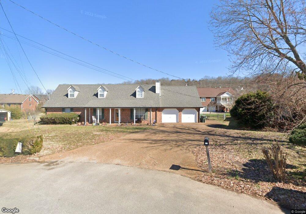
512 Decherd Ln Smyrna, TN 37167
Estimated Value: $446,335 - $535,000
--
Bed
4
Baths
2,532
Sq Ft
$197/Sq Ft
Est. Value
About This Home
This home is located at 512 Decherd Ln, Smyrna, TN 37167 and is currently estimated at $499,334, approximately $197 per square foot. 512 Decherd Ln is a home located in Rutherford County with nearby schools including Rocky Fork Elementary School, Rocky Fork Middle School, and Smyrna High School.
Ownership History
Date
Name
Owned For
Owner Type
Purchase Details
Closed on
Oct 11, 2011
Sold by
Brown Johnny M
Bought by
Martin David N
Current Estimated Value
Home Financials for this Owner
Home Financials are based on the most recent Mortgage that was taken out on this home.
Original Mortgage
$187,950
Outstanding Balance
$128,560
Interest Rate
4.16%
Mortgage Type
Commercial
Estimated Equity
$370,774
Purchase Details
Closed on
Dec 17, 2010
Sold by
Walker Gale Wayne
Bought by
Brown Johnny M
Home Financials for this Owner
Home Financials are based on the most recent Mortgage that was taken out on this home.
Original Mortgage
$180,500
Interest Rate
4.42%
Purchase Details
Closed on
Oct 30, 1997
Sold by
Steve Morales
Bought by
Walker Gale W
Home Financials for this Owner
Home Financials are based on the most recent Mortgage that was taken out on this home.
Original Mortgage
$115,900
Interest Rate
7.31%
Create a Home Valuation Report for This Property
The Home Valuation Report is an in-depth analysis detailing your home's value as well as a comparison with similar homes in the area
Home Values in the Area
Average Home Value in this Area
Purchase History
| Date | Buyer | Sale Price | Title Company |
|---|---|---|---|
| Martin David N | $210,000 | -- | |
| Brown Johnny M | $190,000 | -- | |
| Walker Gale W | $144,900 | -- |
Source: Public Records
Mortgage History
| Date | Status | Borrower | Loan Amount |
|---|---|---|---|
| Open | Martin David N | $187,950 | |
| Previous Owner | Brown Johnny M | $180,500 | |
| Previous Owner | Walker Gale W | $115,900 |
Source: Public Records
Tax History Compared to Growth
Tax History
| Year | Tax Paid | Tax Assessment Tax Assessment Total Assessment is a certain percentage of the fair market value that is determined by local assessors to be the total taxable value of land and additions on the property. | Land | Improvement |
|---|---|---|---|---|
| 2025 | $2,370 | $98,675 | $13,750 | $84,925 |
| 2024 | $2,370 | $98,675 | $13,750 | $84,925 |
| 2023 | $2,370 | $98,675 | $13,750 | $84,925 |
| 2022 | $2,114 | $98,675 | $13,750 | $84,925 |
| 2021 | $2,133 | $73,050 | $10,500 | $62,550 |
| 2020 | $2,133 | $73,050 | $10,500 | $62,550 |
| 2019 | $2,133 | $73,050 | $10,500 | $62,550 |
| 2018 | $2,046 | $73,050 | $0 | $0 |
| 2017 | $1,943 | $54,500 | $0 | $0 |
| 2016 | $1,943 | $54,500 | $0 | $0 |
| 2015 | $1,943 | $54,500 | $0 | $0 |
| 2014 | $1,355 | $54,500 | $0 | $0 |
| 2013 | -- | $56,725 | $0 | $0 |
Source: Public Records
Map
Nearby Homes
- 650 Spring Hill Dr
- 715 Saint Francis Ave
- 502 Saint Francis Ave
- 400 Megan Dr
- 502 Johnstown Dr
- 508 Williamsport Dr
- 421 Saint Francis Ave
- 804 Bromley Ct
- 800 Bromley Ct
- 532 Johnstown Dr
- 508 Spinnaker Ct
- 115 Saint Michaels Ln
- 540 Johnstown Dr
- 505 Spinnaker Ct
- 374 Rock Springs Rd
- 520 Mcgrath Dr
- 610 Spring Hill Dr
- 416 Mountain View Ct
- 614 Spring Hill Dr
- 618 Spring Hill Dr
- 510 Decherd Ln
- 511 Decherd Ln
- 410 Williamsport Dr
- 412 Williamsport Dr
- 408 Williamsport Dr
- 508 Decherd Ln
- 103 Michael Cir
- 410 Fellers Ln
- 509 Decherd Ln
- 414 Williamsport Dr
- 406 Williamsport Dr
- 408 Fellers Ln
- 101 Michael Cir
- 416 Williamsport Dr
- 411 Williamsport Dr
- 104 Michael Cir
- 413 Williamsport Dr
- 409 Williamsport Dr
- 404 Williamsport Dr
- 305 Megan Dr