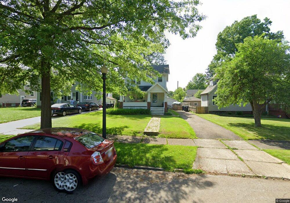
512 Greenwood Ave Akron, OH 44320
West Akron NeighborhoodEstimated Value: $150,672 - $184,000
3
Beds
1
Bath
1,170
Sq Ft
$140/Sq Ft
Est. Value
About This Home
This home is located at 512 Greenwood Ave, Akron, OH 44320 and is currently estimated at $164,168, approximately $140 per square foot. 512 Greenwood Ave is a home located in Summit County with nearby schools including Summit Academy School, Our Lady Of The Elms Elementary School, and Julie Billiart School Akron.
Ownership History
Date
Name
Owned For
Owner Type
Purchase Details
Closed on
Feb 21, 2024
Sold by
Logan Brian M
Bought by
Logan Brian M and Logan Coralee A
Current Estimated Value
Purchase Details
Closed on
Feb 20, 2024
Sold by
Logan Brian M
Bought by
Logan Brian M and Logan Coralee A
Purchase Details
Closed on
Feb 8, 2002
Sold by
Crowley Marjorie A
Bought by
Logan Brian M
Create a Home Valuation Report for This Property
The Home Valuation Report is an in-depth analysis detailing your home's value as well as a comparison with similar homes in the area
Home Values in the Area
Average Home Value in this Area
Purchase History
| Date | Buyer | Sale Price | Title Company |
|---|---|---|---|
| Logan Brian M | -- | None Listed On Document | |
| Logan Brian M | -- | None Listed On Document | |
| Logan Brian M | $88,000 | Approved Statewide Title Age |
Source: Public Records
Tax History Compared to Growth
Tax History
| Year | Tax Paid | Tax Assessment Tax Assessment Total Assessment is a certain percentage of the fair market value that is determined by local assessors to be the total taxable value of land and additions on the property. | Land | Improvement |
|---|---|---|---|---|
| 2025 | $2,374 | $43,075 | $10,794 | $32,281 |
| 2024 | $2,374 | $43,075 | $10,794 | $32,281 |
| 2023 | $2,374 | $43,075 | $10,794 | $32,281 |
| 2022 | $2,424 | $34,601 | $8,638 | $25,963 |
| 2021 | $2,426 | $34,601 | $8,638 | $25,963 |
| 2020 | $2,391 | $34,600 | $8,640 | $25,960 |
| 2019 | $2,140 | $27,970 | $8,380 | $19,590 |
| 2018 | $2,112 | $27,970 | $8,380 | $19,590 |
| 2017 | $2,146 | $27,970 | $8,380 | $19,590 |
| 2016 | $2,147 | $27,970 | $8,380 | $19,590 |
| 2015 | $2,146 | $27,970 | $8,380 | $19,590 |
| 2014 | $2,129 | $27,970 | $8,380 | $19,590 |
| 2013 | $2,375 | $32,070 | $8,380 | $23,690 |
Source: Public Records
Map
Nearby Homes
- 1390 Delia Ave
- 571 Crestview Ave
- 419 Dorchester Rd
- 632 Orlando Ave
- 454 Roslyn Ave
- 560 Mineola Ave
- 325 Mineola Ave
- 693 Roslyn Ave
- S/L 40 W Sunset View Dr
- S/L 37 W Sunset View Dr
- S/L 39 W Sunset View Dr
- S/L 38 W Sunset View Dr
- 425 Orlando Ave
- 589 Glendora Ave
- 601 Glendora Ave
- 739 Roslyn Ave
- S/L 12 W Sunrise View Dr
- 616 Dorchester Rd
- S/L 9 Sunrise View Dr
- S/L 7 Sunrise View Dr
- 508 Greenwood Ave
- 522 Greenwood Ave
- 502 Greenwood Ave
- 555 Roslyn Ave
- 561 Roslyn Ave
- 549 Roslyn Ave
- 498 Greenwood Ave
- 565 Roslyn Ave
- 545 Roslyn Ave
- 511 Greenwood Ave
- 1383 Delia Ave
- 1391 Delia Ave
- 517 Greenwood Ave
- 507 Greenwood Ave
- 492 Greenwood Ave
- 539 Roslyn Ave
- 521 Greenwood Ave
- 1395 Delia Ave
- 501 Greenwood Ave
- 533 Greenwood Ave