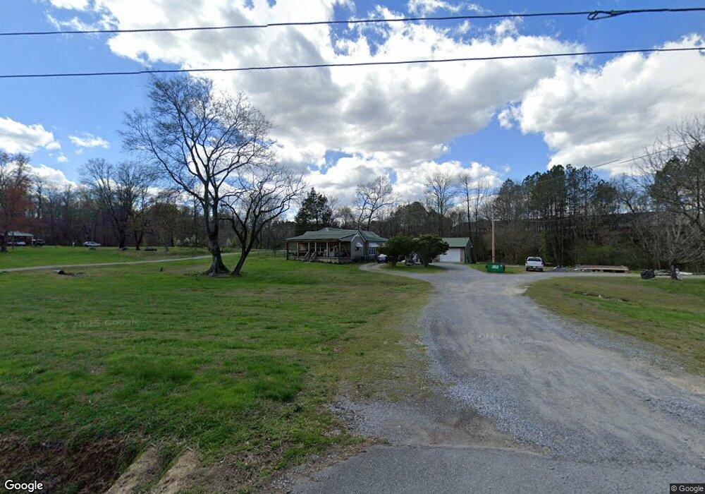
512 Highway 95 Rock Spring, GA 30739
Rock Spring NeighborhoodEstimated Value: $224,000 - $374,000
--
Bed
1
Bath
2,128
Sq Ft
$137/Sq Ft
Est. Value
About This Home
This home is located at 512 Highway 95, Rock Spring, GA 30739 and is currently estimated at $292,372, approximately $137 per square foot. 512 Highway 95 is a home located in Walker County with nearby schools including Rock Spring Elementary School, Lafayette High School, and Alice M Daley Adventist School.
Ownership History
Date
Name
Owned For
Owner Type
Purchase Details
Closed on
Dec 11, 1995
Sold by
Mcgill James Lamar
Bought by
Mcgill Jonas Lamar and Mcgill Shirley
Current Estimated Value
Purchase Details
Closed on
Dec 22, 1994
Sold by
Mcgill Lamar and Mcgill Shirley
Bought by
Mcgill James Lamar
Purchase Details
Closed on
Dec 31, 1976
Sold by
Swader Robert D and Swader Wanda
Bought by
Mcgill Lamar and Mcgill Shirley
Purchase Details
Closed on
Sep 30, 1975
Sold by
Sharp Vestell
Bought by
Swader Robert D and Swader Wanda
Purchase Details
Closed on
Mar 30, 1970
Bought by
Sharp Vestell
Create a Home Valuation Report for This Property
The Home Valuation Report is an in-depth analysis detailing your home's value as well as a comparison with similar homes in the area
Home Values in the Area
Average Home Value in this Area
Purchase History
| Date | Buyer | Sale Price | Title Company |
|---|---|---|---|
| Mcgill Jonas Lamar | -- | -- | |
| Mcgill James Lamar | -- | -- | |
| Mcgill Lamar | -- | -- | |
| Swader Robert D | -- | -- | |
| Sharp Vestell | -- | -- |
Source: Public Records
Tax History Compared to Growth
Tax History
| Year | Tax Paid | Tax Assessment Tax Assessment Total Assessment is a certain percentage of the fair market value that is determined by local assessors to be the total taxable value of land and additions on the property. | Land | Improvement |
|---|---|---|---|---|
| 2024 | $1,579 | $71,481 | $7,975 | $63,506 |
| 2023 | $1,509 | $66,786 | $6,330 | $60,456 |
| 2022 | $1,358 | $57,540 | $5,169 | $52,371 |
| 2021 | $1,236 | $47,820 | $5,169 | $42,651 |
| 2020 | $1,099 | $41,108 | $5,169 | $35,939 |
| 2019 | $1,119 | $41,108 | $5,169 | $35,939 |
| 2018 | $1,088 | $41,108 | $5,169 | $35,939 |
| 2017 | $1,085 | $36,075 | $5,169 | $30,906 |
| 2016 | $945 | $36,075 | $5,169 | $30,906 |
| 2015 | $1,025 | $37,442 | $9,632 | $27,810 |
| 2014 | $1,024 | $37,442 | $9,632 | $27,810 |
| 2013 | -- | $37,442 | $9,632 | $27,810 |
Source: Public Records
Map
Nearby Homes
- 5602 Georgia 95
- 00 Georgia 95
- 1003 Highway N Old 27
- 1370 Old Highway 27
- 10180 Us Highway 27
- 701 Bicentennial Trail
- 1902 Long Hollow Rd
- 15 Willow Cir
- 23 Willow Cir
- 16 Willow Cir
- 11 Willow Cir
- The Pearson Plan at Laurel Ridge
- The Benson II Plan at Laurel Ridge
- The Langford Plan at Laurel Ridge
- The Lawson Plan at Laurel Ridge
- The Piedmont Plan at Laurel Ridge
- The Coleman Plan at Laurel Ridge
- The McGinnis Plan at Laurel Ridge
- The Caldwell Plan at Laurel Ridge
- 195 Honeysuckle Dr
- 542 Highway 95
- 51 Meadow Brook Dr
- 582 Highway 95
- 582 Georgia 95
- 28 Meadow Brook Dr
- 28 Meadowbrook Dr
- 594 Highway 95
- 64 Meadowbrook Dr
- 64 Meadow Brook Dr
- 77 Meadow Brook Dr
- 102 Meadow Brook Dr
- 662 Highway 95
- 684 Highway 95
- 3411 Peavine Rd
- 137 Meadow Brook Dr
- 148 Meadow Brook Dr
- 100 Pin Oak Dr
- 163 Meadow Brook Dr
- 7403 N Highway 27
- 0 Meadowbrook Dr