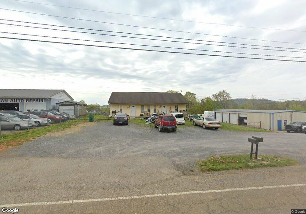
512 Jarnigan Ave Morristown, TN 37813
Estimated Value: $313,000 - $443,799
--
Bed
2
Baths
3,700
Sq Ft
$101/Sq Ft
Est. Value
About This Home
This home is located at 512 Jarnigan Ave, Morristown, TN 37813 and is currently estimated at $373,600, approximately $100 per square foot. 512 Jarnigan Ave is a home located in Hamblen County with nearby schools including Lincoln Heights Elementary School, Lincoln Heights Middle School, and Morristown West High School.
Ownership History
Date
Name
Owned For
Owner Type
Purchase Details
Closed on
Sep 10, 2020
Sold by
Trent Jacinda and Trent Scott
Bought by
Dueck Ronald P
Current Estimated Value
Home Financials for this Owner
Home Financials are based on the most recent Mortgage that was taken out on this home.
Original Mortgage
$100,000
Interest Rate
2.9%
Mortgage Type
Commercial
Purchase Details
Closed on
Sep 17, 2009
Bought by
Graham Deborah Jean
Purchase Details
Closed on
Sep 23, 1992
Bought by
Carpenter Anthony and Carpenter Nancy
Purchase Details
Closed on
Sep 7, 1983
Bought by
Howerton James B and Howerton Roetta S
Purchase Details
Closed on
Jan 7, 1983
Purchase Details
Closed on
Mar 24, 1979
Purchase Details
Closed on
Oct 26, 1978
Create a Home Valuation Report for This Property
The Home Valuation Report is an in-depth analysis detailing your home's value as well as a comparison with similar homes in the area
Home Values in the Area
Average Home Value in this Area
Purchase History
| Date | Buyer | Sale Price | Title Company |
|---|---|---|---|
| Dueck Ronald P | $275,000 | None Available | |
| Graham Deborah Jean | -- | -- | |
| Carpenter Anthony | $65,000 | -- | |
| Howerton James B | -- | -- | |
| -- | -- | -- | |
| -- | -- | -- | |
| -- | $10,100 | -- |
Source: Public Records
Mortgage History
| Date | Status | Borrower | Loan Amount |
|---|---|---|---|
| Closed | Dueck Ronald P | $100,000 |
Source: Public Records
Tax History Compared to Growth
Tax History
| Year | Tax Paid | Tax Assessment Tax Assessment Total Assessment is a certain percentage of the fair market value that is determined by local assessors to be the total taxable value of land and additions on the property. | Land | Improvement |
|---|---|---|---|---|
| 2024 | $1,188 | $67,480 | $18,880 | $48,600 |
| 2023 | $1,188 | $67,480 | $0 | $0 |
| 2022 | $2,133 | $67,480 | $18,880 | $48,600 |
| 2021 | $2,133 | $67,480 | $18,880 | $48,600 |
| 2020 | $2,422 | $67,480 | $18,880 | $48,600 |
| 2019 | $2,519 | $74,080 | $22,600 | $51,480 |
| 2018 | $2,334 | $74,080 | $22,600 | $51,480 |
| 2017 | $2,297 | $74,080 | $22,600 | $51,480 |
| 2016 | $2,193 | $74,080 | $22,600 | $51,480 |
| 2015 | $2,040 | $74,080 | $22,600 | $51,480 |
| 2014 | -- | $74,080 | $22,600 | $51,480 |
| 2013 | -- | $85,760 | $0 | $0 |
Source: Public Records
Map
Nearby Homes
- 440 S Fairmont Ave
- 837 Pauline Ave
- 1530 Rayburn Dr
- 731 Lennie Ave
- 203 Lincoln Ave
- 1476 Darbee Dr
- 1211 W 6th St N
- 816 W 2nd St N
- 900 Baird Ave
- 1002 Watercrest St
- 722 W 2nd St N
- Darwin Plan at Southwood
- Penwell Plan at Southwood
- Elston Plan at Southwood
- Robie Plan at Southwood
- Cali Plan at Southwood
- Belhaven Plan at Southwood
- 1442 Darbee Dr
- 1049 Greenway Dr
- 2018 Southwood Cir
- 1541 Godwin St
- 428 Jarnigan Ave
- 1538 Jones St
- 1533 Godwin St
- 1534 Jones St
- 431 Jarnigan Ave
- 1529 Godwin St
- 427 Jarnigan Ave
- 1528 Jones St
- 1521 Godwin St
- 421 Jarnigan Ave
- 1520 Jones St
- 1535 Jones St
- 1522 Godwin St
- 1529 Jones St
- 1516 Jones St
- 409 Jarnigan Ave
- 1515 Godwin St
- 1538 Lincoln Ave
- 1521 Jones St