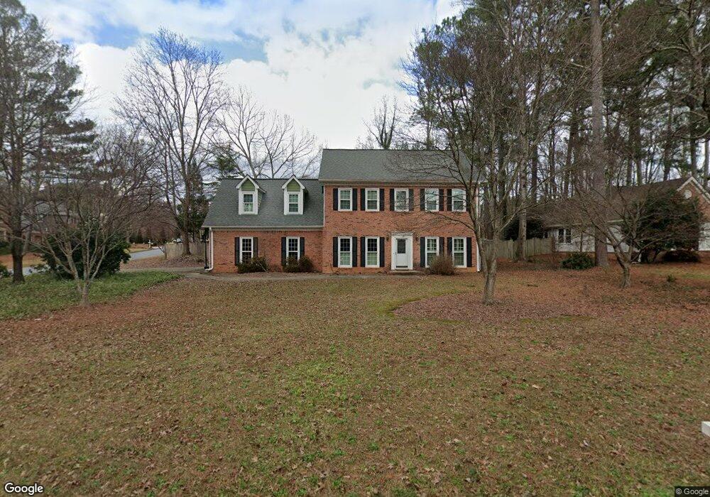
512 Lees Trace SW Marietta, GA 30064
Southwestern Marietta NeighborhoodEstimated Value: $591,000 - $612,000
4
Beds
3
Baths
2,833
Sq Ft
$212/Sq Ft
Est. Value
About This Home
This home is located at 512 Lees Trace SW, Marietta, GA 30064 and is currently estimated at $601,249, approximately $212 per square foot. 512 Lees Trace SW is a home located in Cobb County with nearby schools including A.L. Burruss Elementary School, Marietta Sixth Grade Academy, and Marietta Middle School.
Ownership History
Date
Name
Owned For
Owner Type
Purchase Details
Closed on
Dec 8, 2008
Sold by
Lewis Jimmy L and Lewis Linda B
Bought by
Maddox Matthew I and Maddox Brittany W
Current Estimated Value
Home Financials for this Owner
Home Financials are based on the most recent Mortgage that was taken out on this home.
Original Mortgage
$220,000
Outstanding Balance
$143,554
Interest Rate
5.96%
Mortgage Type
New Conventional
Estimated Equity
$457,695
Create a Home Valuation Report for This Property
The Home Valuation Report is an in-depth analysis detailing your home's value as well as a comparison with similar homes in the area
Home Values in the Area
Average Home Value in this Area
Purchase History
| Date | Buyer | Sale Price | Title Company |
|---|---|---|---|
| Maddox Matthew I | $275,000 | -- |
Source: Public Records
Mortgage History
| Date | Status | Borrower | Loan Amount |
|---|---|---|---|
| Open | Maddox Matthew I | $220,000 |
Source: Public Records
Tax History Compared to Growth
Tax History
| Year | Tax Paid | Tax Assessment Tax Assessment Total Assessment is a certain percentage of the fair market value that is determined by local assessors to be the total taxable value of land and additions on the property. | Land | Improvement |
|---|---|---|---|---|
| 2025 | $725 | $224,716 | $52,000 | $172,716 |
| 2024 | $725 | $224,716 | $52,000 | $172,716 |
| 2023 | $573 | $190,716 | $46,000 | $144,716 |
| 2022 | $725 | $139,236 | $29,800 | $109,436 |
| 2021 | $743 | $139,236 | $29,800 | $109,436 |
| 2020 | $742 | $130,932 | $29,800 | $101,132 |
| 2019 | $742 | $130,932 | $29,800 | $101,132 |
| 2018 | $740 | $114,028 | $28,000 | $86,028 |
| 2017 | $594 | $114,028 | $28,000 | $86,028 |
| 2016 | $596 | $106,868 | $28,000 | $78,868 |
| 2015 | $647 | $95,736 | $28,000 | $67,736 |
| 2014 | $669 | $95,736 | $0 | $0 |
Source: Public Records
Map
Nearby Homes
- 1047 Chestnut Hill Cir SW
- 1198 Seminary Dr SW
- 332 Rockmann Ln SW
- 1211 Cliffpine Ct SW
- 1161 Rockmann Terrace SW
- 988 Grantham Way SW
- 652 Trailwood Ln SW
- 1410 Dallas Cir SW
- 560 Manning Rd SW
- 1121 Cannongate Crossing SW
- 1017 Cannongate Crossing SW
- 1011 Cannongate Crossing SW
- 839 Manning Villas Ct SW
- 805 Manning Way SW
- 818 Manning Way SW Unit 1
- 594 Manning Rd SW
- 916 Cannon Gate Crossing
- 916 Cannongate Crossing SW Unit 916
- 506 Lees Trace SW
- 1104 Cedar Branch Ct SW
- 0 Lees Trace SW Unit 8826552
- 1101 Cedar Branch Ct SW
- 1105 Cedar Branch Ct SW
- 515 Lees Trace SW
- 502 Lees Trace SW
- 1078 Foreststone Way SW
- 1110 Cedar Branch Ct SW
- 521 Lees Trace SW
- 1109 Cedar Branch Ct SW
- 496 Lees Trace SW
- 1079 Foreststone Way SW
- 1072 Foreststone Way SW
- 1139 Chestnut Hill Cir SW
- 1039 Chestnut Hill Cir SW
- 1115 Cedar Branch Ct SW
- 0 Foreststone Way
- 1037 Chestnut Hill Cir SW
- 1041 Chestnut Hill Cir SW