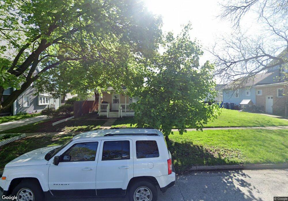
512 N Sherman St Crown Point, IN 46307
Estimated Value: $206,000 - $235,000
3
Beds
1
Bath
912
Sq Ft
$243/Sq Ft
Est. Value
About This Home
This home is located at 512 N Sherman St, Crown Point, IN 46307 and is currently estimated at $221,815, approximately $243 per square foot. 512 N Sherman St is a home located in Lake County with nearby schools including Timothy Ball Elementary School, Robert Taft Middle School, and Crown Point High School.
Ownership History
Date
Name
Owned For
Owner Type
Purchase Details
Closed on
Jul 17, 2008
Sold by
Trinkle Laura
Bought by
Markovski Blagoja and Markovska Jagoda
Current Estimated Value
Home Financials for this Owner
Home Financials are based on the most recent Mortgage that was taken out on this home.
Original Mortgage
$88,000
Outstanding Balance
$57,600
Interest Rate
6.36%
Mortgage Type
Purchase Money Mortgage
Estimated Equity
$164,215
Purchase Details
Closed on
Oct 12, 2005
Sold by
Donley Mary Lou and Estate Of Carol L Rhodes
Bought by
Trinkle Laura
Create a Home Valuation Report for This Property
The Home Valuation Report is an in-depth analysis detailing your home's value as well as a comparison with similar homes in the area
Home Values in the Area
Average Home Value in this Area
Purchase History
| Date | Buyer | Sale Price | Title Company |
|---|---|---|---|
| Markovski Blagoja | -- | Ticor Title Highland | |
| Trinkle Laura | -- | -- |
Source: Public Records
Mortgage History
| Date | Status | Borrower | Loan Amount |
|---|---|---|---|
| Open | Markovski Blagoja | $88,000 |
Source: Public Records
Tax History Compared to Growth
Tax History
| Year | Tax Paid | Tax Assessment Tax Assessment Total Assessment is a certain percentage of the fair market value that is determined by local assessors to be the total taxable value of land and additions on the property. | Land | Improvement |
|---|---|---|---|---|
| 2024 | $3,908 | $159,400 | $31,200 | $128,200 |
| 2023 | $1,351 | $142,200 | $27,100 | $115,100 |
| 2022 | $1,351 | $136,600 | $27,100 | $109,500 |
| 2021 | $1,178 | $128,200 | $22,600 | $105,600 |
| 2020 | $1,191 | $126,000 | $22,600 | $103,400 |
| 2019 | $1,188 | $122,300 | $22,600 | $99,700 |
| 2018 | $1,176 | $117,900 | $22,600 | $95,300 |
| 2017 | $1,178 | $117,200 | $22,600 | $94,600 |
| 2016 | $1,185 | $116,400 | $22,600 | $93,800 |
| 2014 | $1,075 | $116,200 | $22,600 | $93,600 |
| 2013 | $1,092 | $111,800 | $22,600 | $89,200 |
Source: Public Records
Map
Nearby Homes
- 511 N West St
- 138 N Grant St
- 808 N West St
- 221 N West St
- 150 N Ridge St
- 306 Holton Ridge
- 360 N Indiana Ave
- 380 N Indiana Ave
- 312 Summit Park Ct S
- 310 N Indiana Ave
- 301 Hoffman St
- 0 W Joliet St
- 411 Prairie St
- 407 Prairie St
- 621 Pratt St
- 512 W Joliet St
- 531 E Joliet St
- 206 Birch St
- 1206 Sycamore St
- 222 Maple St
- 516 N Sherman St
- 302 E Goldsboro St
- 216 E Goldsboro St
- 306 E Goldsborough St
- 505 N Grant St
- 501 N Grant St
- 511 N Sherman St
- 515 N Sherman St
- 212 E Goldsborough St
- 212 E Goldsboro St
- 519 N Sherman St
- 309 E Goldsboro St
- 307 E Goldsboro St
- 307 E Goldsborough St
- 522 N Sherman St
- 419 N Grant St
- 206 E Goldsboro St
- 215 E Goldsboro St
- 205 E Monitor St
- 415 N Grant St