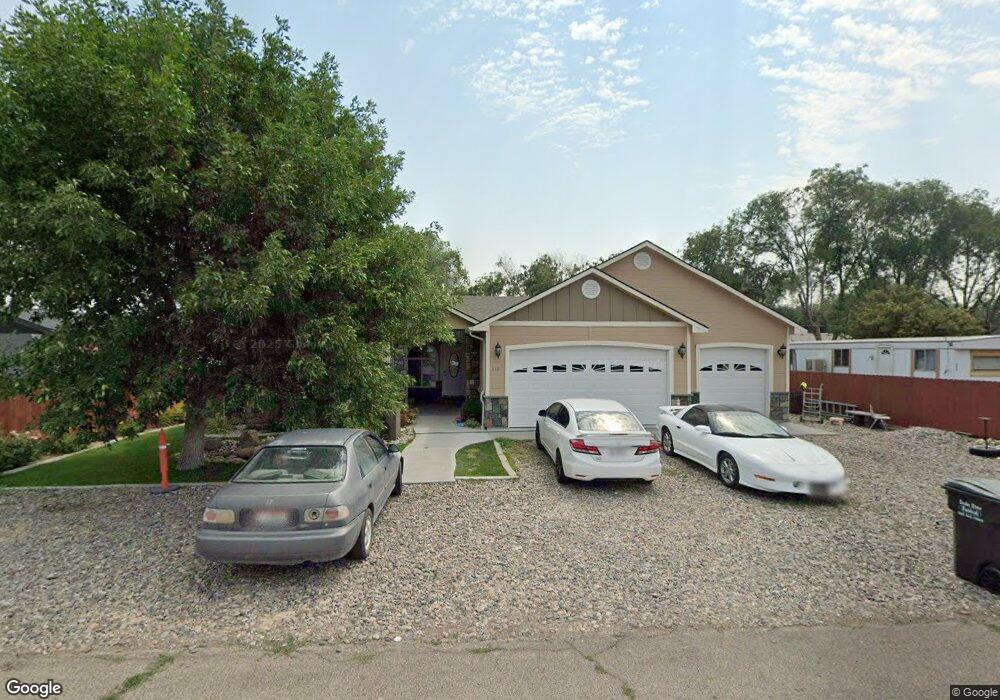
512 NW Date Ave Mountain Home, ID 83647
Estimated Value: $283,000 - $315,000
3
Beds
1
Bath
1,308
Sq Ft
$227/Sq Ft
Est. Value
About This Home
This home is located at 512 NW Date Ave, Mountain Home, ID 83647 and is currently estimated at $296,703, approximately $226 per square foot. 512 NW Date Ave is a home located in Elmore County with nearby schools including West Elementary School, Hacker Middle School, and Mountain Home Junior High School.
Ownership History
Date
Name
Owned For
Owner Type
Purchase Details
Closed on
Aug 3, 2020
Sold by
Negrete Guadencia Alanis
Bought by
Lopez Alanis Rosa M
Current Estimated Value
Purchase Details
Closed on
Jun 6, 2016
Sold by
Lopez Alanis Victor Manuel
Bought by
Negrete Gaudencia Alanis and Lopez Alanis Rosa M
Purchase Details
Closed on
Jun 26, 2008
Sold by
Lopez Alanis Fernando
Bought by
Alanis Lopez Alanis Victor Manuel and Alanis Negrete Gaudencia
Purchase Details
Closed on
Aug 7, 2006
Sold by
U S Bank Na
Bought by
Lopez-Alianis Fernando
Purchase Details
Closed on
Dec 20, 2005
Sold by
Sheppler Amber
Bought by
U S Bank
Create a Home Valuation Report for This Property
The Home Valuation Report is an in-depth analysis detailing your home's value as well as a comparison with similar homes in the area
Home Values in the Area
Average Home Value in this Area
Purchase History
| Date | Buyer | Sale Price | Title Company |
|---|---|---|---|
| Lopez Alanis Rosa M | -- | None Available | |
| Negrete Gaudencia Alanis | -- | None Available | |
| Alanis Lopez Alanis Victor Manuel | -- | -- | |
| Lopez-Alianis Fernando | -- | -- | |
| U S Bank | -- | -- |
Source: Public Records
Tax History Compared to Growth
Tax History
| Year | Tax Paid | Tax Assessment Tax Assessment Total Assessment is a certain percentage of the fair market value that is determined by local assessors to be the total taxable value of land and additions on the property. | Land | Improvement |
|---|---|---|---|---|
| 2024 | $1,265 | $277,124 | $41,000 | $236,124 |
| 2023 | $1,265 | $251,656 | $32,000 | $219,656 |
| 2022 | $1,319 | $235,621 | $28,500 | $207,121 |
| 2021 | $635 | $166,334 | $23,800 | $142,534 |
| 2020 | $584 | $132,273 | $19,800 | $112,473 |
| 2019 | $508 | $92,074 | $19,800 | $72,274 |
| 2018 | $387 | $61,670 | $16,493 | $45,177 |
| 2017 | $351 | $52,514 | $16,493 | $36,021 |
| 2016 | $354 | $52,514 | $16,493 | $36,021 |
| 2015 | $436 | $0 | $0 | $0 |
| 2012 | -- | $41,086 | $19,404 | $21,682 |
Source: Public Records
Map
Nearby Homes
- 1879 N West Enterprise St
- 722 NW Date Ave
- 1120 NW Foster Dr
- 1224 NW Mandarin St
- 420 NW Heron Ave
- 995 NW Maggie Ct
- 508 W 2nd N
- 422 W 3rd N
- 420 Oak Ct
- 410 Chestnut St
- 850 Garrett St
- 1075 Teal Cir
- 165 Sagebrush Ave
- 885 Partridge Dr
- 960 Sunset Strip
- 910 Gregory Ln
- 80 A St
- 1265 Eric Ct
- 127 E 8th N
- 405 N 2nd E
- 546 NW Date Ave
- 528 NW Date Ave
- 620 NW Date Ave
- 442 NW Date Ave
- 445 NW Cedar Ave
- 493 NW Date Ave
- 505 NW Date Ave
- 567 NW Cedar Ave
- 568 NW Date Ave
- 412 NW Date Ave
- 461 NW Date Ave
- 427 NW Date Ave
- 445 NW Date Ave
- 492 NW Cedar Ave
- 510 NW Elmcrest Ave
- 490 NW Elmcrest Ave
- 438 NW Cedar Ave
- 518 NW Elmcrest Ave
- 438 NW Cedar Ave
- 1750 Peregrine Dr