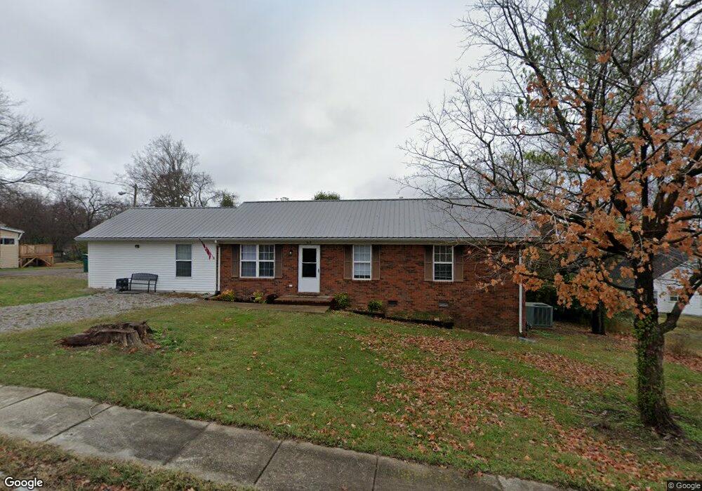
512 Silver St Lewisburg, TN 37091
Estimated Value: $220,493 - $272,000
--
Bed
1
Bath
1,551
Sq Ft
$162/Sq Ft
Est. Value
About This Home
This home is located at 512 Silver St, Lewisburg, TN 37091 and is currently estimated at $251,123, approximately $161 per square foot. 512 Silver St is a home located in Marshall County with nearby schools including Marshall Elementary School, Oak Grove Elementary School, and Westhills Elementary School.
Ownership History
Date
Name
Owned For
Owner Type
Purchase Details
Closed on
Feb 11, 2000
Bought by
Buffalo Valley Inc
Current Estimated Value
Purchase Details
Closed on
Sep 26, 1997
Sold by
Elvin White and Elvin Sara
Bought by
Tankersley Edward B
Purchase Details
Closed on
May 16, 1997
Sold by
Clarence Leonard John
Bought by
Elvin White and Elvin Sara
Create a Home Valuation Report for This Property
The Home Valuation Report is an in-depth analysis detailing your home's value as well as a comparison with similar homes in the area
Home Values in the Area
Average Home Value in this Area
Purchase History
| Date | Buyer | Sale Price | Title Company |
|---|---|---|---|
| Buffalo Valley Inc | $200,000 | -- | |
| Tankersley Edward B | $6,000 | -- | |
| Elvin White | $23,500 | -- |
Source: Public Records
Tax History Compared to Growth
Tax History
| Year | Tax Paid | Tax Assessment Tax Assessment Total Assessment is a certain percentage of the fair market value that is determined by local assessors to be the total taxable value of land and additions on the property. | Land | Improvement |
|---|---|---|---|---|
| 2024 | -- | $43,275 | $3,125 | $40,150 |
| 2023 | $1,343 | $43,275 | $3,125 | $40,150 |
| 2022 | $1,343 | $43,275 | $3,125 | $40,150 |
| 2021 | $1,177 | $25,300 | $1,575 | $23,725 |
| 2020 | $1,177 | $25,300 | $1,575 | $23,725 |
| 2019 | $1,139 | $25,300 | $1,575 | $23,725 |
| 2018 | $1,127 | $25,300 | $1,575 | $23,725 |
| 2017 | $1,127 | $25,300 | $1,575 | $23,725 |
| 2016 | $1,086 | $21,225 | $1,625 | $19,600 |
| 2015 | $991 | $21,225 | $1,625 | $19,600 |
| 2014 | $991 | $21,225 | $1,625 | $19,600 |
Source: Public Records
Map
Nearby Homes
- 0 New Lake Rd Unit RTC3030964
- 726 Thomas Ave
- 215 5th Ave N
- 316 Haynes St
- 594 5th Ave N
- 630 6th Ave N
- 627 6th Ave N
- 518 Maple St
- 543 2nd Ave N
- 416 1st Ave N
- 525 Maple St
- 610 Forrest St
- 638 2nd Ave N
- 319 Greenwood St
- 231 Greenwood St
- 319 E Hill Ave
- 1600 Larry Dospil Dr
- 1111 W End Ave N
- 117 W End Ave N
- 1144 Apple St
- 0 Bob Davis Rd Unit 1917238
- 0 New Lake Rd Unit 1834223
- 0 Bob Davis Rd Unit 1814779
- 0 Bob Davis Rd Unit RTC2352582
- 0 Contact Unit RTC2314758
- 0 Contact Unit RTC2314565
- 0 Hwy 64w Lot 2
- 0 Hwy 64w Unit 2
- 518 Mcdowell Ln
- 504 Silver St
- 524 Silver St
- 434 5th Ave N
- 440 5th Ave N
- 534 Silver St
- 523 Mcdowell Ln
- 448 5th Ave N
- 330 5th Ave N
- 431 5th Ave N
- 423 5th Ave N
- 456 5th Ave N