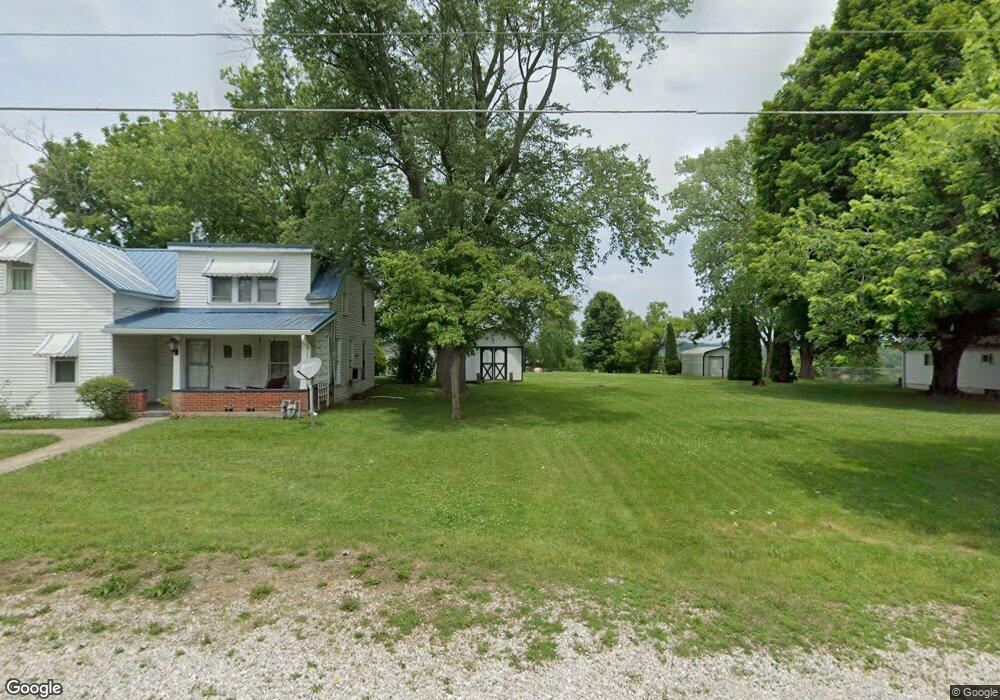
512 State Route 555 Little Hocking, OH 45742
Estimated Value: $155,127 - $306,000
4
Beds
2
Baths
1,456
Sq Ft
$151/Sq Ft
Est. Value
About This Home
This home is located at 512 State Route 555, Little Hocking, OH 45742 and is currently estimated at $219,532, approximately $150 per square foot. 512 State Route 555 is a home with nearby schools including Warren High School.
Ownership History
Date
Name
Owned For
Owner Type
Purchase Details
Closed on
Sep 25, 2024
Sold by
Jett Arlene Kay and Jett Jill Jenise
Bought by
Jett Arlene Kay and Jett Jill Jenise
Current Estimated Value
Purchase Details
Closed on
Oct 18, 2021
Sold by
Jett Arlene Kaye
Bought by
Jett Arlene Kaye and Jett Jill Jenise
Purchase Details
Closed on
Mar 25, 1992
Bought by
Jett Arlene Kaye
Create a Home Valuation Report for This Property
The Home Valuation Report is an in-depth analysis detailing your home's value as well as a comparison with similar homes in the area
Home Values in the Area
Average Home Value in this Area
Purchase History
| Date | Buyer | Sale Price | Title Company |
|---|---|---|---|
| Jett Arlene Kay | -- | None Listed On Document | |
| Richards Tracy | $7,000 | None Listed On Document | |
| Jett Arlene Kaye | -- | None Available | |
| Jett Arlene Kaye | -- | -- |
Source: Public Records
Tax History Compared to Growth
Tax History
| Year | Tax Paid | Tax Assessment Tax Assessment Total Assessment is a certain percentage of the fair market value that is determined by local assessors to be the total taxable value of land and additions on the property. | Land | Improvement |
|---|---|---|---|---|
| 2024 | $757 | $29,090 | $6,270 | $22,820 |
| 2023 | $757 | $35,060 | $11,390 | $23,670 |
| 2022 | $1,028 | $35,060 | $11,390 | $23,670 |
| 2021 | $871 | $29,860 | $9,190 | $20,670 |
| 2020 | $815 | $29,860 | $9,190 | $20,670 |
| 2019 | $803 | $29,860 | $9,190 | $20,670 |
| 2018 | $679 | $26,070 | $7,990 | $18,080 |
| 2017 | $675 | $26,070 | $7,990 | $18,080 |
| 2016 | $1,285 | $26,070 | $7,990 | $18,080 |
| 2015 | $408 | $20,440 | $7,790 | $12,650 |
| 2014 | $1,019 | $20,440 | $7,790 | $12,650 |
| 2013 | $205 | $20,440 | $7,790 | $12,650 |
Source: Public Records
Map
Nearby Homes
- 00 Orchard Dr
- 0 T1309
- 4278 Newbury Rd
- 000 Newbury Rd
- 0 Newberry Rd Unit 4279424
- 1175 Collins Rd
- 0 Houston Rd
- 0 Houston Rd
- 29500 Houston Rd
- 128 Haynes Rd
- 1421 Hocking Rd
- 2853 Lake Washington Rd
- 631 Short Brook Rd
- 5595 N Torch Rd
- 1396 State Route 339
- 1462 State Route 339
- 464 Cave Hill Rd
- 200 Club Dr
- 257 Walnut Grove
- 0 N Torch Rd
- 480 State Route 555
- 80 Baker Rd
- 550 State Route 555
- 515 State Route 555
- 568 State Route 555
- 529 State Route 555
- 116 Walnut Ridge Dr
- 114 Walnut Ridge Dr
- 85 Baker Rd
- 573 State Route 555
- 106 Walnut Ridge Dr
- 128 Baker Rd
- 116 Walnut Ridge
- 70 Walnut Ridge
- 104 Walnut Ridge Dr
- 115 Walnut Ridge Dr
- 615 State Route 555
- 119 Walnut Ridge Dr
- 113 Walnut Ridge Dr
- 148 Baker Rd