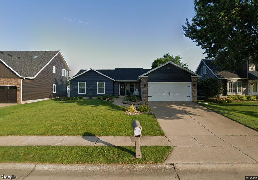
5120 Fillmore Ct Davenport, IA 52806
North Side NeighborhoodEstimated Value: $303,000 - $342,000
3
Beds
3
Baths
1,574
Sq Ft
$204/Sq Ft
Est. Value
About This Home
This home is located at 5120 Fillmore Ct, Davenport, IA 52806 and is currently estimated at $321,458, approximately $204 per square foot. 5120 Fillmore Ct is a home located in Scott County with nearby schools including Cumberland Hall School, Harrison Elementary School, and Academy Of Continuing Education.
Ownership History
Date
Name
Owned For
Owner Type
Purchase Details
Closed on
Apr 14, 2022
Sold by
Howard Kyle B and Howard Debra L
Bought by
Howard Kyle B and Howard Debra L
Current Estimated Value
Purchase Details
Closed on
Sep 1, 2006
Sold by
Howard Kyle B and Howard Patricia A
Bought by
Howard Kyle B and Howard Patricia A
Create a Home Valuation Report for This Property
The Home Valuation Report is an in-depth analysis detailing your home's value as well as a comparison with similar homes in the area
Home Values in the Area
Average Home Value in this Area
Purchase History
| Date | Buyer | Sale Price | Title Company |
|---|---|---|---|
| Howard Kyle B | $1,000 | None Listed On Document | |
| Howard Kyle B | -- | None Available |
Source: Public Records
Tax History Compared to Growth
Tax History
| Year | Tax Paid | Tax Assessment Tax Assessment Total Assessment is a certain percentage of the fair market value that is determined by local assessors to be the total taxable value of land and additions on the property. | Land | Improvement |
|---|---|---|---|---|
| 2025 | $4,610 | $284,700 | $42,210 | $242,490 |
| 2024 | $4,500 | $257,980 | $42,210 | $215,770 |
| 2023 | $4,612 | $257,980 | $42,210 | $215,770 |
| 2022 | $4,632 | $215,900 | $39,200 | $176,700 |
| 2021 | $4,632 | $215,900 | $39,200 | $176,700 |
| 2020 | $4,086 | $202,310 | $39,200 | $163,110 |
| 2019 | $4,000 | $178,260 | $39,200 | $139,060 |
| 2018 | $3,914 | $178,260 | $39,200 | $139,060 |
| 2017 | $991 | $178,260 | $39,200 | $139,060 |
| 2016 | $3,904 | $178,260 | $0 | $0 |
| 2015 | $3,904 | $173,150 | $0 | $0 |
| 2014 | $3,846 | $173,150 | $0 | $0 |
| 2013 | $3,780 | $0 | $0 | $0 |
| 2012 | -- | $181,510 | $36,410 | $145,100 |
Source: Public Records
Map
Nearby Homes
- 4705 N Sturdevant St
- 4618 Fillmore Ln
- 4757 Willow Cir
- 4743 Willow Cir
- 5210 N Division St
- 1729 Welshire Dr
- 4804 Northwest Blvd
- 5436 N Division St
- 5510 N Division St
- 4612 Warren St Unit 5
- 825 Northbrook Dr
- 5721 Taylor St
- 4942 Brown St
- 5735 Taylor St
- 4449 Royal Oaks Dr
- 1415 W 59th St
- 5804 Lillie Ave
- 1033 W 58th St
- 28 W Village Cir
- 1927 W 55th St
- 5108 Fillmore Ct
- 5109 Garner Dr
- 5115 Garner Dr
- 5104 Fillmore Ct
- 5107 Garner Dr
- 5140 Fillmore Ct
- 5119 Garner Dr
- 5125 Fillmore Ct
- 5111 Fillmore Ct
- 1508 W 51st St
- 5121 Garner Dr
- 5125 Garner Dr
- 1410 W 51st St
- 5135 Fillmore Ct
- 1511 W 51st St
- 5078 Fillmore Ln
- 5112 Garner Dr
- 1602 W 51st St
- 5108 Garner Dr
- 1435 W 52nd St