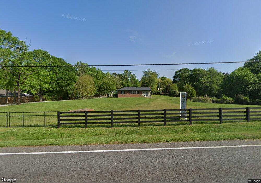
5122 Browns Bridge Rd Gainesville, GA 30504
Estimated Value: $365,000 - $443,000
3
Beds
1
Bath
1,602
Sq Ft
$242/Sq Ft
Est. Value
About This Home
This home is located at 5122 Browns Bridge Rd, Gainesville, GA 30504 and is currently estimated at $387,795, approximately $242 per square foot. 5122 Browns Bridge Rd is a home located in Hall County with nearby schools including McEver Elementary School, Chestatee Middle School, and Chestatee High School.
Ownership History
Date
Name
Owned For
Owner Type
Purchase Details
Closed on
Oct 19, 2010
Sold by
Doss Rives M
Bought by
Bell William P
Current Estimated Value
Home Financials for this Owner
Home Financials are based on the most recent Mortgage that was taken out on this home.
Original Mortgage
$92,000
Outstanding Balance
$60,265
Interest Rate
4.36%
Mortgage Type
New Conventional
Estimated Equity
$327,530
Purchase Details
Closed on
Aug 1, 2010
Sold by
Doss Larry E and Doss Douglas J
Bought by
Doss Rives M
Purchase Details
Closed on
Aug 13, 2004
Sold by
Doss S E
Bought by
Doss Larry Edward and Doss Rivers
Create a Home Valuation Report for This Property
The Home Valuation Report is an in-depth analysis detailing your home's value as well as a comparison with similar homes in the area
Home Values in the Area
Average Home Value in this Area
Purchase History
| Date | Buyer | Sale Price | Title Company |
|---|---|---|---|
| Bell William P | $130,000 | -- | |
| Doss Rives M | -- | -- | |
| Doss Larry Edward | -- | -- |
Source: Public Records
Mortgage History
| Date | Status | Borrower | Loan Amount |
|---|---|---|---|
| Open | Bell William P | $92,000 |
Source: Public Records
Tax History Compared to Growth
Tax History
| Year | Tax Paid | Tax Assessment Tax Assessment Total Assessment is a certain percentage of the fair market value that is determined by local assessors to be the total taxable value of land and additions on the property. | Land | Improvement |
|---|---|---|---|---|
| 2025 | $2,688 | $114,800 | $22,960 | $91,840 |
| 2024 | $2,736 | $109,800 | $22,080 | $87,720 |
| 2023 | $2,561 | $118,560 | $22,080 | $96,480 |
| 2022 | $2,395 | $92,120 | $22,080 | $70,040 |
| 2021 | $2,290 | $86,480 | $18,720 | $67,760 |
| 2020 | $2,278 | $83,600 | $18,720 | $64,880 |
| 2019 | $2,179 | $79,240 | $18,720 | $60,520 |
| 2018 | $1,535 | $53,872 | $18,720 | $35,152 |
| 2017 | $1,465 | $53,872 | $18,720 | $35,152 |
Source: Public Records
Map
Nearby Homes
- 5119 Ash Cir
- 5320 Sherri Dr
- 5490 Hulsey Cir
- 4510 Browns Bridge Rd
- 5471 Dogwood Ln
- 4451 Flat Creek Dr
- 4469 Flat Creek Dr
- 4134 Heidi Ln
- 4129 Greyfield Bluff Dr
- 4142 Greyfield Bluff Dr
- 4080 Ryckeley Dr
- 4058 Ryckeley Dr
- 4175 Cumberland Point Dr
- 4048 Ryckeley Dr
- 4225 Twin Rivers Dr
- 4075 Fincher Dr
- 9395 Edgewater Dr
- 5659 Nags Head Cir
- 9340 Ann Harbor Dr
- 5212 Watchmans Cove
- 5130 Fourth Colony Dr
- 5136 Fourth Colony Dr
- 5142 Fourth Colony Dr
- 5125 Browns Bridge Rd
- 5129 Browns Bridge Rd
- 5133 Browns Bridge Rd
- 5129 4th Colony Dr
- 5129 Fourth Colony Dr
- 5121 Browns Bridge Rd
- 5109 Browns Bridge Rd
- 5145 Browns Bridge Rd
- 5141 Fourth Colony Dr
- 5150 Fourth Colony Dr
- 5120 Ash Cir
- 5154 Fourth Colony Dr
- 5178 Browns Bridge Rd Unit 81
- 5178 Browns Bridge Rd
- 5201 Browns Bridge Rd
- 5138 Ash Cir
- 4930 Browns Bridge Rd