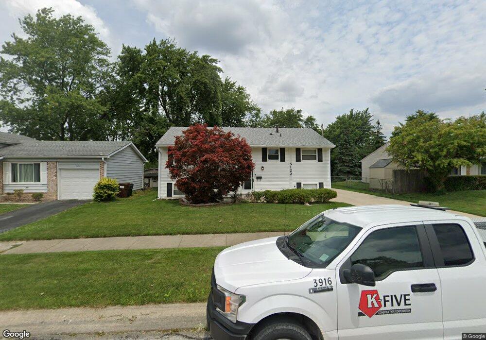
5122 Greentree Rd Oak Forest, IL 60452
Estimated Value: $257,589 - $278,000
3
Beds
2
Baths
991
Sq Ft
$269/Sq Ft
Est. Value
About This Home
This home is located at 5122 Greentree Rd, Oak Forest, IL 60452 and is currently estimated at $266,647, approximately $269 per square foot. 5122 Greentree Rd is a home located in Cook County with nearby schools including Kimberly Heights Elementary School, Scarlet Oak Elementary School, and Arbor Park Middle School.
Ownership History
Date
Name
Owned For
Owner Type
Purchase Details
Closed on
Jul 29, 2005
Sold by
First National Bank
Bought by
Dixon Roland T
Current Estimated Value
Home Financials for this Owner
Home Financials are based on the most recent Mortgage that was taken out on this home.
Original Mortgage
$152,000
Outstanding Balance
$78,540
Interest Rate
5.8%
Mortgage Type
Fannie Mae Freddie Mac
Estimated Equity
$188,107
Create a Home Valuation Report for This Property
The Home Valuation Report is an in-depth analysis detailing your home's value as well as a comparison with similar homes in the area
Home Values in the Area
Average Home Value in this Area
Purchase History
| Date | Buyer | Sale Price | Title Company |
|---|---|---|---|
| Dixon Roland T | $217,000 | Cti |
Source: Public Records
Mortgage History
| Date | Status | Borrower | Loan Amount |
|---|---|---|---|
| Open | Dixon Roland T | $152,000 |
Source: Public Records
Tax History
| Year | Tax Paid | Tax Assessment Tax Assessment Total Assessment is a certain percentage of the fair market value that is determined by local assessors to be the total taxable value of land and additions on the property. | Land | Improvement |
|---|---|---|---|---|
| 2025 | $6,442 | $21,130 | $3,678 | $17,452 |
| 2024 | $6,442 | $21,130 | $3,678 | $17,452 |
| 2023 | $4,284 | $21,130 | $3,678 | $17,452 |
| 2022 | $4,284 | $12,617 | $3,176 | $9,441 |
| 2021 | $4,219 | $12,617 | $3,176 | $9,441 |
| 2020 | $4,168 | $12,617 | $3,176 | $9,441 |
| 2019 | $5,248 | $15,126 | $2,841 | $12,285 |
| 2018 | $5,130 | $15,126 | $2,841 | $12,285 |
| 2017 | $5,133 | $15,126 | $2,841 | $12,285 |
| 2016 | $5,090 | $13,713 | $2,507 | $11,206 |
| 2015 | $4,889 | $13,713 | $2,507 | $11,206 |
| 2014 | $4,791 | $13,713 | $2,507 | $11,206 |
| 2013 | $4,120 | $13,385 | $2,507 | $10,878 |
Source: Public Records
Map
Nearby Homes
- 16908 Laramie Ave
- 16909 W Thackeray Lot #8 St
- 16861 Thackery Ave
- 5048 171st St
- 5319 Martha Ln
- 17027 Judy Ct
- 5345 Forest Trail
- 5166 Aldersyde Rd
- 16938 Cicero Ave
- 5426 Bonnie Trail
- 5417 Christopher Dr
- 5524 Christopher Dr
- 5320 175th St
- 17140 Central Ave
- 4847 175th St
- 16456 George Dr
- 4428 Lisa Ln
- 16465 Terry Ln
- 16417 George Dr
- 16465 Roy St
- 5148 Greentree Rd
- 5116 Greentree Rd
- 5143 Elmwood Rd
- 5162 Greentree Rd
- 5123 Elmwood Rd
- 5090 Greentree Rd
- 5167 Elmwood Rd
- 5123 Greentree Rd
- 5031 Elmwood Rd
- 5149 Greentree Rd
- 5117 Greentree Rd
- 5172 Greentree Rd Unit 2
- 5163 Greentree Rd
- 5173 Elmwood Rd
- 5074 Greentree Rd
- 5091 Greentree Rd
- 5113 Farmsley Ct
- 5115 Farmsley Ct
- 5173 Greentree Rd
- 5178 Greentree Rd
Your Personal Tour Guide
Ask me questions while you tour the home.